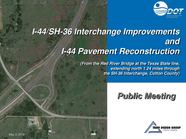

I-44/SH-36 Interchange Improvements and I-44 Pavement Reconstruction (From the Red River Bridge at the Texas State line, extending north 1.24 miles through the SH-36 Interchange, Cotton County) Public Meeting May 3, 2016
I-44/SH-36 Interchange Meeting Purpose • Purpose and Need for Project • 3 Interchange Alternatives Considered • Preferred Alternative • Public Input/Feedback
I-44/SH-36 Interchange Project Location COTTON COUNTY Project Location TEXAS
I-44/SH-36 Interchange Area Features US-70 Comanche Red River Casino Kiowa Casino Existing Bridge Comanche Casino Travel Plaza SH-36 Project Location E 2000 ROAD (EW 200)
I-44/SH-36 Interchange Recently-Completed Projects Comanche Red River Casino US-70 SH-36 Reconstruction (2012) SH-36 • New Asphalt Pavement North of SH-36 Interchange to US-70 • Two and Three Lanes • 12-ft Wide Lanes I-44 Pavement Reconstruction (2013) • New Concrete Pavement North of SH-36 Interchange to US-70 • 10-ft Wide Shoulders • Asphalt Pavement Overlay through SH-36 Interchange Kiowa • Four Lane Interstate Casino • 12-ft Wide Lanes • 4-ft Wide Inside Shoulders SH-36 • 10-ft Wide Outside Shoulders • Cable Barrier Project Location Comanche Casino Travel Plaza E 2000 Road (EW 200)
I-44/SH-36 Interchange Existing I-44 Existing I-44 Through the Interchange • Four 12-ft Wide Lanes • 4-ft Wide Inside Shoulders, 10-ft Wide Outside Shoulders • 44-ft Wide Median with Cable Barrier • Asphalt Pavement from Red River Bridge through SH-36 Interchange (Recent Overlay) • Annual Average Daily Traffic, Vehicles per Day (vpd) • Current (2016) = 13,200 vpd • Projected (2036) = 21,500 vpd E 2000 ROAD (EW 200)
I-44/SH-36 Interchange Existing SH-36 and Bridge Existing SH-36 Through Interchange • SH-36: Two 12-ft Wide Lanes, 10-ft Wide Shoulders • SH-36 Bridge: Two 12-ft Wide Lanes, 2-ft Wide Shoulders E 2000 ROAD (EW 200) • SH-36: Asphalt Pavement in Need of Improvement • Annual Average Daily Traffic • Current (2016) = 2,900 vpd • Projected(2036) = 5,800 vpd
I-44/SH-36 Interchange Existing Interchange Existing Interchange • Diamond/Loop Ramp Configuration • Traffic on Exit Ramps must Stop at Stop Sign Before Turning onto SH-36 • Single Lane Ramps • 15-ft Wide Lanes • 2-ft Wide Inside Shoulders • 8-ft Wide Outside Shoulders E 2000 ROAD (EW 200)
I-44/SH-36 Interchange Purpose and Need Improve Safety and Traffic Operations
I-44/SH-36 Interchange Existing Conditions in Need of Improvement Narrow Shoulders on Bridge Merge Lane on I-44 too Short Loop Ramp Curve too Tight • Inadequate Bridge Clearances • I-44 Exit Ramp at Loop too Short Pavement Condition in Need of Upgrade No Merge Lane on SH-36 from Loop Ramp
I-44/SH-36 Interchange Collisions, 2010 - 2015 COLLISION DATA LEGEND E E E H R R S F E R
I-44/SH-36 Interchange Proposed Project • Reconstruct I-44 Pavement • Expand SH-36 Bridge to Four 12-Ft. Wide Lanes and 10-Ft. Wide Shoulders • Shift SH-36 Bridge Alignment South • Improve I-44 Vertical Clearance Under Bridge • Allow for Phased Construction • Keep Bridge Open to Traffic during Construction • Ramps Will Remain Open Most of the Time • Improve Interchange Ramp Geometry • Lengthen On/Off Ramps
I-44/SH-36 Interchange Alternative 1: Diamond Interchange
I-44/SH-36 Interchange Alternative 2: Loop/Diamond Interchange, with Loop Ramp & Stub Ramp
I-44/SH-36 Interchange Alternative 2A: Loop/Diamond Interchange, with Loop Ramp & Free-Flow Ramp
I-44/SH-36 Interchange Constraints Mapping Reconnaissance Performed to Identify Constraints • Wetlands and Waters • Threatened & Endangered Species Critical Habitat • Archeological Sites and Historic Properties • Aboveground or Underground Storage Tanks • Oil/Gas Wells • Residences • Commercial Facilities • Tribal Properties • Utilities
I-44/SH-36 Interchange Composite Constraints Map
I-44/SH-36 Interchange Tribal Stakeholder Coordination • Apache Tribe, Comanche Nation, and Kiowa Tribe • Stakeholder Meeting Held May 20, 2015 • 3 Interchange Alternatives Presented • Possible Future Development on E 2000 Road (EW 200) Discussed
I-44/SH-36 Interchange Comparison of Alternatives Alternative 2A: Alternative 2: Loop/Diamond Comparison Alternative 1: Loop/Diamond Interchange, Interchange, with Loop Ramp Parameter Diamond Interchange with Loop Ramp & Free-Flow & Stub Ramp Ramp Traffic Operations Good Good Better Interchange Geometry Better Good Good Flexibility to Can be modified to Alternative 2A, Not Applicable Not Applicable Accommodate if future traffic dictates Traffic Growth 5 Acres Tribal Property Environmental 3 Acres Tribal Property 2 Acres Tribal Property 1 Residential Relocation Impacts* 1 Commercial Property Impacted 6 Utilities Impacted 5 Utilities Impacted 6 Utilities Impacted Utility Impacts Right-of-Way Impacts 8 Acres 2 Acres 12 Acres Total Project Cost $21 million $19 million $23 million *: No other environmental constraints identified.
I-44/SH-36 Interchange Preferred Alternative
I-44/SH-36 Interchange Preferred Alternative Alternative 2: Loop/Diamond Interchange, with Improved Loop Ramp (NB I-44 to NB SH-36) and Stub Ramp (NB I-44 to EB E 2000 Road) • Advantages: • Least Environmental Impacts • Least Utility Impacts • Least Right-of-Way Impacts • Least Total Project Cost • Adequately Accommodates Projected Future Traffic Volumes • Can Be Modified to Alternative 2A, if Necessary to Accommodate Future Traffic
I-44/SH-36 Interchange What Happens Next? • Consider Comments from Public Meeting • Complete Preliminary Design Report • Begin Detailed Environmental Studies and Design Plans
I-44/SH-36 Interchange Roadway Improvement Process • Complete Environmental Studies and Plans • 8-Year Construction Work Plan: • Right-of-Way (Year 2018) • Utilities (Year 2018) • Construction (Year 2021)
I-44/SH-36 Interchange Submit Your Comments • Leave your written comments with us tonight. • Download and submit a comment form at: www.odot.org/publicmeetings • Submit your written comments by mail to: Oklahoma Department of Transportation Environmental Programs Division 200 N. E. 21st Street Oklahoma City, OK 73105 • Fax your written comments to: (405) 522-5193 • Email your comments to: Odot-environment@odot.org • Please submit your comments by May 17, 2016.
I-44/SH-36 Interchange Thank Thank you! you!
Recommend
More recommend