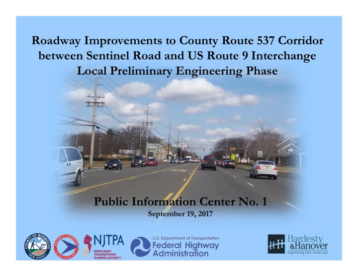

Roadway Improvements to County Route 537 Corridor between Sentinel Road and US Route 9 Interchange Local Preliminary Engineering Phase Public Information Center No. 1 September 19, 2017
Project Location Map Total Length of Project = 9570 LF (1.81 Miles)
Project Overview • The purpose of this project is to improve traffic safety, reduce traffic congestion, and provide better accommodations for various modes of transportation along the Monmouth County Route 537 Corridor • Federal funding being utilized for design and construction of the roadway improvements through Local Capital Project Delivery Program (LCPD) • Improvements to US Route 9 and NJ Route 33 interchanges are not part of this project
NJTPA Local Capital Project Delivery Program Local Preliminary Local Concept Final Design (FD)/ Right Engineering (LPE) Development (LCD) of Way Acquisition Construction ANTICIPATED COMPLETED MARCH SCHEDULED TO BEGIN COMPLETION MAY 2013 DECEMBER 2018 2018 Purpose and Need Approved Design Exception Construction Contract Complete Construction Statement Report Documents and PS&E package Concept Development & Cost Estimates (Final Environmental Reevaluations Continue Public Alternatives Analyses Design, ROW and Outreach Construction) Selection of Preliminary Approved Environmental Secure Environmental Permits As-Builts Preferred Alternative (PPA) Document Environmental Screening Preliminary Design Acquisition of ROW Update and Finalize Report & NEPA Design Communications Classification Report Concept Development Preliminary Engineering Final Utility Relocation Report Report Schemes Close-out Documentation Initiate Public Outreach & Continue Public Outreach & Continue Public Outreach & Involvement Involvement Involvement
Project Considerations • Proposed Traffic Volumes Projected to 2032 – All approved/under construction development generated traffic included in volume projections – Bellemead Development Phase I (400 residential units) with conditional approval also included (currently on hold) – Background growth includes projected population and employment growth based on NJTPA Plan 2040.
Local Preliminary Engineering Plans - 2017 • Based on Preliminary Preferred Alternative (PPA) selected in 2013 at the conclusion of LCD Phase
Local Preliminary Engineering Plans - 2017 Wells Fargo
Local Preliminary Engineering Plans - 2017
Local Preliminary Engineering Plans - 2017
Local Preliminary Engineering Plans - 2017 TD Bank Bank of America
Local Preliminary Engineering Plans - 2017 Mount’s Corner Shopping Center Moore’s Tavern
Local Preliminary Engineering Plans - 2017
Local Preliminary Engineering Plans - 2017 Colonial Plaza Applegate Farm
Local Preliminary Engineering Plans - 2017 Colonial Plaza Urgent Care
Local Preliminary Engineering Plans - 2017 State Jurisdiction Limit
Local Preliminary Engineering Plans - 2017
Local Preliminary Engineering Plans - 2017
Local Preliminary Engineering Plans - 2017
Local Preliminary Engineering Plans - 2017
Local Preliminary Engineering Plans - 2017
Local Preliminary Engineering Plans - 2017
Local Preliminary Engineering – Right of Way • Number of Properties = 32 Partial Impacts = 9 Full Property Acquisitions
Environmental Documentation • Section 106 (Cultural Resources) • NEPA Document (Categorical Exclusions Documentation) – Hazardous Waste Study – Air-Quality Study – Noise Study – Ecology Study – Socio-Economics
Cultural Resources • Cultural Resources Investigation performed under Section 106 of the National Historic Preservation Act
Cultural Resources • Phase I/II Archaeological Survey • Intensive-level Historic Architectural Survey • Eight archaeological sites identified • Historic Properties include Walker-Combs-Hartshorne House and Dr. Thomas Henderson House Site • Adverse Effects on historic properties resolved through development of a Memorandum of Agreement and implementation of mitigation measures • Coordination with NJDOT, FHWA and NJ SHPO
Permits Agency Approval Freehold Soil Conservation District Soil Erosion & Sediment Control Plan Certification NJDEP Freshwater Wetlands Permit NJDEP Water Quality Certificate NJDEP Flood Hazard Area Permit NJDEP Storm Water Management Plan Approval
Community Involvement (LPE Phase) • Local Officials Meeting No. 1 with the Township of Freehold, February 9, 2016 • Local Officials Meeting No. 2 with the Township of Freehold, February 1, 2017 • Community Stakeholders Meeting, February 15, 2017 • Public Information Center, September 19, 2017 – Comments accepted through Friday, October 20, 2017 • Community Outreach to continue in Final Design (FD) Phase
Project Schedule • Completion of Preliminary Engineering Phase - May 2018 • Final Design Phase & ROW Acquisitions - Fall 2018 to Spring 2021 • Construction Authorization FY 2021 – September 30, 2021 • Construction - Fall 2021 to Fall 2023
Project Contact Information • Daria Jakimowska, Monmouth County Project Manager • Phone: (732) 431-7760 • Email: daria.jakimowska@co.monmouth.nj.us • Monmouth County Web site address: – Go to: www.visitmonmouth.com – Select ‘County Bridge & Road Projects’ from the right side box – Click ‘Freehold – West Main Street (CR537)’ – Note: This Power Point Presentation and Presentation Boards will be posted on the Monmouth County website • County welcomes community input – please complete the PIC Comment Form (30-day period ends October 20, 2017)
Questions • Q & A will be held at display board areas to discuss and address specific questions
Recommend
More recommend