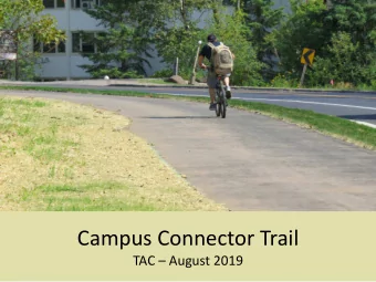
NORTH – SOUTH CONNECTOR Public Information Meeting January 30, 2018 | LaPorteCivic Auditorium and Event Center
Project Team Client: LaPorte County, Indiana Consultant: Lochmueller Group • Richard Mrozinski – Commissioner • Susan Al Abbas, PE – Project Principal • Michael Gonder – Commissioner • Steve Fleming, PE – Project Manager • Vidya Kora – Commissioner • David Goffinet – Public Involvement • Mitch Bishop – Planner • Brian Arterbery, PE – Project Engineer • Jay Sullivan – County Hwy Engineer • Chad Costa – Environmental Manager • Kate Lucier, M.Sc., PWS – Environmental Stakeholders Biologist • City of La Porte • Ruth Hook, M.Sc. – Environmental • Indiana Department of Transportation Biologist • Federal Highway Administration • Whitney Pierle – Client Liaison
Why Are We Here? Developing a study to determine the most feasible North-South Connector route including: • Reviewing project history • Establishing a project vision • Identifying multiple potential routes • Completing an environmental study to determine potential impacts • Provide the public with an opportunity to engage in the decision making process • Incorporate the public comments received into decisions as the project advances
Process PROJECT DEVELOPMENT PROCESS Scoping Environmental Preliminary Right-of-Way Completion • Engineering Engineering Assessment • National • Land Acquisition • Mitigation Sites Environmental Constructed / • Corridor Study / • Design • Appraisal & Feasibility Policy Act Monitoring Purchasing Upon • Obtain Appropriate Document Enforced Study NEPA Completion Permits / • Human & Natural • Project Mitigation Plans Construction • Build or No Build
History of North-South Connector • Previous studies have been completed Multiple feasibility & traffic studies • • Northwestern Indiana Regional Planning Commission 2040 Long- Range Plan Economic Development Corridor • • Results confirmed viability of a corridor on the east side of LaPorte to promote economic vitality & reduce congestion along US 35 & SR 39 through town
2015 Traffic Study • Completed feasibility study identifying two “Broad Banded” corridors A & B • Corridor becomes less effective progressing • further east B A • “Broad Banded” corridors provided room for multiple alternatives to be considered
2015 Traffic Study Four major intersections would benefit: 3 1. US 35 & SR2 1 4 2. US 35 & Boyd Blvd 3. US 35 & SR 39 2 4. SR 2 & SR 4
Traffic Study Analysis 2035 – US 35 at SR 2 No Build F (65.8 secs PM Peak) Build Route A * Route B * AM B B PM B B * - “Route A” & “Route B” is in reference to the “Broad Banded” corridors from the Feasibility Study
Traffic Study Analysis AVERAGE DELAY (sec/veh) * * INTERSECTION No Build Route A Route B AM PM AM PM AM PM 65.8 US 35 & SR 2 11.6 8.3 19.3 12.8 21 US 35 & Boyd Blvd 6.6 8.7 9.4 8.5 8.9 8.5 US 35 & SR 39 9.3 15.7 6.5 13.6 8.5 12.7 SR 2 & SR 4 8.1 13.3 8.2 11.8 12.5 13.6 * - “Route A” & “Route B” is in reference to the “Broad Banded” corridors from the Feasibility Study
Traffic Study Analysis CRASH DATA (2014-2017) CRASH SEVERITY INTERSECTION Fatal Injury Property Damage Only Total SR 4 & Boyd Blvd 0 4 4 8 SR 2 & SR 4 0 1 12 13 SR 2 & Boyd Blvd 0 6 21 27 SR 2 & Fail Rd 0 7 14 21 Fail Rd & CR 200N 0 0 1 1 SR 39 & US 20 0 1 0 1 US 35 & SR 39 0 6 15 21 US 35 & SR 2 0 7 42 49 US 35 & Boyd Blvd 0 11 5 16 US 35 & US 6 (W) 0 1 15 16 US 35 & US 6 (E) 0 0 4 4
Traffic Study Analysis Level of Service By 2035, if nothing is done (No Build) the queueing at the intersection of SR 2 & US 35 will be as shown in red during the PM period (4pm – 6pm)
Traffic & Economic Development Study Results • New corridor could service Genesis Industrial Park & Kingsbury Industrial Park • 21,000 projected vehicles per day Desired Area Potential Economic Development • Helps alleviate traffic congestion downtown • Reduce trucks on SR 2 and US 35/39 Downtown La Porte • Improved truck mobility • Improved access to Indiana Toll Road
Purpose & Need A DRAFT Purpose & Need Statement has been developed. Highlights Include: • Reduce forecasted congestion (especially due to truck traffic) in the City of LaPorte’s central business district. • Support the development of the Central City of LaPorte as a Livable Center. • Improve vehicular and pedestrian safety. • Improve access for economic development. The Purpose & Need draws extensively from the current NIRPC Long Range Plan ( 2040 Comprehensive Regional Plan ) and other planning documents.
Alignment Alternatives
Vision Develop a safe, reliable, efficient, integrated and connected multi- modal transportation system that promotes access, mobility and economic development.
Alignment Alternatives • Six route options Four south of SR 2 • Two north of SR 2 • • Severs Road Alternative eliminated • All proposed routes include a bridge over the Norfolk Southern Railroad • All proposed routes include an interchange at SR 2
Alignment Alternative (South) A1 A3 A2 A4
Alignment Alternative (North) C2 C1
Alignment Update Length (Ft) Cost 16,687 51.9 M A-1 All alternatives incorporate a 18,756 56.6 M A-2 railroad 17,846 56.5 M A-3 overpass and 25,057 69.5 M interchange at A-4 SR 2. 4,224 40.4 M Bridge Area 13,985 52.8 M Sever’s Road 15,999 36.1 M C-1 20,157 44.3 M C-2
North South Connector TYPICAL SECTION URBAN SECTION 35 MPH Speed Limit
North South Connector RURAL SECTION 55 MPH Speed Limit
Process PROJECT DEVELOPMENT PROCESS Environmental Scoping Preliminary Right-of-Way Completion • National Engineering Environmental Policy • Engineering • Land Acquisition • Mitigation Sites Act Document Assessment Constructed / • Design • Appraisal & • Human & Natural Monitoring • Corridor Study / Purchasing Upon • Obtain Enforced • Build or No Build Feasibility Study NEPA Completion Appropriate • Project Permits / Construction Mitigation Plans WE ARE HERE
Transportation Process & the National Environmental Policy Act • Why is an Environmental Evaluation being completed? North-South Connector has obligated funds from the Federal Highway Administration • for the Planning Phase • Any Federal action causes the need for an evaluation under the National Environmental Policy Act Purpose & need • Alternatives analysis (also includes Do Nothing, Existing Facilities improvements) • Impacts to the social and natural environment • Early & often involvement with the public • • The NEPA Document to be prepared is an Environmental Assessment FHWA must issue a formal decision on environmental consequences •
Transportation Process & the National Environmental Policy Act Items assessed in the NEPA process Land Use Wetlands & Waterways Relocations Hazardous Waste Air Quality Wildlife Historic & Archaeological Endangered Species Water Quality Parks & Recreational Facilities Socioeconomics Floodplain Noise Environmental Justice Lighting & Visual Farmland
Transportation Process & the National Environmental Policy Act • Early in the NEPA process = No decisions on route or impacts have been made Input from the public is needed on alternatives & resources • Intent is to perform detailed analyses on two “A” alternatives & two “C” alternatives • • Continued engagement with the public Various stakeholder meetings • Community Advisory Committee • Public Hearing in early 2019 • • Outcome = Federal Highway Administration decision document Finding of No Significant Impact = environmental evaluation complete • Elevate to an Environmental Impact Statement = more studies required •
Public Feedback Needed Written comments Interactive updates to community resources maps Comments can be emailed or mailed to: Lochmueller Group, Inc. Lochmueller Group, Inc. Attn. Kate Lucier Attn. Steve Fleming 3502 WoodviewTrace, Suite 150 130 South Main Street, Suite 300 Indianapolis, IN 46268-3137 South Bend, IN 46601 KLucier@lochgroup.com SFleming@lochgroup.com ALL COMMENTS DUE BY FEBRUARY 15, 2018
How to Stay Engaged • Mailing List – sign in to tonight’s meeting • Project specific website is being developed at www.laportecounty.org • Public Hearing – early 2019, date will be posted to project website
THANK YOU
Recommend
More recommend
Unleash a World of Digital Possibilities—Browse, Share, and Explore Content Without Boundaries