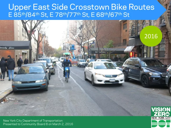

Upper East Side Crosstown Bike Routes E 85 th /84 th St, E 78 th /77 th St, E 68 th /67 th St 2016 New York City Department of Transportation Presented to Community Board 8 on March 2, 2016
Presentation Overview (1) Background Bike Network • Route and Design Considerations • (2) Project Description Proposed Design • Design Precedents • (3) Summary of Proposal East 84 th St, between York Ave and East End Ave
Project Background Community Board 8 Bike Network Connectivity Request to study crosstown bike routes (November 2015) First and Second Ave Protected Bike Lanes Central Park Carl Schurz & Limited East-West John Jay Park Crosstown Bike Routes In the Upper East Side Citibike Expansion Limited Bike Access to Manhattan Neighborhood Waterfront Destinations Greenway Parks, Subway, Institutions, Existing Network
Project Overview Crosstown Bike Routes East End Ave & Dedicated bike lanes Gracie Square Connecting Central Park, 1 st Ave Bike Shared bike route Path, East River Esplanade, Subway, connection to Carl Schurz Institutions Park + East River • No Parking Loss Esplanade • No Vehicular Lane Removal York Ave & Cherokee Pl Dedicated bike lane + shared bike route connection to John Jay Park + East River Esplanade
Existing Issues 2 miles between 90 th /91 st Streets and 55 th /54 th Streets Gap in Bike Network Limited bike network in one of NYC’s densest 2 miles neighborhoods
Central Park and East River Esplanade Connections 0.3 miles Manhattan Waterfront Greenway Entrances 0.4 miles 0.5 miles Central Park Entrances
E 84 TH & E 85 th Streets Central Park Entrance Subway No Parking Loss No Loss of Travel Lanes E 86 th Street Commercial Corridor Maintains equidistance between Manhattan Waterfront • existing + proposed routes Greenway Entrance Central Park + Greenway entrance • Close to subway station • Near commercial corridor •
Proposed Design 84 th Street between 5 th Avenue & Madison Avenue Existing No Parking Loss No Loss of Travel Lanes Maintain Bike Lanes Travel Lanes Provide dedicated Discourage space for cyclists speeding Increase Proposed predictability of cyclist location
Proposed Design 85 th Street at 5 th Avenue Existing No Parking Loss No Loss of Travel Lanes Bike Lanes Standard Width Provide dedicated Travel Lanes space for cyclists Discourage speeding Increase predictability Predictable movements of cyclist location Proposed
E 77 TH & E 78 th Streets Central Park Entrance Subway No Parking Manhattan Waterfront Loss No Loss of Greenway Entrance Travel Lanes Maintains equidistance between • proposed routes Central Park + Greenway entrance • Close to subway station •
E 67 TH & E 68 th Streets Central Park Entrance Institutions No Parking Loss No Loss of Travel Lanes Subway Maintains equidistance between proposed routes • Central Park entrance • Institutions • Close to subway station •
Crosstown Routes Existing Conditions – 85 th , 84 th , 78 th , 77 th , 68 th , 67 th Streets Wide Travel Lanes encourages speeding East 67 th St, between Park Ave and Madison Ave Lack of dedicated bike space encourages riding on both sides and provides less predictability East 84 th St, between Lexington Ave and 3 rd Ave
Crosstown Routes Proposed Design– 85 th , 84 th , 78 th , 77 th , 68 th , 67 th Streets Existing No Parking Loss No Loss of Travel Lanes Standard Width Bike Lanes Travel Lanes Provide dedicated space Discourage speeding for cyclists Increase predictability of Proposed cyclist location
Crosstown Routes Example of Proposed Design– 85 th , 84 th , 78 th , 77 th , 68 th , 67 th Streets 54 th St, Manhattan
Hospitals on Bike Routes Manhattan 8 Hospitals • Outer Boroughs 10 Hospitals • Brooklyn Hospital Center – Ashland Pl Bronx Lebanon Hospital – Grand Concourse Map highlights Bike Network core
NYPD Precincts and Fire Houses on Bike Routes Manhattan 6 NYPD Precincts • 7 Fire Houses • Outer Boroughs 13 NYPD Precincts • 29 Fire Houses • Map highlights Bike Network core FDNY Engine 65 – W 43 rd St, MN
Schools on Bike Routes Manhattan 85 Public & Private Schools • Outer Boroughs 397 Public & Private Schools • Public School 11 – W 21 st St, MN Map highlights Bike Network core
Bike Routes on Bus Routes Bike Infrastructure 174 Bus Routes overlap with • a bike route W 43 rd St – M34 Bus Map highlights Bike Network core
Summary/Benefits E 85 th St, Between 3 rd Ave and 2 nd Ave (1) Increased Safety for Road Users Organizes roadway • Reduces speeds/calms traffic • Increases awareness of cyclists • (2) New Connections – Critical Crosstown Bike Routes Central Park + East River Esplanade • Bike Share • 1 st Ave and 2 nd Ave Protected Bike Paths • Numerous Institutions • Subway •
Public Engagement Street Ambassadors DOT can coordinate Street Ambassadors safety outreach including light & bell giveaways with implementation Outreach on 1 st Ave on September 22, 2015 21 Outreach at the Ed Koch Queensboro Bridge on November 16, 2015
Public Engagement Commercial Bike Unit DOT can coordinate Commercial Bike Unit safety outreach with implementation For more information visit: http://www.nyc.gov/html/dot/html/bicyclists/commercial-cyclists.shtml#bicyclists 22
Thank Questions? You nyc.gov/dot
Recommend
More recommend