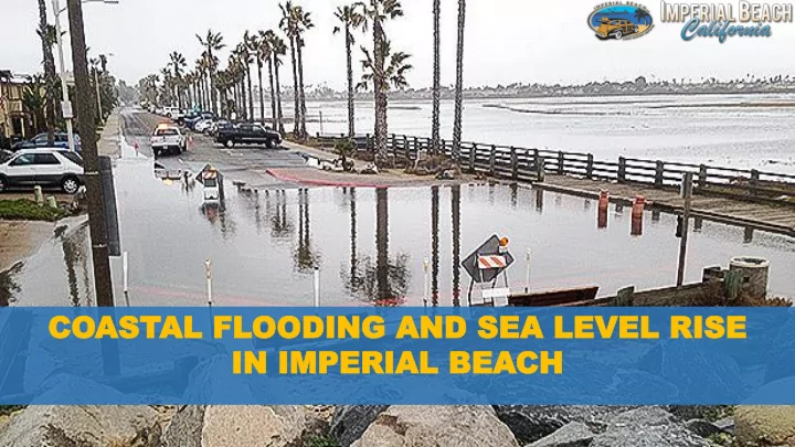

CO COAST ASTAL FL AL FLOODIN OODING AND S G AND SEA LE EA LEVEL RIS VEL RISE IN IMPERIAL IN IMPERIAL BEA BEACH CH
Wildseabook.com
JANU ANUAR ARY Y 1983 El Niño 1983 El Niño
SEA LEVEL RISE IMPACT ANALYSIS • Land Use • Roads • Public Transportation • Wastewater • Stormwater • Schools and Parks • Hazardous Materials
LAND USE LAND USE EXISTING EXISTING CONDITIONS CONDITIONS • Numb Number er of of par parce cels ls in in exist xisting ing Hazar Hazard d Zon Zones es vs vs to tota tal • Tot otal al = 5955 = 5955 • Nu Nuisan isance ce = 77 ( = 77 (74 74 res esiden idential, tial, 3 3 pu public blic (sc (scho hool) ol) • Coa Coast stal al Flood looding ing = = 1082 1082 • Coa Coast stal al Er Eros osion ion = = 383 383
CO COAST ASTAL AL ER EROSION OSION Tidal Inundation All Modeling assumes no adaptation Erosion Baseline (shorepos_100y_00) Erosion 0.5m (shorepos_100y_05) Erosion 1.0m (shorepos_100y_10) Erosion 2.0m (shorepos_100y_20) Modeling done separately by USGS and DoD - SPAWAR
FUTURE FUTURE NUISANCE NUISANCE FLOODING FL OODING Elevation top of Pipe - (ft NAVD) Baseline Drainage Basin 0.5m 1m 2m I 4.3 18% 49% 81% 100% G 4.7 12% 40% 75% 100% I 4.8 11% 38% 74% 100% I 5.1 8% 32% 69% 99% H 6 2% 16% 49% 96% I 6.5 1% 10% 38% 93% K 6.6 0% 9% 36% 92% K - P 9 0% 0% 3% 56% E 12.1 0% 0% 0% 5%
KEY KEY FINDINGS FINDINGS • Sto Storm m wate ter r – su subs bsta tant ntial ial de decr crea ease se in in st stor ormw mwate ter ca capa pacity city • La Land nd Use Use – pa parce cels ls an and bu d buil ilding dings s 30 30% • Roa oads ds – 40 40% % of of all all roa oads ds impa impact cted ed • Mos Most t vu vulner lnerable ble ne neighb ighbor orho hood ods s – • Sou South th Sea Sea Coa Coast st • No North th of of P Palm alm Ave/C e/Car arna natio tion • Neigh Neighbo borh rhoo ood d ar arou ound nd Bay Bayside side Elemen Elementa tary y
ADAPT AD APTATION TION STRA STRATEG TEGIES ES 1. Fee Simple Acquisition: 16. Nearshore Placement 30. Branch Box Breakwaters 2. Conservation Easements: 17. Offshore Sand Deposits 31. Floating Breakwaters 3. Transfer of Development 18. Added Courser Sand than 32. Submerged Breakwaters Native 4. Rolling Easement 33. Dune Restoration 19. Opportunistic Sand 5. Structural or Habitat Adaption 34. Beach Dewatering 20. Canyon Interception 6. Setback Development 35. Seawalls 21. Inter-littoral Cell Transfers 7. Controlling Surface Run-off 36. Revetments 22. Berms/Beach Scraping 8. Controlling Groundwater 37. Gabions 23. Perched Beaches 9. Beach Nourishment 38. Cobble Nourishment 24. Groins 10.Harbor By-Passing 39. Dynamic Revetments 25. Breakwaters 11.Back-Passing 40. Geotextile Revetment 26. Dune Nourishment 12.Subaerial Placement 41. Floating Reefs 27. Delta Enhancement 13.Artificial Seaweed 42. Rubber Dams 28. Headland Enhancement 14.Geotextile Core 43. Sand Fencing 29. Geotextile Groins
APPLIED APPLIED SCIENCE/TECHNOL SCIENCE/TECHNOLOGY OGY
LCP CP-LOCAL OCAL CO COAST ASTAL PLAN AL PLAN
PUBLIC PUBLIC INFRASTR INFRASTRUCTURE UCTURE
NATURAL TURAL CLIMA CLIMATE TE SOL SOLUTIONS UTIONS BL BLUE UE CA CARB RBON ON
PUBLIC PUBLIC ACC CCESS ESS
“..our knowledge is increasing at breakneck speed..Our new-found knowledge leads to faster economic, social and political changes; which leads only to faster and greater upheavals. Consequently we are less and less able to make sense of the present or forecast the future.”” Yuval Noah, Homo Deus
Recommend
More recommend