Deland Park Beach Sheboygan, Wisconsin Looking west over wet, flat - PowerPoint PPT Presentation
Deland Park Beach Sheboygan, Wisconsin Looking west over wet, flat beach areas at Deland Park Beach in Sheboygan. Looking southwest over wet, flat beach areas at Deland Park Beach in Sheboygan . Looking north over a low, flat beach area at Deland
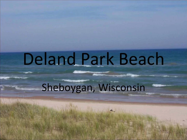
Deland Park Beach Sheboygan, Wisconsin
Looking west over wet, flat beach areas at Deland Park Beach in Sheboygan.
Looking southwest over wet, flat beach areas at Deland Park Beach in Sheboygan .
Looking north over a low, flat beach area at Deland Park Beach in Sheboygan .
Looking north over a wide expanse of low, wet sand at Deland Park Beach in Sheboygan .
Looking west at a group of loafing seagulls at Deland Park Beach in Sheboygan .
Looking southeast at the City of break wall at Deland Park Beach in Sheboygan . A slight Cladophora accumulation can be seen.
Looking west at a storm water discharge pipe near the north end of Deland Park Beach in Sheboygan .
Looking west at a storm water discharge near the north end of Deland Park Beach in Sheboygan .
Looking west at a stormwater outfall at Deland Park Beach in Sheboygan .
King Park Beach Sheboygan, Wisconsin
Looking south over the King Park Beach in Sheboygan.
Looking south over the flat, wide swash zone and low, flat wet sand at King Park Beach in Sheboygan .
Looking west, southwest at a small dune area along the west edge of King Park Beach in Sheboygan .
Looking west over the low, flat, wet sand area at the south end of King Park Beach in Sheboygan .
The storm water outfall showing dry weather flow near the south end of King Park Beach.
Looking west at the storm water outfall at King Park Beach in Sheboygan .
Looking east from the storm water outfall at King Park Beach in Sheboygan .
Before/After Examples Egg Harbor, Wisconsin
BEFORE: Low, flat beach with large swash zone. Rock jetties reduce water movement.
BEFORE: Low, flat beach with large swash zone. Minimal vegetation to hold sand in place. Waterfowl loafing helps create environment for bacterial growth.
BEFORE: Low, flat beach with large swash zone. Large populations of waterfowl consistently utilizing beach area.
DURING CONSTRUCTION: Beach is nourished to minimize swash zone and improve infiltration. Native plantings are used to hold sand in place and discourage waterfowl. Stormwater runoff is treated through infiltration and bio- infiltration prior to entering the sandy beach area.
DURING CONSTRUCTION: Native plantings improve aesthetics, treat stormwater, and hold sand in place. Walkways and picnic areas are established throughout the planting area.
AFTER: Beach is higher and drier as a result of beach nourishment.
AFTER: Native vegetation assists in holding sand in place, treating stormwater runoff from parking lot and nearby roadways, and preventing waterfowl loafing.
AFTER: Boardwalks and pathways direct beachgoers to sandy beach area with minimal disturbance to vegetation.
AFTER: Picnic areas are designated throughout park/beach area.
Recommend


More recommend
Explore More Topics
Stay informed with curated content and fresh updates.