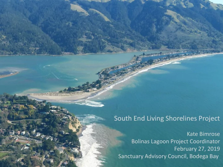

South End Living Shorelines Project Kate Bimrose Bolinas Lagoon Project Coordinator February 27, 2019 Sanctuary Advisory Council, Bodega Bay
PROJECT NEED: Communities surrounding the South End of Bolinas Lagoon face frequent flooding that is likely to worsen with sea level rise and increased storm intensity. If habitat in this area is not restored, flooding will all but eliminate important refugia for plant and wildlife species and undermine access/safety of surrounding trails and roads. PROJECT AREA: The South End project encompasses the eastern span of Dipsea Road in the Seadrift community and Calle del Arroyo Road in Stinson Beach.
Dipsea Road Shoreline along the eastern section of Dipsea Road is eroding, causing a steep scarp that drops upwards of 10 ft to the lagoon. Continued erosion will: • Limit habitat refugia for plants and animals as water levels rise • Contribute increased sedimentation/fill into the lagoon • Eventually undermine the local walking path, Dipsea Road, and nearby homes
Dipsea Road Objectives: • Establish transitional habitat along this section of the road by creating a gradual slope from the waters edge to the road • Facilitate water travel over this area rather than carving out from underneath it • Allow the lagoon to expand during storms and as sea levels rise • Provide habitat for plants and animals to utilize as water levels rise • Help stabilize this section of shoreline, securing the walkway and the road and homes beyond it
Calle del Arroyo Calle del Arroyo frequently floods during storms and high tide events, particularly at a ~500ft section that dips as low as 7.5ft NAVD88. Past 5 years = 29 events with water levels >7ft NAVD88 and 6 events with water levels >7.5ft NAVD88 in Bolinas Lagoon Continued high water events: • Flood the only access road in and out of Stinson Beach patios/calles and Seadrift community • Turn marsh/intertidal habitat into subtidal habitat, drowning important wetlands that could act as a buffer to protect to the road • Threaten nearby homes and utilities
Calle del Arroyo Objectives: • Build up wetlands to create new habitat as a natural buffer to rising water levels • Build up wetlands to provide transitional habitat for plant and animal species • Increase the reliability and safety of Calle del Arroyo to reduce flooding events during storms and as sea level rises • Prioritize construction options that incorporate green techniques – have to consider drainage and ponding so we may need to think about combination green and gray techniques
Things to keep in mind: • Scope and timeframe (how big and for how long) • Data gaps (hydrologic modeling, stream runoff and sediment analysis, storm and ground water interaction) • To fill or not to fill - balance project components to reduce impacts to the sanctuary (construction of transitional habitat may impact wetlands, permitting process, mitigation requirements) • Support (public concerns, continued partner buy-in, funding availability) Status and Next Steps: • Preliminary community outreach to educate the public on benefits of living shorelines and the goals and objectives of the South End project • Consulted with Marin County to gain preliminary support for the project • Raised funding for phase 1 of the project – work leading up to feasibility study • Completed pre-feasibility memo • San Francisco Bay Joint Venture Design Review Panel • Prop 1 grant for fluvial study on tributaries • Present project to larger community at State of the Lagoon meeting May 2 nd • Identify data gaps and needed surveys/assessments in preparation for feasibility study
Thank you!
Recommend
More recommend