LIVING SHORELINES The following are notes and diagrams from a - PDF document
LIVING SHORELINES The following are notes and diagrams from a presentation made by Peri Coleman of Delta Environmental Consulting, to the Port Adelaide Environment Forum in June 2015. Along the LeFevre Peninsula, while there are risks to our coast
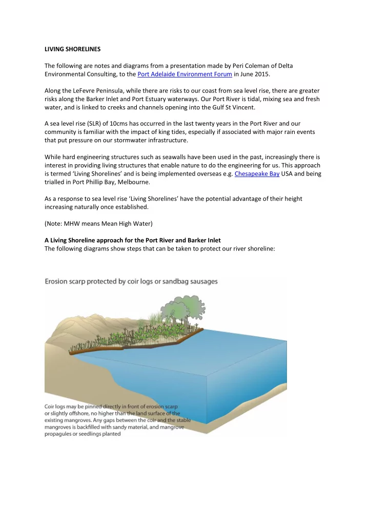
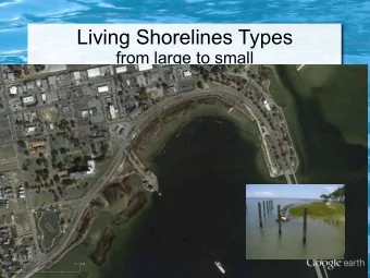
LIVING SHORELINES The following are notes and diagrams from a presentation made by Peri Coleman of Delta Environmental Consulting, to the Port Adelaide Environment Forum in June 2015. Along the LeFevre Peninsula, while there are risks to our coast from sea level rise, there are greater risks along the Barker Inlet and Port Estuary waterways. Our Port River is tidal, mixing sea and fresh water, and is linked to creeks and channels opening into the Gulf St Vincent. A sea level rise (SLR) of 10cms has occurred in the last twenty years in the Port River and our community is familiar with the impact of king tides, especially if associated with major rain events that put pressure on our stormwater infrastructure. While hard engineering structures such as seawalls have been used in the past, increasingly there is interest in providing living structures that enable nature to do the engineering for us. This approach is termed ‘Living Shorelines’ and i s being implemented overseas e.g. Chesapeake Bay USA and being trialled in Port Phillip Bay, Melbourne. As a response to sea level rise ‘Living Shorelines’ have the potential advantage of their height increasing naturally once established. (Note: MHW means Mean High Water) A Living Shoreline approach for the Port River and Barker Inlet The following diagrams show steps that can be taken to protect our river shoreline:
A Living Shoreline approach to sandy beaches While sand replenishment is widely recognised and used to protect sandy beaches, native vegetation can also contribute to dune stabilisation.
Recommend


More recommend
Explore More Topics
Stay informed with curated content and fresh updates.