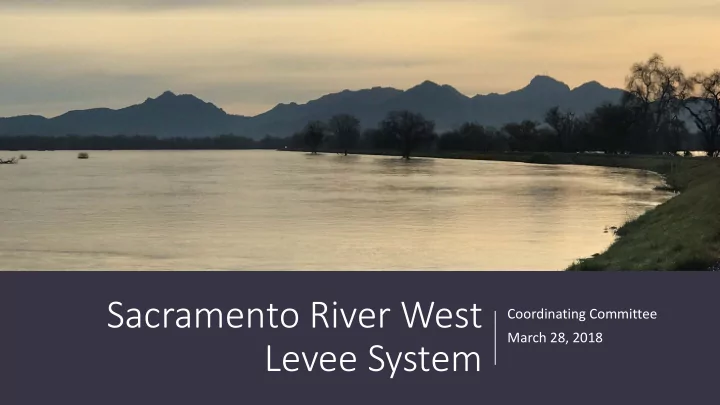

Sacramento River West Coordinating Committee March 28, 2018 Levee System
Who We Are RD 108 was formed in 1870 to build levees and “reclaim” land To more accurately reflect the lands benefited, the legislature created: the Knights Landing Ridge Drainage District in 1913 the Sacramento River West Side Levee District 1915 Today RD 108, Sacramento River Westside Levee District and the Knights Landing Ridge Drainage District work together to maintain approximately 90 miles of levees . RD 108 also delivers water to nearly 48,000 acres of farmland within southern Colusa County and northern Yolo County.
Colusa Yuba City Grimes Knights Landing Woodland Davis Sacramento
What We Were Formed to Do Operate and Maintain Levees Weed control Rodent Control Levee Road Maintenance Vegetation Management Levee Patrol and Flood fight first responders
What We Actually Do Lead Regional Flood Planning efforts Lead Regional Emergency Response Planning Helping Implement CVFPP 2017 Lead Regional SWIF efforts Implement Major Levee Repair Improvement Projects
FLOOD EMERGENCY RESPONSE PROJECT PHASE I Phase I Flood Safety Plans and Maps for 16 levee maintaining agencies across a 6-County Region 5 Unified Flood Fight Commands, strengthening partnerships among local and state agencies Just in Time Training Program, widely used across the state during the 2017 Events
FLOOD EMERGENCY RESPONSE PROJECT PHASE II Phase II SEMS/NIMS training and table top TSA-34 @ Elder Creek Host Agency: Tehama FCWCD exercises Purchased fully-stocked ConEx containers, with DWR-recommended flood fight CSA-06 @ Colusa Weir Host Agency: MA1 (SuMY) supplies for each LMA Regional stockpile system to include rock SSA-09 @ Tisdale Weir stockpiles and additional flood fight Host Agency: RD1500 &RD70/1660 supplies Purchased radios to improve communications among agencies throughout the region YDP-03 @ Rough & Ready Host Agency: SRWSLD/RD108
CVFPP 2017 Implementation Led Mid & Upper Sacramento River RFMP Pursuing Advancement Mitigation opportunities through Mid Sacramento Valley Regional Conservation Investment Strategy Developing Comprehensive Bypass Management Plans, starting with Tisdale Bypass Habitat Improvement Projects such as the Sacramento River Side Channel Project Small Community Feasibility Studies
Small Community Feasibility Studies City of Colusa Grimes Knights Landing
Systemwide Improvement Framework Plans Sept. 2010 USACE Periodic Inspection of the Sacramento River West Bank levee system Feb. 2012 USACE Periodic Inspection of the Knights Landing Levee System Identified a number of levee maintenance deficiencies with both systems which USACE rated as “Unacceptable” USACE changed systems status to “Inactive” in PL84-99 Local agencies agreed to collaborate on developing System-Wide Improvement Framework (SWIF) plans for each system. RD108, SRWSLD, & KLRDD agreed to lead the SWIF effort.
SWIF - Sacramento River West Bank Levee System LMAs RD 108 SRWSLD LD 1 LD 2 RD 787 MA 1 120 Miles of Levee MA 12
SWIF - Knights Landing Levee System LMAs Knights Landing Ridge Drainage District Yolo County DWR 15 Miles of Levee
SWIF Status SWIF Letter of Intents (LOIs) submitted in November 2013, which temporarily restored P.L. 84-99 eligibility . LOIs approved by USACE in March 2015. The LOI approvals placed a two-year deadline on preparing the SWIF, and also required submittal of a progress report on SWIF development after one year. SWIF progress reports submitted in February 2016 and were approved by the USACE in March 2016. The final draft SWIF plans were submitted in March 2017.
SWIF Status Final draft SWIF plans are currently under review by USACE 2017 Storms resulted in significant damage to system 57 days of high water and continuous levee patrols
2017 River Stages: Sacramento River at Wilkins Slough Monitor Stage
Moon Bend
Cecil Lake
Missouri Bend FSRP
USACE Emergency Seepage Berm
Back Levee Slips
~30 feet of bank was lost Erosion Sites in 2017 alone 2015 Wilson Bend Road 2017
SWIF Status Being active in PL84-99 was critical Expect to receive $26M in Federal funding to repair damaged sites SWIF preparation cost $26,000 Return on investment has been immediate and significant
Implementing Major Levee Repair Projects Example : Missouri Bend Seepage Repair Project SRWSLD leading permitting, design and construction 6,000 foot long Critical Repair Site Significant Seepage in 2016 and 2017 $5M Project- FSRP Funding 85% Local cost share places a major burden on SRWSLD resources
Sacramento River West Side Levee District Formed in 1915 Boundaries cover over 156 square miles. Located in two counties, Yolo and Colusa Includes parts of the City of Colusa and the Town of Grimes Maintains over 50 miles of levee
SRWSLD Operating Budget
Where the Money Goes
* Local cost share only
Budget Impact of One Special Project
Funding Issues We can’t be the bank for the State on special projects Retention Rules must change No funding capacity to assume responsibility for Three Rs Locals cannot take on Three Rs No funding capacity to implement SWIF Use FSRP to fund SWIF compliance? Property owners already paying multiple flood assessments State Assessment would violate local trust. Locals have zero confidence that a State Assessment system will efficiently gather dollars and allocate them back to the locals.
Questions/Discussion
Recommend
More recommend