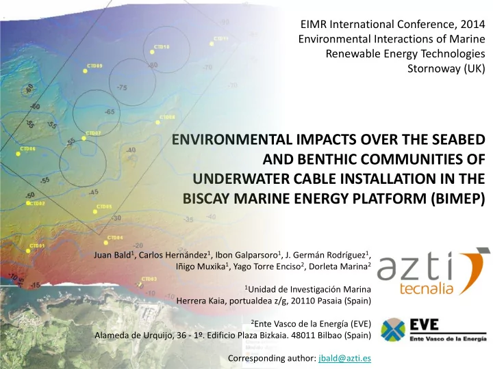

EIMR International Conference, 2014 Environmental Interactions of Marine Renewable Energy Technologies Stornoway (UK) ENVIRONMENTAL IMPACTS OVER THE SEABED AND BENTHIC COMMUNITIES OF UNDERWATER CABLE INSTALLATION IN THE BISCAY MARINE ENERGY PLATFORM (BIMEP) Juan Bald 1 , Carlos Hernández 1 , Ibon Galparsoro 1 , J. Germán Rodríguez 1 , Iñigo Muxika 1 , Yago Torre Enciso 2 , Dorleta Marina 2 1 Unidad de Investigación Marina Herrera Kaia, portualdea z/g, 20110 Pasaia (Spain) 2 Ente Vasco de la Energía (EVE) Alameda de Urquijo, 36 - 1º. Edificio Plaza Bizkaia. 48011 Bilbao (Spain) Corresponding author: jbald@azti.es
INTRODUCTION OBJECTIVE METHODOLOGY RESULTS CONCLUSION The Biscay Marine Energy Platform ( bimep ) is Basque Country Spain 1538 m an offshore infrastructure for the 5 4 demonstration and tes ting of marine energy 898m harnessing devices promoted by the Basque 1787m Energy Agency (Ente Vasco de la Energía - EVE) 3 6 Bimep is located close to Arminza town (Basque Country, Northern Spain) and it 2449 m consists on a 5.3 km 2 sea area between 50 and 90 m depths where four static submarine 1 2 cables will be placed, operating at 13kV and 1153m 5MW. 1700 m On land, bimep will establish a research centre in Arminza town where developers will be able to monitor de behaviour and performance of the devices ARMINZA
INTRODUCTION OBJECTIVE METHODOLOGY RESULTS CONCLUSION The installation of the submarine cables Basque began on the 11th of September 2013 with Country Spain 1538 m the PLRG of the cable route 5 4 898m 1787m 3 6 2449 m 1 2 1153m 1700 m ARMINZA
INTRODUCTION OBJECTIVE METHODOLOGY RESULTS CONCLUSION And ended between the 20th and 27th of Basque September 2013 with the laying of the four Country Spain 1538 m submarine cables 5 4 898m 1787m 3 6 2449 m 1 2 1153m 1700 m ARMINZA
INTRODUCTION OBJECTIVE METHODOLOGY RESULTS CONCLUSION After de laying of the cables, an attempt was Basque Country done in order to bury the cable route from the Spain 1538 m 5 4 outcrop of the cables at 15 m depth, until the bimep perimeter by means of an hydraulic fan, 898m 1787m but finally this option was discarded and the 3 cables were simply lay down in the seafloor 6 2449 m 1 2 1153m 1700 m ARMINZA
INTRODUCTION OBJECTIVE METHODOLOGY RESULTS CONCLUSION Not to submit the BIMEP project to the whole EIA process Nevertheless,….taking into account the great uncertainties about some predicted environmental impacts , underlined the need to implement the proposed Environmental Monitoring Program (EMP) of the EIS
INTRODUCTION OBJECTIVE METHODOLOGY RESULTS CONCLUSION Among other environmental factors, seabed alteration was foreseen to occur during the commissioning stage of the submarine cables and consequently may affect related benthic habitats and species
INTRODUCTION OBJECTIVE METHODOLOGY RESULTS CONCLUSION EUNIS Habitat Classification 2012 A5.142: Circalittoral coarse sediment
INTRODUCTION OBJECTIVE METHODOLOGY RESULTS CONCLUSION EUNIS Habitat Classification 2012 A4. Circalittoral rock and other hard substrata (A4.121; A4.212; A4.22;) 1
INTRODUCTION OBJECTIVE METHODOLOGY RESULTS CONCLUSION EUNIS Habitat Classification 2012 A3. Infralittoral rock and other hard substrata 1
INTRODUCTION OBJECTIVE METHODOLOGY RESULTS CONCLUSION Two mitigating measures were suggested: (i) to plan de cable route over soft sediments; (ii) to maintain a security distance of 100 m of the cable route from the “Sea bream Island”
INTRODUCTION OBJECTIVE METHODOLOGY RESULTS CONCLUSION The main objective was to monitor and check the environmental impacts associated to the installation of the submarine cables of BIMEP over the seabed and benthic communities
INTRODUCTION OBJECTIVE METHODOLOGY RESULTS CONCLUSION Seabed characterisation 1538 m 5 4 Using a high-resolution RESON SeaBat 7125 multibeam echosounder . 898m 1787m 3 6 2449 m 1 2 1153m As result of that methodology, a 0,5m resolution seafloor digital elevation 1700 m model was produced ARMINZ A
INTRODUCTION OBJECTIVE METHODOLOGY RESULTS CONCLUSION Seabed characterisation Visual inspection 1538 m 5 4 With a underwater video camera attached 898m 1787m to a Seaeye Falcon Remote Operated 3 Vehicle (ROV) in 38 points distributed all along the submarine cable route and the 6 mooring areas 2449 m 1 1 2 1153m 1700 m ARMINZ A
INTRODUCTION OBJECTIVE METHODOLOGY RESULTS CONCLUSION 1538 m 5 4 898m 1787m 3 6 2449 m 1 2 1153m 1700 m 20 m ARMINZA
INTRODUCTION OBJECTIVE METHODOLOGY RESULTS CONCLUSION 1538 m 5 4 898m 1787m 3 6 2449 m 1 2 1153m 1700 m 70 m ARMINZA
INTRODUCTION OBJECTIVE METHODOLOGY RESULTS CONCLUSION 1538 m 5 4 70 m 898m 1787m 3 6 2449 m 1 2 1153m 1700 m ARMINZA
INTRODUCTION OBJECTIVE METHODOLOGY RESULTS CONCLUSION No significant alterations of the seafloor 1538 m and benthic communities were observed 5 4 70 m 898m 1787m 3 6 2449 m 1 1 2 1153m 1700 m ARMINZA
INTRODUCTION OBJECTIVE METHODOLOGY RESULTS CONCLUSION EMP of the submarine cables installation in bimep showed that: a) the observed impacts are in the range and even below of those predicted in the EIS of bimep b) the effectiveness of the protection measures proposed in the EIS of bimep for the preservation of the biological values of the singular submarine mountain known as “Isla de las Lubinas”.
EIMR International Conference, 2014 Environmental Interactions of Marine Renewable Energy Technologies Stornoway (UK) ¡¡¡Thank you very much for your attention!!! Juan Bald 1 , Carlos Hernández 1 , Ibon Galparsoro 1 , J. Germán Rodríguez 1 , Iñigo Muxika 1 , Yago Torre Enciso 2 , Dorleta Marina 2 1 Unidad de Investigación Marina Herrera Kaia, portualdea z/g, 20110 Pasaia (Spain) 2 Ente Vasco de la Energía (EVE) Alameda de Urquijo, 36 - 1º. Edificio Plaza Bizkaia. 48011 Bilbao (Spain) Corresponding author: jbald@azti.es
Recommend
More recommend