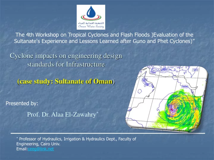

The 4th Workshop on Tropical Cyclones and Flash Floods )Evaluation of the Sultanate's Experience and Lessons Learned after Guno and Phet Cyclones)” Cyclone impacts on engineering design standards for Infrastructure (case study: Sultanate of Oman ) Presented by: Prof. Dr. Alaa El-Zawahry * * Professor of Hydraulics, Irrigation & Hydraulics Dept., Faculty of Engineering, Cairo Univ. Email:ceeg@link.net
OUTLINE Introduction Generation Mechanism of Cyclones Cyclones Naming Categories of Tropical Cyclones Cyclones History in Oman Gonu, Phet, and Mikono Cyclones Meteorological Model Ground Stations Damage of Gonu and Impacts on Design Criteria Risk Management
Generation Mechanism of Cyclones What are the Necessary Conditions for the Formation of the Tropical Cyclones? » Low-level relative Vorticity ( ζ r ) » Coriolis parameter (ƒ) » Low vertical shear » Sea surface temperatures » Vertical gradient of effective potential temperature ( θ e ) » Middle troposphere relative humidity (RH)
Generation Mechanism of Cyclones
Convective Towers
Cyclones Naming Importance for naming tropical cyclones It would help identify each individual tropical cyclone Local and international media become focused to the tropical cyclone It does not confuse the public when there is more than one tropical cyclone in the same area The name of the tropical cyclone is well remembered by million of people as it is unforgettable event shoes name will long be remembered Warnings reach a much wider audience very rapidly
Cyclones Naming Naming of tropical cyclones over north Indian Ocean The Panel member’s name are listed alphabetically country wise The name will be used sequentially column wise The first name will start from the first row of column one and continue sequentially to the last row in column eight. Example, this will be as Onil, Hibaru, Pyar, Baaz …………. Amphan The names which have been already used from the list are highlighted
Cyclones Naming Column One Column Two Column Three Column Four Panel Member Name Pron ’ Name Pron ’ Name Pron ’ Name Pron ’ Bangladesh Onil Onil Ogni Og-ni Nisha Ni-sha Giri Gi-ri India Agni Ag’ni Akash Aakaa’sh Bijli Bij’li Jal Jal Maldives Hibaru --- Gonu --- Aila --- Keila --- Myanmar Pyarr Pyarr Yemyin Ye-myin Phyan Phyan Thane Thane Oman Baaz Ba-az Sidr Sidr ’ Ward War’d Murjan Mur’jaan Pakistan Fanoos Fanoos Nargis Nar gis Laila Lai la Nilam Ni lam Sri Lanka Mala --- Rashmi Rash’mi Bandu --- Mahasen --- Thailand Mukda Muuk-dar Khai Muk Ki-muuk Phet Pet Phailin Pi-lin
Cyclones Naming Column Five Column Six Column Seven Column Eight Panel Member Name Pron ’ Name Pron ’ Name Pron ’ Name Pron ’ Bangladesh Helen Helen Chapala Cho-po-la Ockhi Ok-khi Fani Foni India Lehar Le’har Megh Me’gh Sagar Saa’gar Vayu Vaa’yu Maldives Madi --- Roanu --- Mekunu --- Hikaa --- Myanmar Nanauk Na-nauk Kyant Kyant Daye Da-ye Kyarr Kyarr Oman Hudhud Hud’hud Nada N’nada Luban L’luban Maha M’maha Pakistan Nilofar Ni lofar Vardah Var dah Titli Titli Bulbul Bul bul Sri Lanka Priya --- Asiri Aa’siri Gigum Gi’gum Soba --- Thailand Komen Goh-men Mora Moh-rar Phethai Pay-ti Amphan Um-pun
Categories of Tropical Cyclones Tropical Cyclone Intensity Scale Category Wind Speed Super Cyclonic Storm > 222 km/h Very Severe Cyclonic Storm 118 – 221 km/h Severe Cyclonic Storm 88 – 117 km/h Cyclonic Storm 62 – 87 km/h Deep Depression 52 – 61 km/h Depression ≤ 51 km/h
Storms affecting the Arabian Peninsula by Storms affecting the Arabian Peninsula by period month Month Number of storms Period Number of storms 1800s May 5 14 1900 – 49 June 10 18 1950s 3 July 3 1960s 6 August 1 1970s 11 September 3 1980s 2 October 7 1990s 6 November 2000s 8 5 2010s December 11 5
Gonu Cyclone (June 2007) Wind Speed (kts) Forecasted ( June 1, 2007 ) Dis = 5 km Do3 a) 00:00UTC b) 06:00UTC c) 12:00UTC d) 18:00UTC Weather Research and Forecasting Model
Gonu Cyclone (June 2007) Wind Speed (kts) Forecasted ( June 7, 2007 ) Dis = 5 km Do3 a) 00:00UTC b) 06:00UTC c) 12:00UTC d) 18:00UTC Weather Research and Forecasting Model
Gonu Cyclone (June 2007) Lat:19.2N Lat:18.7N Lon:64.9E Lon:66.0E METEOSAT-7 RGB = CH (1,4) Weather Research and Forecasting Model
Gonu Cyclone (June 2007) Lat:23.9N Lat:23.0N Lon:59.4E Lon:60.4E Weather Research and Forecasting Model
Gonu Cyclone (June 2007) Weather Research and Forecasting Model
Category Results and Discussion Super Cyclonic Storm Very Severe Parameter SI WRF-ARW Range of Error Cyclonic Storm Generally, in the model Severe Cyclonic June 1 D (in late the day) D (in late the day) Storm June 2 DD – CS (Along the day) D – DD (Along the day) forecast period, the intensity Cyclonic Storm of the tropical cyclone was SCS - VSCS Within 3 and 4 June the model Deep Depression relatively weaker than the June 3 Along the day upgraded the system gradually observed. Depression SuCS – VSCS until reached SCS. Wind Speed (intensity) June 4 In late the day The system attained peak The system stills VSCS The model upgraded the system winds SuCS late on June 4, until early on June 6, and gradually until reached VSCS in While the model attained the system downgraded early on June 6, and the June 5, peak winds VSCS early on to SCS until late on system downgraded gradually. 6 June 6. June 6. The sy stem downgraded to The sy stem downgraded to CS CS until weakened at the until weakened at the late of the June 7 late of the day. day. Weather Research and Forecasting Model
Phet Cyclone (June 2010) Wind Speed (kts) Forecasted ( May 31, 2010 ) Dis = 15 km Do2 a) 00:00UTC b) 06:00UTC c) 12:00UTC d) 18:00UTC Weather Research and Forecasting Model
Phet Cyclone (June 2010) Lat:22.9N Lat:22.5N Lon:59.5E Lon:57.8E Weather Research and Forecasting Model
Category Super Cyclonic Results and Discussion Storm Very Severe Cyclonic Storm Severe Cyclonic Storm Parameter SI WRF-ARW Range of Error Cyclonic Storm May31 D D Generally, in the model Deep Depression DD – CS DD – SCS forecast period, the intensity of June 1 Depression the tropical cyclone was Along the day Along the day Wind Speed (intensity) relatively as the observed. SCS – VSCS SCS - VSCS June 2 Along the day Along the day The system attained peak The system stopped as VSCS winds VSCS at June 3, While 3, 4 June along the 2 days the model attained peak winds VSCS at the same time. The system gradually downgraded 5, 6 June to CS along the 2 days and dissipated early on June 7. Weather Research and Forecasting Model
Mukono Cyclone
Ground Stations at Gonu Cyclone
Ground Stations at Phet Cyclone
Gonu, Phet, & Bell Design Storms
Wadi Aday Flows
Road Damage & Remediation Bridges
Road Damage & Remediation Bridges
Road Damage & Remediation Culvert & Road Pavement
Road Damage & Remediation Side Ditch
Effect of Cyclones on Properties Branch from Wadi Alansab with Area The Study Area 17.85 Km 2
ghala ghala ghala ghala 22 22 Legend Legend WS PF 1 WS PF 1 WS PF 2 WS PF 2 20 Ground 20 Ground 18 18 Elevation (m) Elevation (m) 16 16 14 12 14 10 0 100 200 300 400 500 600 700 800 12 0 100 200 300 400 500 600 700 800 Main Channel Distance (m) Main Channel Distance (m) Bridge Scour RS = 465 RS = 340 10 .03 Legend 26 Legend WS PF 1 22 WS PF 1 WS PF 2 Ground 24 Ground Ineff 20 Ineff Elevation (m) 22 Bank Sta Bank Sta Elevation (m) Contr Scour 18 20 Total Scour 16 18 14 16 -50 0 50 100 150 200 250 14 -20 0 20 40 60 80 100 Station (m) Station (m)
Effect of Cyclones on Dams 1200 Al Ansab Dam Inflow 100 Yrs Outflow Initially Dry Outflow Initially Half Full 1000 Outflow Initially Full 800 Flow (m3/s) 600 400 5000 200 Inflow 4500 Outflow Initially Dry PMF Outflow Initially Half Full 4000 Outflow Initially Full 0 3500 0 5 10 15 20 25 Time (hrs) Flow (m3/s) 3000 Inflow & Outflow Hydrographs 2500 2000 1500 1000 500 0 0 5 10 15 20 25 Time (hrs) Inflow & Outflow Hydrographs
Effect of Gonu on Road Design 105 Rain stations 128 After Screening 67 North and 10 Dhofar
Effect of Gonu on Road Design Rainfall Old Manual, (1994 Item and Its New Manual (After Gonu) 2010 addendums) Sultanate of Oman is divided to four IDFCs One for All Oman zones. Each zone has its own IDFC I (mm/hr) corresponding to 140 174 (for IDFC of Zone 1) 100 Yrs at 0.25 hr If the catchment has a time of concentration less than 2 hours, there is no need to include cyclone effect (The manual IDFCs will be used). Gonu Effect ---- While if the time of concentration is more than 2 hours, cyclone effect should be taken into consideration (The manual IDFCs will not be used)
Recommend
More recommend