Ensemble Tropical Cyclone Activity Prediction using TIGGE data - PowerPoint PPT Presentation
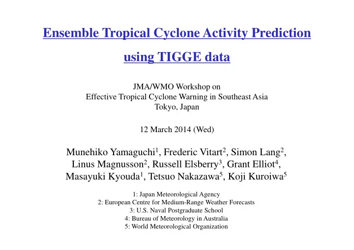
Ensemble Tropical Cyclone Activity Prediction using TIGGE data JMA/WMO Workshop on Effective Tropical Cyclone Warning in Southeast Asia Tokyo, Japan 12 March 2014 (Wed) Munehiko Yamaguchi 1 , Frederic Vitart 2 , Simon Lang 2 , Linus Magnusson 2
Ensemble Tropical Cyclone Activity Prediction using TIGGE data JMA/WMO Workshop on Effective Tropical Cyclone Warning in Southeast Asia Tokyo, Japan 12 March 2014 (Wed) Munehiko Yamaguchi 1 , Frederic Vitart 2 , Simon Lang 2 , Linus Magnusson 2 , Russell Elsberry 3 , Grant Elliot 4 , Masayuki Kyouda 1 , Tetsuo Nakazawa 5 , Koji Kuroiwa 5 1: Japan Meteorological Agency 2: European Centre for Medium-Range Weather Forecasts 3: U.S. Naval Postgraduate School 4: Bureau of Meteorology in Australia 5: World Meteorological Organization
Outline of the talk 1. Introduction of TIGGE What is TIGGE? What is the benefit of using TIGGE? 2. Ensemble tropical cyclone activity prediction M otivation, Verification M ethod, Results, Future Plan 3. Topic : M ulti-center ensemble predictions for Hurricane Sandy , Cyclones Phailin and Nargis , and Typhoon Haiyan 4. Summary
What is TIGGE? P a s t F u tu re R e s e a rc h P h a s e O p e ra tio n a l P h a s e T IG G E C y c lo n e X M L (s ta rte d 2 0 0 6 ) (s ta rte d 2 0 0 8 ) G o a l: E n h a n c e d u s e o f e n s e m b le p re d ic tio n fo r o p e ra tio n a l p u rp o s e s P re s e n t Various projects to demonstrate the value of ensemble prediction have been conducted. North Western Pacific Tropical Cyclone (TC) Ensemble Forecast Project (NWP-TCEFP) Severe Weather Forecasting Demonstration Project (SWFDP)
What is the benefit of using TIGGE? P a s t MCGE R e s e a rc h P h a s e EPS at EPS at T IG G E C y c lo n e X M L CMA ECMWF (s ta rte d 2 0 0 6 ) (s ta rte d 2 0 0 8 ) EPS at JMA EPS at EPS at KMA XXX MCGE is an ensemble of ensembles of major NWP centers. TIGGE makes it possible to construct a new ensemble, which is M ulti-Center Grand Ensemble (M CGE).
Track Prediction for Typhoon SOULIK (2013) Blue portion of the tracks is the Day 1 forecast and the green , orange , and red portions are the Day 2, Day 3, and Day 4 forecasts.
Ensemble Size = 207
Black line is the observed track. The number on the black line indicates day(s) from the initial date.
Track Prediction for Typhoon FITOW (2013)
Ensemble Size = 207
Black line is the observed track. The number on the black line indicates day(s) from the initial date.
What is the benefit of using MCGE? Typhoon SOULIK Typhoon FITOW Init.: 2013.07.08 12UTC Init.: 2013.10.03 12UTC M CGE products provide forecasters with additional information on the forecast uncertainty and increase the level of confidence in the forecast.
Systematic verification of MCGE The relative benefits of MCGE over single model ensemble (SME) are investigated from both deterministic and probabilistic perspectives. 58 TCs in the western North Pacific from 2008 to 2010 are verified. 1. TC strike probability Reliability is improved in M CGE, especially in the high-probability range. M CGE reduces the missing area by about 10 %. 2. Confidence information When multiple SM Es simultaneously predict the low uncertainty, the confidence level increases and a chance to have a large position error decreases. 3. Ensemble mean track prediction The position errors of 5-day predictions by the M CGE-3 are slightly smaller than that of the ensemble mean of the best SM E although the difference is not statistically significant. Y amaguchi, M ., T . Nakazawa, and S. Hoshino, 2012: On the relative benefits of a multi-centre grand ensemble for tropical cyclone track prediction in the western North Pacific, Q.J.R. Meteorol. S oc. , 138 , 2019-2029.
NWP-TCEFP website MRI/JMA operates a website of NWP-TCEFP where the MCGE products of TC tracks are available. Main Page (http://tparc.mri-jma.go.jp/cyclone/login.php) Send e-mail to thorpex@mri-jma.go.jp to get ID and password
Bay of Bengal Tropical Cyclone Experiment NWP-TCEFP website have been transferred to the Indian Meteorological Department website. http://www.imd.gov.in/section/nhac/dynamic/cyclone_fdp/CycloneFDP.htm
Ensemble tropical cyclone activity prediction
Average number of TCs making landfall over a country in a year (Note that the number is calculated using IBTrACS from 197- 2011, so it can be different from the official number ) exc. Okinawa and Amami Inc. Okinawa and Amami Courtesy of Hirose and Fudeyasu (Y okohama National Univ.)
Frequency of days from TC genesis to the landfall -Japan- 50 Courtesy of Hirose and Fudeyasu 45 (Y okohama National Univ.) 40 35 Frequency (%) 30 25 20 15 10 5 0 0 ~ 2 2 ~ 4 4 ~ 6 6 ~ 8 8 ~ 10 10 ~ 12 12 ~ 14 14 ~ Days
Frequency of days from TC genesis to the landfall -Philippines- 50 Courtesy of Hirose and Fudeyasu 45 (Y okohama National Univ.) 40 35 Frequency (%) 30 25 20 15 10 5 0 0 ~ 2 2 ~ 4 4 ~ 6 6 ~ 8 8 ~ 10 10 ~ 12 12 ~ 14 14 ~ Days
Verification of Tropical Cyclone Activity Prediction -description- • Although the performance of ensemble TC predictions has been studied well, the verification samples are usually limited to prediction cases where TCs exist at the initial times (i.e. TC strike probability prediction ). • There are few studies that verify TCs created during the model integrations on the medium-range time scale (i.e. TC genesis prediction ). • Systematic verification of ensemble TC predictions on the short- to medium-range time scale (1 – 14 days) has not been performed yet. • In this study, ensemble predictions of TC activity for a certain domain is verified using TIGGE from ECM WF , J M A, NCEP and UKM O. This study is one of the annual operating plans (AOPs) of the Working Group on M eteorology (WGM ) for 2013.
Verification method • Create TC tracking data using the ECM WF vortex tracker (Vitart et al. 1997, J. of Climate ; Vitart et al. 2007, ECM WF Newsletter). • Verification period is July – October in 2010 to 2012. Verified TCs are TCs with a Tropical Storm intensity or stronger ( 35 knots or stronger ). • Verify ensemble predictions of TC activity within a 3 day time window , which is applied over a forecast length of 2 weeks . Day 0 1 2 3 4 5 6 7 8 9 10 11 12 13 14
Example: TC activity probability maps -Haiyan- • Initial time of the forecasts: 2013/ 10/ 31 12 UTC (about 4 days before the genesis and 8 days before the landfall over the Philippines) • Time window: 2013/ 11/ 05 12 UTC – 2013/ 11/ 08 12 UTC (T+5days – T+8days) TC activity probability maps • Probabilities are calculated at each grid point of a 0.5 x 0.5 deg. grid space Observation (0 or 100%) • A threshold distance of 300km is used to determine whether observed or forecast TCs affect a grid point. Climatological TC activity of this initial time and this forecast time window
Brier Score N 1 2 - f o Brier Score (BS) = ( ) i i N = i 1 N : Number of samples f i : forecast probability (e.g. 0, 0.1, 0.2 … ..0.9, 1) o i : o i is 1 when the event occored and 0 otherwise The BS is a negatively oriented score (smaller is better). BS = 0 means the predictions are perfect. Brier Skill Score (BSS) = 1 – BS/ BS climatology The BSS is a positively oriented score (larger is better). BS < 0 means the predictions are not skillful with respect to climatological.
Why “ activity ” prediction, not “ genesis ” prediction? • In general TCs in models are weaker than those in reality . This tread is strong for ensemble predictions because the horizontal resolution for them is generally low. • It is difficult to say exactly when we can regard model TCs as TCs with a maximum sustained wind of 35 knots or more. • Given that the average lifetime of TCs is about 5 days, verifications with a time wind of 5 days or longer could be regarded as verifications of TC genesis and the subsequent track . • After all, what people are interested in is whether or not TCs exist in a certain domain in a certain forecast time or time window.
Verification of Tropical Cyclone Activity Prediction Blue : ECMW, Red : JMA (up to 9 days) , Green : NCEP, Purple : UKMO Good BSS Bad Time window (day)
Benefits of M CGE Verification for a time window of T+6 – T+9 days Bad 0.070 0.070 0.065 0.065 0.060 0.060 BS 0.055 0.055 0.050 0.050 0.045 0.045 0.040 0.040 ECM WF EPS JM A EPS NCEP EPS UKM O EPS M CGE ECM WF CTL Climatology ECM WF EPS JM A EPS NCEP EPS UKM O EPS ECM WF CTL M CGE Climatology Good
Future studies • Extend the verification into the globe. 20 deg. X 10 deg. The same color bar definition as slide 28 • In verification for individual TC cases, all EPSs are successful in predicting genesis events with a lead time of 5 days or longer in some cases (e.g. Typhoon SON-TINH in 2012), while cases with less predictability also exist (e.g. Typhoon NALGAE in 2011). Investigate the difference in the predictability from the synoptic environment.
Evaluation of TC activity in the North Indian Ocean using ECMWF ensemble Belanger, James I., Peter J. Webster, Judith A. Curry, Mark T. Jelinek, 2012: Extended prediction of north indian ocean tropical cyclones. Wea. Forecasting , 27 , 757 – 769.
Hurricane Sandy, Cyclone Phailin and Typhoon Haiyan images are taken from wikipedia and bbc.co.uk
Hurricane Sandy (2012) Init: 2012/ 10/ 22 12UTC Init: 2012/ 10/ 24 12UTC Init: 2012/ 10/ 26 12UTC Init: 2012/ 10/ 28 12UTC
Recommend
More recommend
Explore More Topics
Stay informed with curated content and fresh updates.
