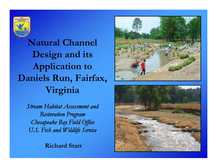

Natural Channel Design and its Application to Daniels Run, Fairfax, Virginia Stream Habitat Assessment and Stream Habitat Assessment and Restoration Program Restoration Program Ch Chesapeake B esapeake Bay Field Office ay Field Office U.S. Fish U.S. Fish and Wildlife Service and Wildlife Service Richard Starr
Presentation Overview • Daniels Run Stream Restoration Project • Watershed and Stream Assessments • Natural Channel Design Methodology (NCD) • Construction Management • Monitoring
Daniels Runs Stream Restoration Project • Partnership Between the U.S. Fish and Wildlife Service and Army Navy Country Club (ANCC), Fairfax, Virginia • Restoration Objective – return 2,500 linear feet of Daniels Run to a stable, self- maintaining state, while meeting the aesthetic and golf playability goals of the Country Club • Project completed July 2007
Watershed and Stream Assessment • Watershed Assessment – Stream-based and land-based assessments – Stream-based - visual assessment of stream character and stability condition – Land-based – land use/land cover, geology, soils, hydrology, basin conditions, and development trends • Stream Assessment – Bankfull determination – Limited Rosgen Levels II and III – Level II – stream type and character (width, depth, pattern, profile, substrate) – Level III – stream stability (incision, entrenchment, confinement, vegetation, erosion potential, shear and critical shear stresses, deposition pattern, meander pattern, channel evolution) • Determine interrelationship of watershed and stream processes (“cause and effect” relationships)
Watershed Boundary Daniels Run
Daniels Run Watershed Condition • Drainage Area – 1.88 square miles • Rosgen valley type VIII • Basin relief – 1 percent • Land use/Land cover - highly developed – 45% medium density residential – 20% industrial/commercial – 35% forested and grass areas (mostly located on ANCC property) – Development located in upper two-thirds of watershed – New development potential low • Geology and soils – poorly to moderately well drained • Hydrology – flashy flow regime due to development, high density storm drains, and lack of flood storage capacity • Stream Condition – stable to unstable conditions
Stream Condition • Rosgen Stream Types – Reach 1-C4 and Reach 2-F4 Reach 2 • Approximately 60% Reach 1 banks eroding • Riparian vegetation – primarily mowed grass • Widespread instability • Stability trend - degrading Reach 2 Reach 1
Natural Channel Design Methodology • Restoration objectives • Design criteria • Form - channel dimension, pattern, and profile • Process – hydraulic and hydrologic analyses • Structures • Iterative Analysis • Plantings
Natural Channel Design Methodology Definition
Natural Channel Design Methodology Definition The creation of a stable dimension, pattern, and profile for a stream type and channel morphology appropriate to its landform and valley, designed such that over time, is self-maintaining meaning its ability to transport the flow and sediment of its watershed without aggrading or degrading.
Daniels Run Restoration Objectives • Restore a natural, self-sustaining stream • Apply natural channel design principles • Maintain golf course playability • Improve in-stream habitat ( i.e ., diversity and quality) • Establish a native riparian buffer without affecting golfing activities • Improve water quality ( e.g ., reduce temperatures and sediment) • Require low maintenance
Restoration Strategy • Total stream reconfiguration • Two Rosgen stream types – C4 and B4c • Structures and soil fabric lifts
Design Criteria Daniels Run Reference Reach Design Criteria No. Variable Symbol Units Reference Data Proposed • Reference Reach 1 Stream Type C4 B4/1c C4 B4/1c Mean n/a 27.0 1.9 1.9 • Ratios based on mi 2 Drainage Area Min n/a n/a n/a n/a 2 bankfull Max n/a n/a n/a n/a Mean n/a 4.0 1.3 1.4 Riffle dimensions 3 Bankfull d bkf ft Min n/a n/a 2.1 1.7 Mean Depth Max n/a n/a 0.7 1.2 • Data range Mean n/a 44.8 19.0 21.0 Riffle 4 Bankfull W bkf ft Min n/a n/a n/a n/a • Defines channel Width Max n/a n/a n/a n/a form and substrate Mean 15.0 11.2 15.0 14.6 Width/Dept 5 W/d bkf Min 9.0 n/a 9.0 12.4 h Ratio • Used as Max 27.0 n/a 18.0 17.2 Riffle Mean n/a 179.3 29.3 33.8 monitoring Bankfull Min n/a n/a n/a n/a ft 2 6 Cross A bkf performance Sectional Max n/a n/a n/a n/a Area measures Riffle Mean n/a 4.7 1.7 2.2 Bankfull 7 d max ft Maximum Max n/a n/a 1.9 2.5 Depth
Form – Cross Section 10 Existing Section Construct Toe Benches to Narrow Low Flow Channel 5 Cut Proposed Section Fill 0 0 10 20 30 40 50 60 70 Deepen Low Flow Channel (a) Cross Section Adjustments
Form – Plan Form
Form – Profile
Process – Hydraulic and Hydrologic Analyses • Sediment transport – Critical shear stress analysis – Entrainment calculations – Modeling • Flood analysis – FEMA – 5 yr, 10 yr, 25 yr, and 50 yr
Structures • Purpose • Type • Location
Daniels Run Stream Restoration Log-Rock Cross Vanes Profile View Plan View
Daniels Run Stream Restoration Rock J-hook Vane Plan View
Daniels Run Stream Restoration Rock W-Weir Cross Section View Plan View Profile View
Daniels Run Stream Restoration Soil Lifts Cross Section View
Planting • Design objectives • Planting Requirements
Planting Plan
Planting Typical
Planting • Design objectives • Planting Requirements • Planting zones • Typicals • Volunteers
Construction Management • Stakeout • Structures • Grading • Materials • Specifications • Stabilization
Monitoring • 3 to 5 yrs • Quantitative performance standards • As-built drawings • Monumented cross sections • Structure evaluation standards • Photo documentation • Vegetation success
Daniels Run Stream Restoration Before and After
Daniels Run Stream Restoration Before and After
U.S. Fish & Wildlife Service - Chesapeake Bay Field Office 177 Admiral Cochrane Drive Annapolis, Maryland 21401 www.chesapeakebay.fws.gov Richard Starr (410) 573-4518 rich_starr@fws.gov Daniels Run Reports and Design: http://www.fws.gov/chesapeake bay/streampub.htm
Recommend
More recommend