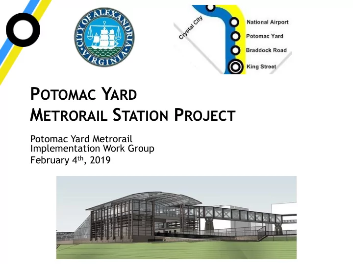

P OTOMAC Y ARD M ETRORAIL S TATION P ROJECT Potomac Yard Metrorail Implementation Work Group February 4 th , 2019
A GENDA Environmental Permitting Update • Project History • Supplemental Field Work • Project Footprint • Compensatory Mitigation • Preparing the revised Joint Permit Application • Next Steps 2 PYMIG| February 4, 2019
C OMMUNITY C OMMENTS • Station Location • Tidal Wetland Limits • Wetland Impacts • Restoration Plan • Regulatory Approval Process – Agencies – Permits 3 PYMIG| February 4, 2019
P ROJECT T EAM Stantec Loretta Cummings PhD MS and PhD Environmental Science /Public Policy - GMU BS Biology/Chemistry - Shepherd College 30+ years experience with 404/401 permitting, NEPA, aquatic biology at USFWS, VDOT , Stantec Chuck Roadley BS Biology - Virginia Tech, MBA - VCU 30+ years experience: Virginia Institute of Marine Science (VIMS), Virginia Marine Resources Commission (VMRC), Williamsburg Environmental Group/Stantec, Member James City County Wetlands Board Sean Wender - Ecologist – MS/BS Biology – 20+ years experience Jason Mann – Ecologist – BS Forestry – 16+ years experience Waterway Surveys & Engineering 39 years performing hydrographic surveys for streams, lakes, rivers and coastlines. 4 PYMIG| February 4, 2019
P ROJECT H ISTORY PYMS Design-Build Project Evolution 2011 – Environmental Impact Statement (NEPA) process began Wetland delineation, values assessment, impact limits, alternatives analysis, purpose & need determined during NEPA June 2, 2016 – Final Environmental Impact Statement Issued Federal Transit Authority ROD October 31, 2016 National Park Service ROD November 11, 2016 October 3, 2017 – Joint Permit Application submitted JPA developed exclusively on EIS data September 10, 2018 – Potomac Yard Contractors selected Contractor selection allows for JPA refinement September 12, 2018 – VDEQ Draft Permit Issued Responses gathered in public comments to be addressed in now-revised JPA 5 PYMIG| February 4, 2019
A ERIAL P HOTOGRAPHS 1988 – Google Imagery 6 PYMIG| February 4, 2019
P ROJECT A REA 7 PYMIG| February 4, 2019
S UPPLEMENTAL FIELD WORK F ALL 2018 • Tidal wetland survey • Non-tidal wetland data points • Habitat Evaluation • Wetland Functional Assessment 8 PYMIG| February 4, 2019
F IELD W ORK - T IDAL L IMITS S URVEY Waterway Surveys & Engineering Ltd Waterway Surveys & Engineering Ltd 9 PYMIG| February 4, 2019
F IELD W ORK - T IDAL L IMITS S URVEY 10 PYMIG| February 4, 2019
T IDAL A REA – L IMITS OF D ISTURBANCE • Original limits of disturbance did include tidal wetlands Revised limits of disturbance avoid the tidal wetlands • A protective barrier will be erected to identify and protect • the wetlands during construction 11 PYMIG| February 4, 2019
F IELD W ORK - W ETLAND D ATA C OLLECTION • Soils • Vegetation • Hydrology 12 PYMIG| February 4, 2019
F IELD W ORK - W ETLAND F UNCTIONS AND V ALUES Functions • Groundwater recharge/Discharge Flow Alteration • • Fish and Shellfish Habitat Sediment/Toxicant Retention • Nutrient Removal • • Sediment Stabilization Wildlife Habitat • Values Recreation • Education • • Uniqueness Aesthetics • • Threatened and Endangered Species 13 PYMIG| February 4, 2019
F IELD W ORK - H ABITAT ASSESSMENT Both Palustrine Emergent (PEM) and • Palustrine Forested (PFO) wetland types are onsite Emergent Tidal (E2EM), Tidal Open Water • (E1UB) and Tidal Stream Channel (R1SB) are present downstream of the project Invasive species are dominant in the areas • of proposed impacts Highly disturbed with spoil piles and • previous grading 14 PYMIG| February 4, 2019
P ROJECT F OOTPRINT Potomac Greens 15 PYMIG| February 4, 2019
P ROJECT F OOTPRINT 16 PYMIG| February 4, 2019
P ROJECT F OOTPRINT - W ETLAND I MPACT R EDUCTION Current October 2017 JPA • Permanent = 1.65 • Permanent = 1.56 – PFO = 1.01 – PFO = 0.92 – PEM = 0.64 – PEM = 0.64 • Temporary = 2.97 • Temporary = 2.01 – PFO = 1.38 – PFO = 1.01 – PEM = 1.59 – PEM = 0.91 REDUCTION 0.09 acre permanent 0.96 acre temporary 17 PYMIG| February 4, 2019
C OMPENSATORY M ITIGATION Wetland Type Amount Ratio Required PFO 0.92 2:1 1.84 PEM 0.64 1:1 0.64 2.48 CREDITS REQUIRED The City must ensure “No Net Loss” of wetlands acreage and functions by providing compensatory mitigation. Credits will be purchased from the approved mitigation bank prior to construction in jurisdictional areas . 18 PYMIG| February 4, 2019
R ESTORATION P LAN • Approximately 2 acres of wetlands temporarily impacted must be restored to the same of better condition • Forested area (1.01 acre) will be planted at a rate of 400 stems per acre • Emergent area (0.91 acre) will be seeded with a wetland mix • Monitoring is required by DEQ during and after construction • Monitoring wells will be installed to verify hydrology • An invasive control plan will be included. • Field studies and reporting will occur of 5-7 years or until the site meets the success criteria required by the agencies 19 PYMIG| February 4, 2019
P REPARING R EVISED A PPLICATION Site visit with the agencies to walk the • property Worked with PYC to minimize the proposed • permanent and temporary impacts PYC is preparing a wetland restoration plan • for the temporary impact areas per DEQ guidance documents Incorporate new ecology and tidal survey • information Documenting Alternatives Analysis • 20 PYMIG| February 4, 2019
N EXT S TEPS • Submit Revised Application in early February • US Army Corps of Engineers • Virginia Department of Environmental Quality • Virginia Marine Resources Commission • Will be posted on City website • Corps & DEQ will take public comments • City will request DEQ hold a public hearing • VMRC to review tidal wetland survey 21 PYMIG| February 4, 2019
Discussion 22 PYMIG| February 4, 2019
Recommend
More recommend