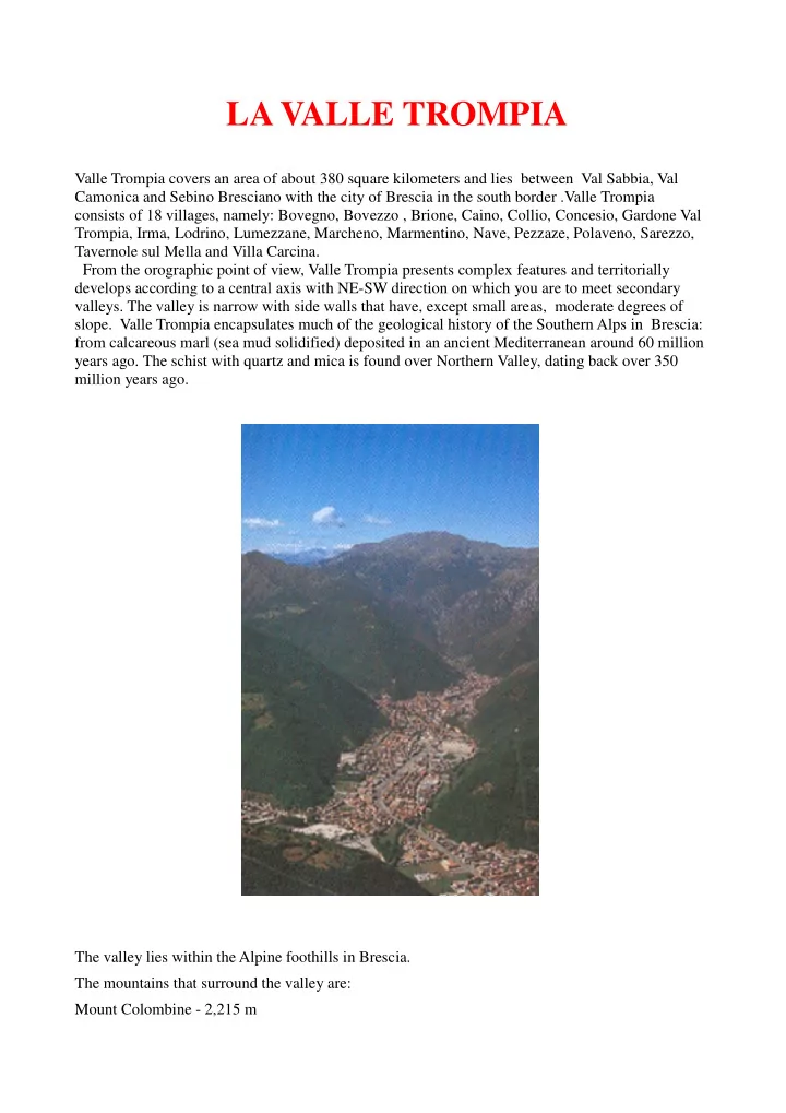

LA VALLE TROMPIA Valle Trompia covers an area of about 380 square kilometers and lies between Val Sabbia, Val Camonica and Sebino Bresciano with the city of Brescia in the south border .Valle Trompia consists of 18 villages, namely: Bovegno, Bovezzo , Brione, Caino, Collio, Concesio, Gardone Val Trompia, Irma, Lodrino, Lumezzane, Marcheno, Marmentino, Nave, Pezzaze, Polaveno, Sarezzo, Tavernole sul Mella and Villa Carcina. From the orographic point of view, Valle Trompia presents complex features and territorially develops according to a central axis with NE-SW direction on which you are to meet secondary valleys. The valley is narrow with side walls that have, except small areas, moderate degrees of slope. Valle Trompia encapsulates much of the geological history of the Southern Alps in Brescia: from calcareous marl (sea mud solidified) deposited in an ancient Mediterranean around 60 million years ago. The schist with quartz and mica is found over Northern Valley, dating back over 350 million years ago. The valley lies within the Alpine foothills in Brescia. The mountains that surround the valley are: Mount Colombine - 2,215 m
Dosso Alto - 2,065 m Mount Muffetto - 2,060 m Corna Blacca - 2006 m These all belong to the district of Maniva which is the northern border of the valley. Very famous, locally, is Mount Guglielmo (1,957 m), which you can see very well from Franciacorta, from the City as well as from the town plains and even from the province of Cremona. Sunset view from Mount Maniva View of the monument on Mount Guglielmo Valle Trompia presents a variation of climate ranging from the one of the lakes of Lombardy, in its lower part, in the mountainous north. Snowfall could be intense , increasing from the low to the
high valley, where the persistence of snow cover allows the practice of winter sports. The rainfall pattern is abundant in the growing season and is therefore conducive to the development of the forest. The lack of rainfall in early spring and autumn creates conditions for possible forest fires. The relationship between man and the environment has caused changing and transformations that modified the original ecosystems forcing the man to act in the territory in order to restore right relationships. They are triggered dynamic processes - evolutionary following precise natural laws tend to bring in the environment that set of conditions of topsoil (tree layer, shrub and herbaceous) and soil (chemical - physical and biological) capable of achieving a durable balance. The most important figures that emerge from the analysis of the situation in forestry Valtrompia identify the high forest of conifers concentrated in the upper valley, the coppice is the most common form, the high forests of hardwood are represented by the chestnut grove, spread formations shrubs due to surface soils present on the slopes of the lower valley, the abandonment of crops in marginal areas and less productive and the development of the pastures above the vegetation. View from Lago d’Iseo
IL FIUME MELLA “Chiare, fresche dolci acque” surely true at the time when the flow of that river inspired the name Mella (lat. Mel, is) that is HONEY. Valle Trompia, more than any other Brescia valley’, ties its territory to the river that has dug for over 40 kilometers from its source to the plains, determining the environment but also the attitudes of the population with its course faster and Alpine first , then slower and piedmont. The basin of the Mella originates from the peaks of Mount Colombine, Mount Maniva and Corna Blacca, after a path that winds for 96 km, joins the Oglio near Ostiano. The northern section of the river flows in the Trompia Valley, fed by tributary basins Bondegno, Bavorgo, Mella of Sarle, Mella of Zerlo, Mella Irma, Avano, Valcavallina Marmentino, Lembrio, Vandeno, re of Inzino, Tronto. To these must be added the valleys of Lodrino with the river Biogno, Polaveno - Brione Gombiera with the river, with the stream of Lumezzane Gobbia and finally the villages of Bovezzo - Nave - Caino arranged along the Garza. In the upper-middle the riverbed is recessed into the bottom of the valley, while Pralboino from the confluence is limited by continuous embankments. From left the River Mella receives several tributaries: Naviglio Canneto Chiusello, Cavata, Tartarus, Moldinaro, Lojolo, the floodway Garza. The tributaries are: Delmona, Canal Waters Alte, Riglio and Navarolo. Of great importance is the impressive canal system that tracked from the Middle Ages, took away water to areas prone to waterlogging for distribution in arid, integrating with the network of "canals", "yellowtails" and "ships". A witness is the abundance that the biological quality of the abundant waters that flow from the soil of the valley, extending along the major line of springs, are also the ruins of the monumental aqueduct from Roman times that supplied the city and the many fountains that 'embellished. Powered by snowfall and rainy, the river has a flow regimes consistent and relatively constant. The abundance of water has always been a determining factor in the economy of the valley, thanks to the intricate network of canals, made especially for the regulation of river water, irrigate crops and, in the past, to power hammers, forges and other activities proto -Industrial.
Photo Fiume Mella
Recommend
More recommend