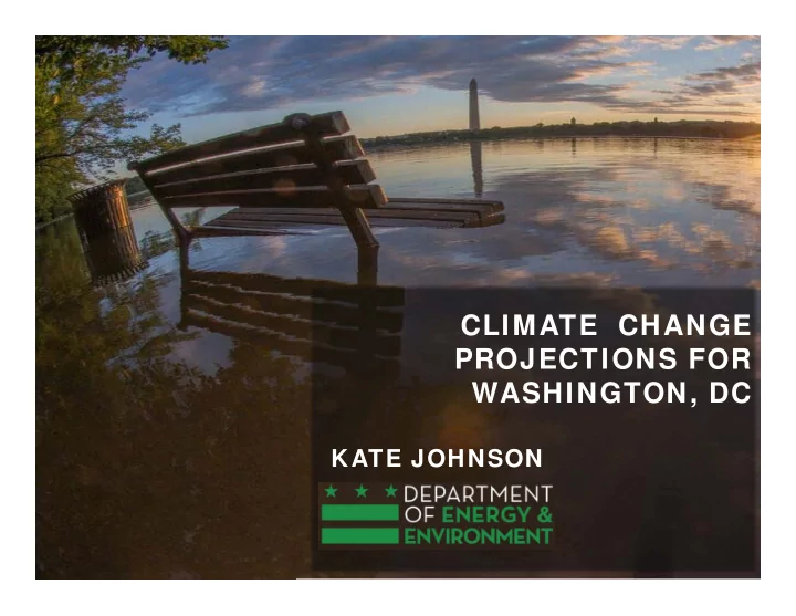

CLIMATE CHANGE PROJECTIONS FOR WASHINGTON, DC KATE JOHNSON Credit: By bosela, http://mrg.bz/DwS0ya
Projecting local climate change ‐ Downscaling Downscaling is the process of incorporating local data into global climate models in order to translate the results to the local level. Daily temperature, High and Low Local data from precipitation, and 9 global climate models emissions 3 weather humidity scenarios stations projections for 1960 ‐ 2100 Climate projections are averaged over 20 ‐ year periods: Baseline 2020s 2050s 2080s (1981 ‐ 2000) (2015 ‐ 2034) (2045 ‐ 2064) (2075 ‐ 2094)
Climate Indicators Precipitation Temperature Extreme Events Average Temperature # of days/year with rainfall at or above 1 in • • Summer Maximum Temperature (daytime) • # of days/year with rainfall at or above 2 in • Summer Minimum Temperature (nightime) • 1 ‐ yr 24 hr storm (in) Extreme Events • 2 ‐ yr 24 hr storm (in) # of heat waves per year • • 15 ‐ yr 24 hr storm (in) Avg heat wave duration (in days) • • 25 ‐ yr 24 hr storm (in) # of days/yr with heat index at or above 95 o F • • 100 ‐ yr 24 hr storm (in) # of days/yr with ambient temp at or above 95 o F • • 200 ‐ yr 24 hr storm (in) • Increase in frequency of the 2012 heat wave • 2 ‐ yr 6 hr storm (in) 15 ‐ yr 6 hr storm (in) • • 100 ‐ yr 6 hr storm (in) • 200 ‐ yr 6 hr storm (in) 80 th Percentile storm (in) • 90 th Percentile storm (in) • 95 th Percentile storm (in) •
Extreme Heat Events Days over 95°F Heat Index Baseline 2020s 2050s 2080s 1 2 3 4 5 6 7 1 2 3 4 5 6 7 1 2 3 4 5 6 7 1 2 3 4 5 6 7 8 9 10 11 12 13 14 8 9 10 11 12 13 14 8 9 10 11 12 13 14 8 9 10 11 12 13 14 June 15 16 17 18 19 20 21 15 16 17 18 19 20 21 15 16 17 18 19 20 21 15 16 17 18 19 20 21 22 23 24 25 26 27 28 22 23 24 25 26 27 28 22 23 24 25 26 27 28 22 23 24 25 26 27 28 29 30 1 2 3 4 5 29 30 1 2 3 4 5 29 30 1 2 3 4 5 29 30 1 2 3 4 5 6 7 8 9 10 11 12 6 7 8 9 10 11 12 6 7 8 9 10 11 12 6 7 8 9 10 11 12 13 14 15 16 17 18 19 13 14 15 16 17 18 19 13 14 15 16 17 18 19 13 14 15 16 17 18 19 July 20 21 22 23 24 25 26 20 21 22 23 24 25 26 20 21 22 23 24 25 26 20 21 22 23 24 25 26 27 28 29 30 31 1 2 27 28 29 30 31 1 2 27 28 29 30 31 1 2 27 28 29 30 31 1 2 3 4 5 6 7 8 9 3 4 5 6 7 8 9 3 4 5 6 7 8 9 3 4 5 6 7 8 9 10 11 12 13 14 15 16 10 11 12 13 14 15 16 10 11 12 13 14 15 16 10 11 12 13 14 15 16 August 17 18 19 20 21 22 23 17 18 19 20 21 22 23 17 18 19 20 21 22 23 17 18 19 20 21 22 23 24 25 26 27 28 29 30 24 25 26 27 28 29 30 24 25 26 27 28 29 30 24 25 26 27 28 29 30 31 31 31 31 1 2 3 4 5 6 7 8 9 10 11 12 13 30 50 70-80 75-105 days days days days Days above 95°F Heat Index (low emission scenario) Days above 95°F Heat Index (high emission scenario)
Extreme Heat Events Heat Wave Length & Frequency Heat waves, defined as 3 consecutive days when the heat index is above 95°F, are projected to be more frequent and last longer.
Precipitation Projections for DC Observed trends in measures of extreme precipitation are expected to continue to increase. Charts show the number of days per year with more than 1” (top) and 2” (bottom) of precipitation in 24h. By the 2080s the number of days per year with more than 2” of rain are expected to more than double from 2 days to 4.5 days under the higher scenario.
Baseline Design Storm 2020s 2050s 2080s Design Storm Events 1981-2000 1.7 1.7 2 Changes in rainfall volumes have a 1-yr 24 hr. storm (in) 1.6 (1.5 - 1.8) (1.5 - 1.8) ( ± <1) significant impact on infrastructure. 3.4 3.7 4 2-yr 24 hr. storm (in) 3.2 (3.2 - 3.7) (3.5 - 3.9) (4 - 5) 6.8 7.1 8 Design storms are the selected 15-yr 24 hr. storm (in) 5.5 (6.0 - 7.3) (6.7 - 7.6) (4 - 9) events that engineers use to design 7.9 8 10 25-yr 24 hr. storm (in) 6.3 drainage infrastructure, bridges, (6.8 - 8.6) (7.5 - 8.8) (8 - 12) 10.5 10.3 14 culverts, etc. 100-yr 24 hr. storm (in) 8.1 (8.9 - 12.4) (9.0 - 11.9) (10 - 16) 12 11.7 16 200-yr 24 hr. storm (in) 9 Input from DC Water, DDOT and (10.1 - 14.7) (9.8 - 13.6) (11 - 19) DDOE’s Stormwater Management 2.4 2.6 3 2-yr 6 hr. storm (in) 2.3 Division informed the selection of ( ± <0.1) (2.6 - 2.7 ( ± <1) events that are used as standards 4.6 4.7 5 15-yr 6 hr. storm (in) 3.6 (4.3 - 4.8) (4.6 - 4.8) (4 - 6) for stormwater, wastewater, and 6.7 6.5 9 transportation infrastructure. 100-yr 6 hr. storm (in) 5.1 (6.5 - 6.8) (6.4 - 6.7) (7 - 10) 7.5 7.2 10 200-yr 6 hr. storm (in) 5.6 (7.2 - 7.7) ( ± <0.1) (8 - 11) The chart shows how rainfall 0.9 0.9 0.95 80 th Percentile storm (in) 0.8 volumes are projected to increase (0.1) (0.1) (0.1-0.15) across the relevant design storm 1.24 1.24 – 1.34 1.24 – 1.39 90 th Percentile storm (in) 1.14 (0.1) (0.1-0.2) (0.1-0.25) events, especially for the more 1.6 – 1.65 1.6 – 1.75 1.75 – 1.85 extreme (100 and 200 year) events. 95 th Percentile storm (in) 1.5 (0.1-0.15) (0.1-0.25) (0.15-0.35)
Design Storms Compared Bar charts compare 24 ‐ hour and 6 ‐ hour design storms for each of the planning horizons. Trend lines show increase in rainfall volumes over time.
Changes in Design Storm Events Implications & Opportunities for Further Modelling Example: Drainage infrastructure is generally designed to handle rainfall from a 15 ‐ year event. Historically, that meant 5.5” of rain. In the future, a storm with the same frequency will bring rainfall of: • 6.8” in the 2020s • 7.1” inches in the 2050s 8” inches in the 2080s • The result, without upgrades, could mean more frequent flooding and CSO discharges.
Kate Johnson katherine.johnson@dc.gov 202 ‐ 299 ‐ 3355 Email : katherine.johnson@dc.gov Web: doee.dc.gov
Recommend
More recommend