Change Angel N. Menndez INA Hydraulics Laboratory Univ. Buenos Aires - PowerPoint PPT Presentation
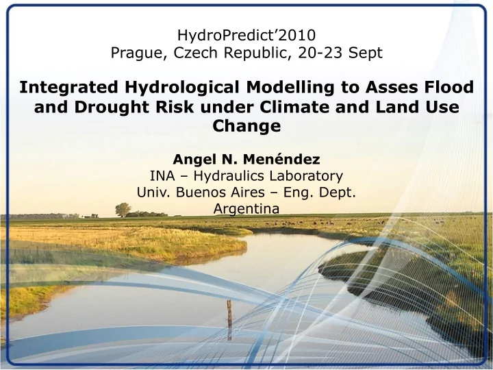
HydroPredict2010 Prague, Czech Republic, 20-23 Sept Integrated Hydrological Modelling to Asses Flood and Drought Risk under Climate and Land Use Change Angel N. Menndez INA Hydraulics Laboratory Univ. Buenos Aires Eng. Dept.
HydroPredict’2010 Prague, Czech Republic, 20-23 Sept Integrated Hydrological Modelling to Asses Flood and Drought Risk under Climate and Land Use Change Angel N. Menéndez INA – Hydraulics Laboratory Univ. Buenos Aires – Eng. Dept. Argentina
PRESENTATION • The Salado Basin • Implementation of Hydrologic Model • Calibration of Hydrologic Model • Model Scenarios • Conclusions
PRESENTATION • The Salado Basin • Implementation of Hydrologic Model • Calibration of Hydrologic Model • Model Scenarios • Conclusions
Salado Basin (Argentina) 170,000 km2 (A1: 15,000 km2)
Salado Basin (Argentina)
PRESENTATION • The Salado Basin • Implementation of Hydrologic Model • Calibration of Hydrologic Model • Model Scenarios • Conclusions
HYDROLOGIC MODEL • Integrated surface and groundwater • Spatially distributed • Time continuous MIKE SHE
DEM for Land Surface (SRTM)
Depression Storage
Land Use Map
Land Use 10.0 Yearly Cycle 9.0 Indice de Area Foliar (-) 8.0 7.0 6.0 5.0 LAI 4.0 3.0 2.0 1.0 0.0 Ene Mar May Jul Set Nov Ene Mar May Jul Set Nov 2.00 Maíz Soja Trigo Pastura Girasol Profundidad de Raiz (m) 1.50 RDF 1.00 0.50 0.00 Ene Mar May Jul Set Nov Ene Mar May Jul Set Nov Maíz Soja Trigo Pastura Girasol
Land Use 4.0 800 Historical Time Series 3.5 700 3.0 600 2.5 500 RD (mm) LAI (-) 2.0 400 1.5 300 1.0 200 0.5 100 0.0 0 ene-63 ene-68 ene-73 ene-78 ene-83 ene-88 ene-93 ene-98 ene-03 LAI Gral. Villegas RD Gral. Villegas
Streams
Surface Flow Obstructions
Hydrogeologic Formations 150 Formación Junín 100 50 Pampeano Cota (m IGM) 0 -50 Araucano Puelche -100 -150 -200 5200000 5240000 5280000 5320000 5360000 5400000 X (GK F5) Nivel de Terreno Piso de la Formación Junín Piso del Pampeano Piso del Araucano y Puelche Piso de la 1º Capa de Cálculo
Rainfall Stations
Climatic Stations
Horizontal discretization 1,000 m x 1,000 m → 14,000 grid cells
PRESENTATION • The Salado Basin • Implementation of Hydrologic Model • Calibration of Hydrologic Model • Model Scenarios • Conclusions
Phreatic levels 80 Nivel de agua subterránea (m) Freatímetro Junín 1 79 78 77 76 75 74 73 72 1960 1970 1980 1990 2000 Años Nivel de Terreno Simulado Medido 102 Nivel de agua subterránea (m) Freatímetro General Pinto 101 100 99 98 97 96 95 94 1960 1970 1980 1990 2000 Años Medido Nivel de Terreno Simulado
Discharge 400 Río Salado en Junín 1980 -2004 350 300 Caudal (m3/s) 250 200 150 100 50 0 1980 1984 1988 1992 1996 2000 2004 Mediciones A1-032 400 Río Salado en Junín 1997 -2004 350 300 Caudal (m3/s) 250 200 150 100 50 0 1997 1998 1999 2000 2001 2002 2003 2004 Mediciones A1-032
Flooded Area 1993 Área inundada Área inundada 1997 Registrada Modelada % % Imagen de 1993 26.7% 19.5% Imagen de 1997 4.8% 7.0% 2001 Imagen de 2001 10.3% 13.6%
Relation discharge/phreatic level 300 250 Discharge 200 Caudal (m3/s) 150 100 50 0 1960 1964 1968 1972 1976 1980 1984 1988 1992 1996 2000 2004 0.00 Profundidad Freática Media (m) 1.00 2.00 Mean Phreatic Level 3.00 4.00 5.00 1960 1964 1968 1972 1976 1980 1984 1988 1992 1996 2000 2004
Flooded Area Flooded Area 1960-2004 500 34.4% 450 30.9% Area Inundada (miles de Ha) 400 27.5% Area Inundada (%) 350 24.1% 300 20.6% 250 17.2% 200 13.7% 150 10.3% 100 6.9% 50 3.4% 0 0.0% 1960 1964 1968 1972 1976 1980 1984 1988 1992 1996 2000 2004 Flooded Area 1991-2004 500 34% 17/12/1993 27/11/1997 05/03/2001 450 31% Area Inundada (miles de Ha) 400 27% Area Inundada (%) 350 24% 300 21% 250 17% 200 14% 150 10% 100 7% 50 3% 0 0% 1991 1992 1995 1996 1999 2000 2003
PRESENTATION • The Salado Basin • Implementation of Hydrologic Model • Calibration of Hydrologic Model • Model Scenarios • Conclusions
Scenarios of Rainfall Change • Scenario A1: reversion to rainfall conditions back in about three decades • Scenario A2: 30 years projection of yearly mean rainfall increase trend (3 mm/year) during the last decades of the XXth century
Scenarios of Rainfall Change Year 0 2 4 6 8 10 12 14 16 18 20 0.00 1.00 Mean Phreatic Depth (m) 2.00 3.00 4.00 5.00 Baseline A1 A2
Scenarios of Rainfall Change 14.0 12.0 10.0 Discharge (m3/s) 8.0 6.0 4.0 2.0 0.0 01-ene 31-ene 02-mar 01-abr 02-may 01-jun 02-jul 01-ago 01-sep 01-oct 01-nov 01-dic 01-ene Date Baseline A1 A2
Scenarios of Rainfall Change Date 01/ene 31/ene 02/mar 01/abr 02/may 01/jun 02/jul 01/ago 01/sep 01/oct 01/nov 01/dic 01/ene 0.0 1.0 Mean Phreatic Depth (m) 2.0 3.0 4.0 5.0 Baseline A1 A2
Scenario of Temperature Increase • Scenario B: 30 years projection, with a yearly mean temperature increase of 0.011 ° C, which leads to an increase in potential evapotranspiration
Scenario of Temperature Increase 3.5 3.0 2.5 Discharge (m3/s) 2.0 1.5 1.0 0.5 0.0 01-ene 31-ene 02-mar 01-abr 02-may 01-jun 02-jul 01-ago 01-sep 01-oct 01-nov 01-dic 01-ene Date Baseline B
Scenario of Temperature Increase Date 01/ene 31/ene 02/mar 01/abr 02/may 01/jun 02/jul 01/ago 01/sep 01/oct 01/nov 01/dic 01/ene 0.0 1.0 Mean Phreatic Depth (m) 2.0 3.0 4.0 5.0 Baseline B
Scenario of Agriculturization • Scenario C: complete agriculturization of the basin with soybean, which reflects in an increase of the amplitude of oscillation of infiltration through changes in LAI and RDF
Scenario of Agriculturization 7.0 6.0 5.0 Discharge (m3/s) 4.0 3.0 2.0 1.0 0.0 01-ene 31-ene 02-mar 01-abr 02-may 01-jun 02-jul 01-ago 01-sep 01-oct 01-nov 01-dic 01-ene Date Baseline C
Scenario of Agriculturization Date 01/ene 31/ene 02/mar 01/abr 02/may 01/jun 02/jul 01/ago 01/sep 01/oct 01/nov 01/dic 01/ene 0.0 1.0 Mean Phreatic Depth (m) 2.0 3.0 4.0 5.0 Baseline C
PRESENTATION • The Salado Basin • Implementation of Hydrologic Model • Calibration of Hydrologic Model • Model Scenarios • Conclusions
CONCLUSIONS (1/2) • Plaussible projected changes in climate and land use over a planning horizon: significant effects on hydrologic response of very mild slope basin • Increase in mean precipitation and agriculturization: increase in flood risk, decrease in drought risk • Increase in temperature: decrease in flood risk, increase in drought risk • Decrease in mean precipitation: flood risk unchanged, increase in drought risk
CONCLUSIONS (2/2) • Methodology to quantify risk changes: valuable input for sustainable agricultural management planning • Time lag (of about a decade) for system response can be determined, and should be taken into account • Combined scenarios should also be studied
http://laboratorios.fi.uba.ar/lmm Thank you …
Recommend
More recommend
Explore More Topics
Stay informed with curated content and fresh updates.
