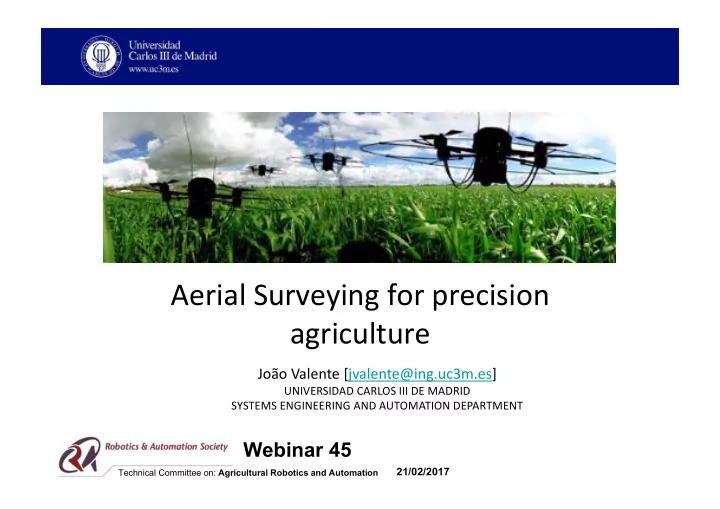

Aerial Surveying for precision agriculture João Valente [jvalente@ing.uc3m.es] UNIVERSIDAD CARLOS III DE MADRID SYSTEMS ENGINEERING AND AUTOMATION DEPARTMENT Webinar 45 21/02/2017 Technical Committee on: Agricultural Robotics and Automation
Outline 1. Background 2. Precision agriculture (PA) 3. Unmanned Aerial Systems (UAS) in PA 4. Aerial Mission planning (AMP) 5. Field experiments 6. Future challenges 2
Background • Population booming: – 1980: 4.5 Billions – 2016: 7.3 Billions – 2050: 9.3 Billions • Wrong food call 3
Precision Agriculture 4
Unmanned Aerial Systems (UAS) in PA UC Davis, USA CAR UPM-CSIC, Spain QuantaLab, IAS-CSIC, Spain 5 UARSF-WUR, Netherlands NASA, USA
Aerial Mission planning (AMP) Problem definition 6
Aerial Mission planning (AMP) Problem definition 7
Aerial Mission planning (AMP) Problem definition 8
Aerial Mission planning (AMP) Problem definition 9
Aerial Mission planning (AMP) Problem definition 10
Aerial Mission planning (AMP) Problem definition 11
Aerial Mission planning (AMP) Problem definition 12
Aerial Mission planning (AMP) Mission summary: • Specifications: • Field polyline/area • Camera parameters • Requirements: • Spatial resolution • Overlapping • Minimum flying time • Constraints: • Initial and final TOL position • Prohibited areas • Safety distance 13
Aerial Mission planning (AMP) Mission summary: • Specifications: • Field polyline/area • Camera parameters ✔ • Requirements: • Spatial resolution ✔ • Overlapping ✔ • Minimum flying time • Constraints: • Initial and final TOL position • Prohibited areas • Safety distance 14
Aerial Mission planning (AMP) Workspace sampling Field Discretized polylines (4) <Lat1, lon1> <Lat2, lon2> N <Lat3, lon3> <Lat4, lon4> 15
Aerial Mission planning (AMP) Workspace sampling II III I IV V VI 16
Aerial Mission planning (AMP) Workspace sampling Mission summary: • Specifications: • Field polyline/area ✔ • Camera parameters ✔ • Requirements: • Spatial resolution ✔ • Overlapping ✔ • Minimum flying time • Constraints: • Initial and final TOL position • Prohibited areas • Safety distance 17
Aerial Mission planning (AMP) Workspace sampling Mission summary: • Specifications: • Field polyline/area ✔ • Camera parameters ✔ • Requirements: • Spatial resolution ✔ • Overlapping ✔ • Minimum flying time Ψ ( • Constraints: • Initial and final TOL position • Prohibited areas • Safety distance 18
Aerial Mission planning (AMP) Workspace sampling Mission summary: • Specifications: • Field polyline/area ✔ width • Camera parameters ✔ • Requirements: • Spatial resolution ✔ • Overlapping ✔ • Minimum flying time height • Constraints: • Initial and final TOL position • Prohibited areas <x,y> ??? • Safety distance 19
Aerial Mission planning (AMP) Workspace sampling • Spatial resolution (Pixel/cm) • Overlapping (%) • Field size (m) d x d y 20
Aerial Mission planning (AMP) Workspace sampling 21
Aerial Mission planning (AMP) Workspace sampling Area sub-division, the robot assignment problem and discretization. 22
Aerial Mission planning (AMP) Path planning What is the best Coverage path? 23
Aerial Mission planning (AMP) Path planning Grid graph 24
Aerial Mission planning (AMP) Path planning Heuristicless • Rules-of-thumb • Brute force • Bread-first search (BFS) • Deep-limited search (DLS) 25
Aerial Mission planning (AMP) Path planning Heuristics • Wave-front planner algorithm • Deep limited search (DLS) • With backtracking procedure 26
Aerial Mission planning (AMP) Path planning Meta-Heuristics • Genetic algorithm (GA) • Ant colony optimization (ACO) • Harmony Search (HS) 27
Aerial Mission planning (AMP) Mosaicing (tools) • OpenCV • Matlab • Panorama tools 28
Aerial Mission planning (AMP) Implementation 29
Field experiments Working cycle Workstation setup Mission execution Mission assignment and validation Mission Real-time feedback 30
Field experiments AMP system inputs Image requisites Field characteristics Camera specification Number of UAS 31
Field experiments • Vineyard parcel (irregular shape) • Corn field (regular shape) • Irregular shape field • Regular shape field • ~63765 m² • ~20000 m² 32
Field experiments • Weed management • FP7 Project: RHEA (Robot Fleets for Highly Effective Agriculture and Forestry Management) http://www.rhea-project.eu 33
Field experiments Corn field https://youtu.be/1VM9VWWbLv4 34
Field experiments • Frost monitoring 35
Field experiments Vineyard parcel https://youtu.be/F4bJdpG8gbw 36
Future challenges • Multi-UAS • Alternative payload systems • Close-the-loop • Farmer-robot interaction • Education 37
Short BIO • Education • PhD. Robotics and Automation, Polytechnic University of Madrid (UPM), Spain, 2014 • MSc. Robotics and Automation, UPM, Spain, 2011 • Integrated MSc. Electronics and Computer science, New University of Lisbon (UNL), Portugal, 2008 • Positions • Research fellow, Wageningen University & Research (WUR), Netherlands, 2017- • Visiting professor, Carlos III University of Madrid, Spain, 2015-2017 • Early stage researcher, UPM, Spain, 2008-2014 • Junior researcher, University of Rome La Sapienza , Italy, 2007-2008 • Further information • Webpage: www.joao-valente.com 38
Thank y u! 39
Recommend
More recommend