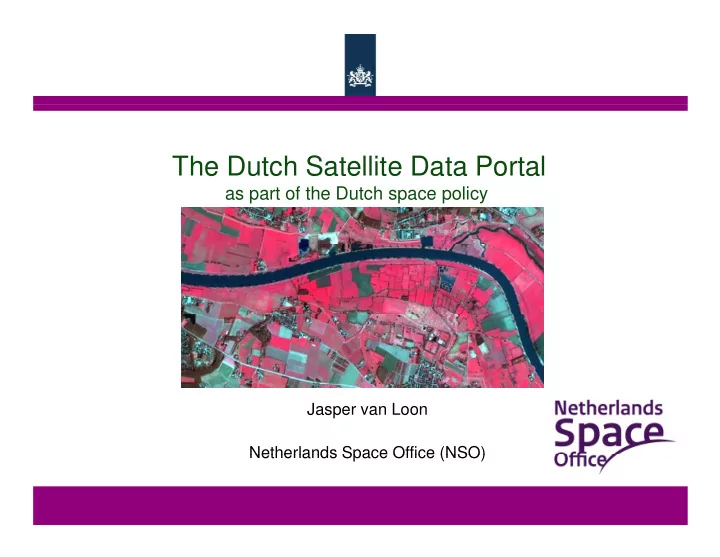

The Dutch Satellite Data Portal The Dutch Satellite Data Portal as part of the Dutch space policy Jasper van Loon Netherlands Space Office (NSO) Netherlands Space Office (NSO)
Netherlands Space Office ( NSO) – 2 5 FTE • Execute the Dutch space policy (upstream and downstream) • • Represents NL in ESA, EU, etc. Represents NL in ESA, EU, etc. • Central point of contact for the Dutch space community • Executing subsidy programs • Communication to the general public
Sputnik, 1957 3 Netherlands Space Office
Netherlands Space Office
Hom e m arket – The Netherlands
Hom e m arket – The Netherlands
Hom e m arket – SW OT analysis Strong: Need for innovation due to ground prices Weak: Densely measured by in situ / airborne / UAV’s Opportunity: Rectangular flat parcels, small country Threats: Need for higher resolution data
Earth observation in The Netherlands • 15 - 20 SME’s (1 -100 FTE), which focus on satellite data • • Mainly spin -offs of universities (Wageningen, Delft, Amsterdam) Mainly spin -offs of universities (Wageningen, Delft, Amsterdam) • Market: - - The Netherlands The Netherlands (precision agriculture, deformations) (precision agriculture, deformations) - Marine (marine conditions, water quality) - Tropics (deforestation) - - Developing countries (water management, food security) Developing countries (water management, food security)
Lim ited grow th dow nstream sector • Satellite images are expensive • The (foreseen) customer is unaware of the possibilities • Competition with aerial images (resolution!) • • Only SME’s involved Only SME’s involved • Limited connection with geo information market • A scientist is in general not an entrepeneur …
GMES Sentinels Sentinel-1 RADAR (land and marine applications) Sentinel-2 Sentinel-2 Multi-spectral (land applications) Multi-spectral (land applications) Sentinel-3 Multi-spectral (marine applications) Sentinel-4 Sentinel-4 Multi-spectral (atmospheric applications, geostationary) Multi-spectral (atmospheric applications, geostationary) Sentinel-5 Multi-spectral (atmospheric applications, polar orbit) Free and open data, guaranteed data continuity Free and open data, guaranteed data continuity
GMES Sentinels Sentinel-1 RADAR (land and marine applications) 2014 Sentinel-2 Sentinel -2 Multi-spectral (land applications) M ulti-spectral (land applications) 2015 2015 S entinel-3 M ulti-spectral (m arine applications) 2015 S Sentinel -4 entinel-4 M M ulti-spectral (atm ulti-spectral (atm ospheric ospheric applications, geostationary) applications, geostationary) S entinel-5 M ulti-spectral (atm ospheric applications, polar orbit) S atellite data portal : 2012 - 2015 F F ree ree and and open open data, guaranteed data, guaranteed data data continuity continuity
Satellite data portal • Economic profit for end- users (precision agriculture) • Reduction of pollution (pesticides in agriculture) • Reduction of governmental costs (e.g. deformation measurements) • Quick start for NL value adding sector • Ministry of Economic Affairs signs contract in Oct 2011. • Ministry of Infrastructure and Environment joins later in Dec 2012. Ministry of Infrastructure and Environment joins later in Dec 2012.
Satellite data portal Preparation for Sentinel - 1: Preparation for Sentinel - 1: - Radarsat - 2 (radar) : 25 meter, 1x per 24 days, 4 polarisations (HH, HV, VH, VV) 4 polarisations (HH, HV, VH, VV) Preparation for Sentinel - 2: - DMC - satellites (MS) - DMC - satellites (MS) : 22 meter, 3x per week, 3 bands : 22 meter, 3x per week, 3 bands - Formosat - 2 (MS) : 8 meter, 1x per 9 days, 4 bands - Formosat - 2 (PAN) : 2 meter, 1x per 9 days, 1 band Preparation for Sentinel - 3: Preparation for Sentinel - 3: - Link to free online data sets
DataDoors (Airbus Defense and Space) DataDoors (Airbus Defense and Space) 14
Precision farming Netherlands Space Office
False colour image (incl. infrared) False colour image (incl. infrared) 16
DMC - data (22m) DMC - data (22m) Formosat - data (8m) Formosat - data (8m) 1 September 2012 4 September 2012 17 Netherlands Space Office
Free and open data Groenmonitor.nl 18 Netherlands Space Office
Vegetation index 15-3-2012 1 5-3-2012 25-5-2012 25-5-2012 19 Netherlands Space Office
Water Netherlands Space Office
Nitrogen - Fertilizer Netherlands Space Office
Amount of pesticides for potato hauling Amount of pesticides for potato hauling 22 Netherlands Space Office
Drought monitoring monitoring using RADAR watertekort Netherlands Space Office
RADAR research in Wadden Sea area using different polarisations using different polarisations 24 Netherlands Space Office
Crop classification Crop classification using RADAR 25 Netherlands Space Office
Deform ation m easurem ents
Lauwersmeerdijk 27
Deform ations in de Port of Rotterdam
Conclusions • Satellite data portal 2012 – 2015 (national funded) • Preparation for the Sentinel program (EU funded) • Multiple applications from the data (NL focus: precision farming, deformation monitoring) • Potential need for other (higher resolution) data Potential need for other (higher resolution) data Jasper van Loon Jasper van Loon Netherlands Space Office j.vanloon@spaceoffice.nl
Recommend
More recommend