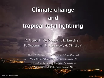
The 13 years of TRMM Lightning Imaging Sensor: The 13 years of TRMM - PowerPoint PPT Presentation
The 13 years of TRMM Lightning Imaging Sensor: The 13 years of TRMM Lightning Imaging Sensor: From individual flash characteristics to decadal tendencies From individual flash characteristics to decadal tendencies 1,2 , S. J. Goodman 3 , W. A.
The 13 years of TRMM Lightning Imaging Sensor: The 13 years of TRMM Lightning Imaging Sensor: From individual flash characteristics to decadal tendencies From individual flash characteristics to decadal tendencies 1,2 , S. J. Goodman 3 , W. A. Petersen 4 , D. E. Buechler 5 , R. I. Albrecht 1,2 , S. J. Goodman 3 , W. A. Petersen 4 , D. E. Buechler 5 , R. I. Albrecht 6 , R. J. Blakeslee 4 , H. J. Christian 5 E. C. Bruning 6 , R. J. Blakeslee 4 , H. J. Christian 5 E. C. Bruning 1 Instituto Nacional de Pesquisas Espaciais (INPE/CPTEC) 1 Instituto Nacional de Pesquisas Espaciais (INPE/CPTEC) 2 2 Cooperative Institute for Climate and Satellites (CICS/UMD) Cooperative Institute for Climate and Satellites (CICS/UMD) 3 National Oceanic and Atmospheric Administration (NOAA/NESDIS/GSFC) 3 National Oceanic and Atmospheric Administration (NOAA/NESDIS/GSFC) 4 NASA Marshall Space Flight Center (NASA/MSFC) 4 NASA Marshall Space Flight Center (NASA/MSFC) 5 University of Alabama-Huntsville (UAH) 5 University of Alabama-Huntsville (UAH) 6 Texas Tech University (TTU) 6 Texas Tech University (TTU)
Introduction The Tropical Rainfall Measuring Mission (TRMM) satellite was launch in November 1997. The TRMM Lightning Imaging Sensor (LIS) is a CCD array that detects lightning events at ~4.3 km of resolution during 92 seconds at nadir: – This short sampling time during the satellite overpass requires several years to compute high resolution climatology. Nowadays, LIS has collected lightning measurements for over 13 years which enable us: – To make compilation of a total lightning climatology maps in high resolution such as 0.25 o and 0.10 o of horizontal resolution. – To infer total lightning trends over the last decade.
Methodology o Each LIS orbit was tracked over the surface of the Tropics (±35 of latitude): – in 0.50 o , 0.25 o and 0.10 o grids – computing the view time and the number of flashes at each pixel during each orbit passage. – flash count at each pixel was corrected by the instrument flash detection efficiency according to the pixel’s local standard time (LST) [Boccippio et al., 2002]
Methodology -2 yr -1 ) was calculated for the 13 Flash rate density (FRD – fl km year and here we analyze: 1) The climatological total lightning map and its maximums 2) Individual flash characteristics in respect to precipitation type 3) Decadal trends
Results 1) The climatological total lightning map 1) The climatological total lightning map and its maximums and its maximums
Results 1) The climatological total lightning map and its maximums 1) The climatological total lightning map and its maximums fl km -2 yr -1 Christian et al. [2003] LIS+OTD 0.50 o , 1995-2000 LIS 0.25 o , 1998-2010 LIS 0.10 o , 1998-2010
1) The climatological total lightning map and its maximums 1) The climatological total lightning map and its maximums 1 st maximum in Christian et al. [2003] (0.50 o resolution): – Kamembe, Rwanda: 82.7 fl km -2 yr -1 , with 221 thunderstorm days per year. 1 st maximum in LIS 0.25 o and 0.10 o (1998-2010): – Lake Maracaibo, Venezuela: 250 fl km -2 yr -1 , with 333 thunderstorm days per year fl km -2 yr -1
1) The climatological total lightning map and its maximums 1) The climatological total lightning map and its maximums – Nocturnal maximum due to a convergence of breezes over a warm lake: fl km -2 yr -1 • Sea breeze • Minimum mean lake water temperature of 28.7 o C • Easterlies • Mountain-valley breeze • Lake breeze
1) The climatological total lightning map and its maximums 1) The climatological total lightning map and its maximums – Nocturnal maximum due to a convergence of breezes over a warm lake: fl km -2 yr -1 • Sea breeze • Minimum mean lake water temperature of 28.7 o C • Easterlies • Mountain-valley breeze Mountain-valley breeze • Lake breeze
1) The climatological total lightning map and its maximums 1) The climatological total lightning map and its maximums – Nocturnal maximum due to a convergence of breezes over a warm lake: fl km -2 yr -1 • Sea breeze • Minimum mean lake water temperature of 28.7 o C • Easterlies • Mountain-valley breeze Mountain-valley breeze • Lake breeze Lake breeze
1) The climatological total lightning map and its maximums 1) The climatological total lightning map and its maximums – Nocturnal maximum due to a convergence of breezes over a warm lake: fl km -2 yr -1 • Sea breeze Sea breeze • Minimum mean lake water temperature of 28.7 o C • Easterlies • Mountain-valley breeze Mountain-valley breeze • Lake breeze Lake breeze
1) The climatological total lightning map and its maximums 1) The climatological total lightning map and its maximums – Nocturnal maximum due to a convergence of breezes over a warm lake: fl km -2 yr -1 • Sea breeze Sea breeze • Minimum mean lake water temperature of 28.7 o C • Easterlies Easterlies • Mountain-valley breeze Mountain-valley breeze • Lake breeze Lake breeze
Results 2) Individual flash characteristics in 2) Individual flash characteristics in respect to precipitation type respect to precipitation type (please see the proceedings for details)
Results 3) Decadal trends 3) Decadal trends
Results 3) Decadal trends: 3) Decadal trends: o resolution: Flashes from LIS orbit dataset at 0.5 – Post-boost orbits field of view were corrected by the pre- boost swath and LIS detection efficiency; – Cummulated daily flashes and viewtimes using a 49-day moving window to capture a full diurnal cycle (Boccippio et at., 2000); – Cummulated flash rate density pentads (5-days). Quantile linear regression calculated for Regional Boxes:
Results 3) Decadal trends: 3) Decadal trends: Quantile linear regression: Quantile linear regression: – Method to estimate the change (trend) of flash rate density (FRD) quantiles as a function of the year; – A quantile is a point taken from the inverse cumulative distribution function of the FRD so that, for examples, the 0.7 quantile is the value such that 70% of the pentad FRD have FRD below this value (70th percentile); K y t = 0 t ∑ k = 1 k x tk t Q ∣ x t1 , ... , x tk = 0 K Q y t ∣ x t1 , ... ,x tk = 0 ∑ k = 1 k x tk – The coefficients β k ( τ ) are estimated for 19 different quantiles ( τ =0.05,0.10,...,0.95) using each time the entire dataset of a regional box.
Results 3) Decadal trends: 3) Decadal trends:
Results 3) Decadal trends: 3) Decadal trends: OLS → -0.4 fl km -2 -2.5 (fl km -2 ) per year @ Q(0.90) = 41.9 fl km -2 -6% per year All quantile trends are significant at 10% level
Results 3) Decadal trends: 3) Decadal trends: Summary for Q(0.95): – Circles = Land trend (or No Mask) – Triangles = Ocean trend • Blue = negative trend on the 95 th percentile • Red = positive trend on the 95 th percentile – only trends with 95% confidence are shown.
Results 3) Decadal trends: 3) Decadal trends: – 13-years is a very small period be considered a climate trend. – But, if if it is a sign of global warming global warming, how can we explain a decrease in the high flash rate densities? • Convective mass flux and T relationship (Betts 1998; Held et al., 2006; Vecchi and Soden 2007): M c = P P − 0.07 T M c Convective ∆ T updraft lightning mass flux
Thank you! (rachel.albrecht@cptec.inpe.br)
Recommend
More recommend
Explore More Topics
Stay informed with curated content and fresh updates.
