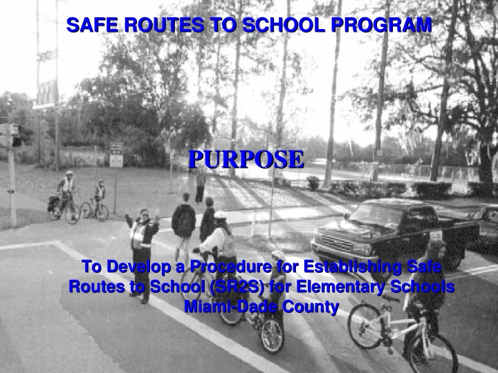

SAFE ROUTES TO SCHOOL PROGRAM SAFE ROUTES TO SCHOOL PROGRAM PURPOSE PURPOSE To Develop a Procedure for Establishing Safe To Develop a Procedure for Establishing Safe Routes to School (SR2S) for Elementary Schools Routes to School (SR2S) for Elementary Schools Miami- -Dade County Dade County Miami
SAFE ROUTES TO SCHOOL PROGRAM SAFE ROUTES TO SCHOOL PROGRAM BENEFITS of SR2S PROGRAMS � Promote Walking & Bicycling to School � Enhance Bicycle and Pedestrian Safety � Improve Quality of Life
SAFE ROUTES TO SCHOOL PROGRAM SAFE ROUTES TO SCHOOL PROGRAM APPROACHES TO SR2S PROGRAMS � Encouragement � Education � Engineering � Enforcement
SAFE ROUTES TO SCHOOL PROGRAM SAFE ROUTES TO SCHOOL PROGRAM SELECTION OF SCHOOLS FOR PILOT PROJECT � Review Pedestrian Crash Records � Identify High Pedestrian Crash Areas
SAFE ROUTES TO SCHOOL PROGRAM SAFE ROUTES TO SCHOOL PROGRAM SELECTION OF SCHOOLS FOR PILOT PROJECT � Selected 15 Elementary Schools in Liberty City
SAFE ROUTES TO SCHOOL PROGRAM SAFE ROUTES TO SCHOOL PROGRAM BACKGROUND RESEARCH Resources � Safe Routes to School, NHTSA � Safe Ways to School, “Tool Kit”, The Florida Traffic and Bicycle Safety Education Program � School Trip Safety Program Guidelines, ITE � Walk to School Safety Program, Walk Boston
SAFE ROUTES TO SCHOOL PROGRAM SAFE ROUTES TO SCHOOL PROGRAM BACKGROUND RESEARCH Case Studies � Marine County, California � The Bronx, New York � Parkmead, California � Greenest City, Toronto Canada � Hampshire, England
SAFE ROUTES TO SCHOOL PROGRAM SAFE ROUTES TO SCHOOL PROGRAM PILOT PROJECT Data Collection � Field Reviews � User Surveys � Interviews (Principals, Parents, Students) � Existing Safe Route Maps � Land Use � School Boundaries � Traffic Control Devices (Signals, Signs, Pavement Markings)
SAFE ROUTES TO SCHOOL PROGRAM SAFE ROUTES TO SCHOOL PROGRAM PILOT PROJECT Evaluation of Alternative Routes � Establish Safe Route Criteria � Develop Evaluation Matrix Other Criteria Major Criteria � Continuity of Streets � Low Traffic Volume � # of Driveways � Low Speeds � Sight Obstructions � No Railroad X-ings � No Canals � Proximity of Police/Fire Station � No Security Concerns
SAFE ROUTES TO SCHOOL PROGRAM SAFE ROUTES TO SCHOOL PROGRAM PILOT PROJECT Preliminary SR2S Maps and Reviews � Develop Preliminary SR2S Maps D R A F T � Reviews (SAC, Principals, PTA)
SAFE ROUTES TO SCHOOL PROGRAM SAFE ROUTES TO SCHOOL PROGRAM PILOT PROJECT Final SR2S Maps � Develop Final SR2S Maps � Instructions – English, Spanish, Creole � Recommends for Improvements to Safe Routes ENGINEERING METHODS Objective Pedestrian Design Bicycle Design Intersection Design Traffic calming Signals and Signs Improve mobility and Sidewalk/Walkway Add bike lane/shoulder Curb extensions Curb extensions Traffic signal reduce exposure for Curb ramps Road narrowing Choker Raised pedestrian crossingSignal enhancement, e.g., pedestrians and Crosswalk enhancements Bicycle Narrowing Pedestrian crossing islandRaised intersection countdown, audible bicyclists Bus stop improvements Widen outside lane or Raised intersection Crosswalk enhancements Accessible pedestrian Overpasses/underpasses shoulder signal Signal timing Improve sight Crosswalk enhancements Add bike lane/shoulder Curb extensions Curb extensions High visibility SCHOOL distance and visibility Roadway lighting Widen outside lane Raised intersection Speed tables and XING signs for motor vehicles Move poles/newspaper Trim vegetation Paving treatments Raised pedestrian Advanced stop lines pedestrians and boxes/signs at street Bicycle boulevard Move poles/newspaper crossing LED pedestrian signals bicyclists corners boxes/signs at street Crosswalk enhancements Lighted crosswalks Trim vegetation Corners Reduce speed of Curb extensions Add bike lane/shoulder Raised intersection See all above, plus: Adjust signal timing for motor vehicles Raised pedestrian crossingReduce width or number Modern roundabout Speed humps motor vehicles Raised intersection of lanes Traffic circle Choker and chicane Lower speed limit, when Reduce width or number Curb radius intersection Paving treatment Landscaping/paving warranted of lanes treatments Speed feedback signs Reduce volume of Pedestrian street Reduce number of lanesGateway treatment Partial street closure Turning restrictions motor vehicles Pedestrian-oriented Bicycle boulevard Diverters or woonerfs Full street closure One-way street conversion design Improve compliance In-street pedestrian Bicycle lane signs Red-light camera Choker High visibility and with traffic laws crossing signs Share the Road signs Mini-circle Chicane warning signs Pedestrian crossing flags Pavement legends Countdown signals Speed hump Neighborhood signs Crossing guards Bicycle signals Improved timing to Speed monitoring trailer Countdown signals discourage jaywalking
SAFE ROUTES TO SCHOOL PROGRAM SAFE ROUTES TO SCHOOL PROGRAM PILOT PROJECT Final SR2S Maps
SAFE ROUTES TO SCHOOL PROGRAM SAFE ROUTES TO SCHOOL PROGRAM PROCEDURE MANUAL Table of Contents � Establish Technical Advisory Committee � User Surveys � Data Research and Field reviews � Route Evaluation � Preliminary Safe Route Selection � Review and Comments � Final SR2S � Production and Distribution � Periodic Reviews of SR2S
Recommend
More recommend