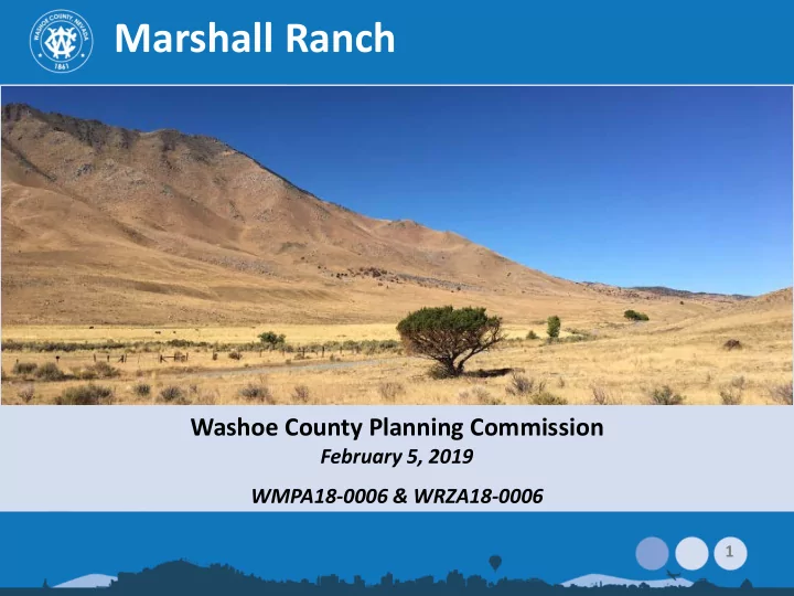

Marshall Ranch Washoe County Planning Commission February 5, 2019 WMPA18-0006 & WRZA18-0006 1
Vicinity Map Off Winnemucca Ranch Rd Just south of Spring Mountain 9 miles north of intersection with Pyramid Hwy 3 parcels ±1,100-acres Recently removed from Reno Sphere of Influence Rural/General Rural 2
Overview of Request Master Plan Amendment – Change from Rural to Rural Residential – Establish character management area (CMA) and policies – Amend Policy 4.6 to allow Medium Density Rural in CMA 3
Policy 4.6 (new text highlighted) WS.4.6 The following Regulatory Zones are permitted within the Warm Springs planning area. Public/Semi Public Facilities (PSP) Parks and Recreation (PR) Open Space (OS) Specific Plan (SP) Medium Density Rural (MDR) ( Only within the Marshall Ranch Character Management Area ) General Rural (GR) General Rural Agriculture (GRA) 4
New CMA – Statement & Policies Character statement: history; rural nature; preservation areas Policies to guide future development – Water provision – Wildlife impacts – Fire safety – Trail access – Access improvements, etc. 5
Overview of Request Regulatory Zone Amendment – From: 1,088 ac. General Rural (1 du/40 ac.) To: 934 ac. Medium Density Rural (1 du/5 ac.) and 154 ac. Open Space (on slopes over 30%) – Current zoning (GR) allows up to 27 homes – Proposed zoning (MDR/OS) allows up to 187 6
Sidebar: Conservation Easement Applicant: conservation easement with North American Land Trust on over ±812 ac. recorded Dec. 2018. – Severely limits residential development – Provides tax benefits Not part of County review – Not part of application; MPA/RZA to be reviewed without regard to easement, nor its merits, quality, longevity or revocability 7
Site Characteristics Limited vegetation; largely grasses Winnemucca Ranch Rd and seasonal creek traverse center of property Varied topography – Sloping lowlands to steep hillsides – 14% (±154-ac.) has slopes over 30%: OS – 26% (±288-ac.) has slopes of 15-30% – Remainder (±646-ac.) has slopes less than 15% 8
Site Photos 9
Site Photos 10
Site Photos 11
Compatibility 12
Water Provision Private community water system proposed; regulated by PUC and maintained by HOA 467.5 a.f. required for 187 lots in Warm Springs Initial application proposed using surface water for groundwater injection project + treatment Policy WS.3.1 requires existing groundwater rights for zone changes Subsequently, applicant demonstrated ownership of 385 a.f.; remainder to be acquired Without private water system, WS.B.8 only allows 4 homes on wells 13
Wastewater Private off-site package treatment facility proposed Would be regulated by State PUC Site is outside of TMSA and facility would not be accepted by County If not feasible, individual septic systems would be required 14
Traffic and Fire Access via Winnemucca Ranch Rd – 5 miles currently unpaved; subdivision would require improvements to County standards (incl. paving) ADT: 1,780; AM peak: 140; PM peak: 187 More detailed traffic study required at tentative map TMFPD – @ La Posada/Pyramid Palomino Valley Volunteer Fire Station 15
Wildlife Impacts Nevada Department of Wildlife (NDOW) – Antelope: ±300 use the area; entire site is within crucial winter range – Mule deer: southern portion of ranch is key winter habitat; remainder is year-round habitat – Nearby: Bighorn sheep, sage-grouse – Coordination with NDOW required to develop 16
Antelope Habitat Crucial Winter Range in dark pink Marshall Ranch outlined in blue 17
Mule Deer Habitat Year Round Habitat in light pink Key Winter Habitat in dark pink Marshall Ranch outlined in blue 18
Wildlife Impacts U.S. Fish & Wildlife Service (FWS) – Interested in potential direct and indirect impacts to Carson Wandering Skipper (endangered butterfly in Warm Springs area) – Population 3 mi. south/southeast of site – Off-site treatment area near ACEC – Coordination with FWS required to develop 19
Public Notice Notice provided to 35 owners of 109 parcels within ±3.8 miles of project site Legal ad published in the RG-J Jan. 25, 2019 20
CAB and Public Comment CAB: Nov. 13, 2018 (official) – no action Jan. 9, 2019 (unofficial) 7 letters received from public Topics: – Conservation easement – Access/traffic impacts – Water rights – Distance to services – Wastewater plans – Quality of life – Emergency services 21
Agency Comments Comments from local, state & federal agencies – Planning; Water Rights; Engineering; Health; Fire; Parks & Open Space; TMWA; NDOT; NDEP; NDOW; School District; US Fish & Wildlife – Largest issues related to water and potential wildlife impacts, as noted in staff report – Addressed with proposed policies 22
Required Findings (combined) Consistency with Master Plan Compatible Land Uses Response to Changed Conditions; More Desirable Use Availability of Facilities No Adverse Effects Desired Pattern of Growth 23
Applicant’s Proposed Change “The minimum allowed lot size will be 5-acres and no clustering or density transfers will be allowed.” – Add to Introduction: Attachment A, 2 nd page, 2 nd to last paragraph as last sentence – Add to Appendix B: proposed Policy WS.B.13 after “(MDR)” 24
Recommendations Master Plan Amendment – Adopt with modifications; certify/sign resolution; forward to BCC – Motion on page 27; with addition of language on minimum 5-acre lot sizes Regulatory Zone Amendment – Adopt/sign resolution; recommend BCC adopt amendment – Motion on page 27 25
Here to Answer Questions: Planning Program – Kelly Mullin, Senior Planner – Chad Giesinger, Planning Manager Water Rights – Vahid Behmaram, Water Management Planner Coordinator Engineering Division – Dwayne Smith, Division Director U.S. Fish & Wildlife 26
Recommend
More recommend