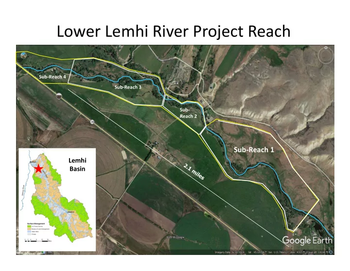

Lower Lemhi River Project Reach Sub‐Reach 4 Sub‐Reach 3 Sub‐ Reach 2 Sub‐Reach 1 Lemhi Basin
Historical Broad Fertile Valley Perspective Wide Vegetated Floodplain Complex Anabranching Channel Lemhi River Reference to Anabranched Watershed …. he found the weir extended across four channels of the river which was here divided by three small islands….. First recorded historical observation of Lemhi Shoshone‐Bannock Fishing (Journals of the Lewis and Clark Expedition, Moultin 1998)
Historical Project Location Perspective Lower Lemhi Mainstem Productive Salmon Habitat to mouth of Lemhi Gebhards 1958
Historical Perspective Lemhi Channelization Railroad was removed in 1939, and transferred to the State of Idaho 1952. The highway engineers preferred to “move the river” rather than construct the many bridges required.
Historical Perspective Lemhi Channelization Gebhards 1958
Historical Perspective Current Lemhi Floodplain Agricultural Development
Historical Perspective Current Lemhi Floodplain Anabranched Channel Configuration Sinuosity Expansive Floodplain
Historical Perspective Current Lemhi Floodplain Agricultural Development
Lemhi Chinook Salmon Life Stage Specific Distribution Adult Production Lemhi RST Early Migration • Spawning Upper River/Hayden • “Early” Parr Fry Displacement (20 – 45k) ‐ Hayden Creek ‐ Upper Lemhi
Lemhi Chinook Salmon Life Stage Specific Distribution Lemhi RST Juvenile outmigration 2011 Hayden Cr Screw trap ‐ Chinook 300 250 200 Total Captured Fry 150 100 50 0 Date
Life Stage Specific Capacity – Lemhi Summer Parr
Life Stage Specific Capacity – Lemhi Summer Parr Lemhi Winter Presmolt Capacity 0 500,000 1,000,000 1,500,000 2,000,000 Number of Summer Parr Available (QRF) Contemporary (Mean) Contemporary (Max) MAT MAT + 25%
Project Updates; Sub‐Reach 2
Project Updates Sub‐Reach 2 Channel Inlet ELJ Channel Watered 1750’ Side Channel 5 Engineered Log Jams 375’ Bank Roughening 15 Habitat Structures * 2016 Completion
Project Updates Sub‐Reach 3 Excavate Floodplains and Channels Raise Surface Water Elevations at Channel Inlets Install Substantial Wood Structures SR3‐Section 2 Lower Upper SR3‐Section 1
SR3 – Section 1 Pre Construction
SR3 – Section 1 Construction 2017 2018
SR3 Construction Ongoing Spring 2018 Fall 2018 Fall 2018
Project Updates
Stokes Ranch Flooding Lidar Elevation Data
Stokes Ranch Prior Scour and Erosion 1992
Stokes Ranch Prior Scour and Erosion 2014
Stokes Ranch IDFG Bank Treatment
Stokes Ranch Flooding 2017 Riprap
Flooding 2018 Riprap
Flooding 2018 Bridge Riprap
Flooding 2018
Temporary Flood Control IDFG Supported Collaborated with Lemhi County Reduced Overland Flooding
Temporary Flood Control Completed Coffer Dam
Project Goals and Objectives Habitat Goal – Improve habitat capacity by increasing floodplain interaction and channel complexity Objectives Phase I – May 2019 Implementation Install bioengineered structures (LWD) to add habitat complexity while stabilize eroding banks ‐ control downstream flooding Incorporate structures into Phase 2 Phase 2 – 2020 Implementation Develop lateral floodplain habitat/anabranched channels Improve mainstem stream sinuosity Add complexity (LWD) side channel/mainstem Develop floodplain interaction
Recommend
More recommend