
SLIDE 1
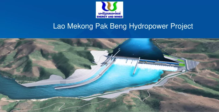
Lao Mekong Pak Beng Hydropower Project Table of content Project - - PowerPoint PPT Presentation
Lao Mekong Pak Beng Hydropower Project Table of content Project Brief Hydrology Sedimentation Geology and exploration Design Layout Dam safety Fish Pass facility Navigation Water quality Sustainable Operation
2
Table of content
3
CHARACTERISTIC OF PROJECT INSTALLED CAPACITY 912 MW NUMBER OF UNITS 16 AVERAGE ANNUAL OUTPUT 47.65x10⁸ KWh ANNUAL OPERATING HOURS 5225 h TONNAGE OF SHIP LOCK 500t
August 2007
December 2008
December 2012
March 2014
July 2014
5
Analysis of natural geography
Data collect
Meteorological data Hydrological data Data assessment Hydrology survey Analysis Climate condition Runoff characteristic Flood characteristic …….
calculate
Meteorological elements Runoff Design Flood Rating curve ……
Station Area(km2) Stage Flow Chiang Saen 189,000 1960-2014 1960-2014 Sop Kok 201,000 1972-1987 1972-1987 Chiang Khong 204,000 1972-2014 Pak Beng 218,000 1976-1981、1985、 1989-1990、1992- 1993、1999- 2006,2008-2014 2008-2014 Laungprabang 268,000 1960-2014 1960-2014
Hydrol rologi
cal data avai aila labl ble e
Gauge Station A Gauge Station B Gauge Station D Gauge Station C Discharge Measurement
300 305 310 315 320 325 1000 2000 3000 4000 5000 6000 7000 8000 H(m) Discharge(m3/s) Dischareg Measured in 2008 Discharge Measured in 2009 Discharge Measured in 2010 Discharge Measured in 2011 Dischareg Measured in 2012 Discharge Measured in 2013 Discharge Measured in 2014
Measure discharge and water level longitudinal and cross section
Hydraulic
formula
Rating curve
Rating curve of Gauge station D Rating curve of dam site
11
12
iment ent inve vest stig igati ation
KHIDI have carried out sediment investigation from Yunjinghong to Luang Prabang hydrological station, river diagram shows in the picture.
13
Main stream Branches Drainage area (km2) Referenced sediment transport modulus (t/km2.a) Adopted sediment transport modulus (t/km2.a) Yunjinghong - Pakbeng Intervals of Damsite (t/km2.a) Yunjinghong 149100 726 726 Nanban River 7679 747 750 350 Exit of Lancang River (Guanlei) 163000 250 Chiang Saen 189000 300~500 Nam Ing River 9750 53 Namtha River 8990 156 Pakbeng Damsite 218000 Nam OU River (Muong Ngoy) 19258 233
iment ent inve vest stig igati ation
14
Sediment data of hydrological station Sediment investigation of mainstream and tributaries Data assessment WsJing Ms Calculated formula of Sediment amount of Pak Beng Dam Site Sediment Amount
Suspended load: 142.68×10⁶t Bed Load: 4.28×10⁶t Suspended load: 37.99×10⁶t Bed Load: 1.034×10⁶t Natural condition Consider US dam
15
Suspended load Bed load
16
Siltation Period (Year) Incoming Sediment (106t) Siltation Amount (106t) Sediment Delivery Rate (%) Losing Rate of Storage below Normal Water Level (%) Losing Rate of Effective Storage (%) 5 195 42 78.59 5.15 0.49 10 390 81 79.22 9.77 1.23 15 585 117 80.03 13.87 2.11 20 780 148 81.07 17.35 3.05 30 1171 191 83.66 22.15 4.72 40 1561 224 85.64 25.72 6.06 50 1951 252 87.10 28.62 7.16 60 2341 272 88.36 30.77 8.07 70 2732 224 89.48 32.21 8.73 80 3122 298 90.44 33.27 9.30 90 3511 307 91.26 34.06 9.80 100 3901 314 91.95 34.69 10.24
17
This shows the siltation thickness changes. Siltation thickness in front
year when the power station putting into
18
In order verify the flushing effect of the discharging sluicing gates, we simulate the Siltation thickness changes in the front of the dam before and after the gates open.
Plant operation for 5 years before discharging gates open Plant operation for 5 years after discharging gates open
19
Sediment before discharge sluices Sediment before powerhouse
20
21
22
No. Earthquake time Place name Magnitude Earthquake intensity in the project area 1 19251222 Laos 6.8 Ⅴ 2 19340212 West Laos 6 Ⅶ 3 19350513 At the border between Thailand and Laos 6.5 Ⅶ 4 19370921 Northwest Laos 6 Ⅴ 5 19961221 Thailand 5.6 Ⅴ 6 20000119 Laos 5.8 Ⅴ 7 20000331 Laos 5.4 Ⅴ 8 20070516 Vieng Phoukha, Laos 6.6 Ⅵ 9 20110324 Northeastern Myanmar 6.8 Ⅴ
Catalogue of Strong Earthquakes with Intensity ≥V Degree Occurred in the Project Area
Earthquake
500 Km Orange area corresponds to Severe zone Yellow area corresponds to Middle zone Green area corresponds to Moderate zone water and blue area corresponds to Minor zone Nam Ngum 0.03 (Moderate Zone) Nam Leuk 0.10 (Moderate Zone) From the above maps, Source : International Seismological Centre (U.K.)
24
Designed seismic dynamic parameter 50-year exceeding probability 100-year exceeding probability 10% 5% 2% Amax (gal) 154 209 365 β 2.0 2.0 2.0 Tg (sec) 0.25 0.25 0.25 ah (g) 0.157 0.213 0.372
Seismic Dynamic Parameter Values
25
26
27
lock discharge sluice powerhouse Fish way
Project Layout
28
Number of Units 16 Type of unit bulb Unit capacity 57MW Total capacity 912MW Height of plant 64m Length of plant 410m
29
Number of sluices 14 Type of weir broad-crested Size of gates 15m×23m Elevation of weir 317m Energy dissipation hydraulic jump Operation opened and closed in dynamic water
30
Number of steps 1
Size of chamber 120m×12m×4m Total tonnage 1.5×10⁶ t/year
31
Length 1.6km Slope 1.85% Width 10m
32
Flood Release Structures
8 sand outlets, size 2.5m×5m 14 sand outlets, size 15m×23m
Check flood 30200m3/s
Design flood 26800m3/s
33
First-Stage Diversion Structures
include dry season cofferdam, longitudinal concrete cofferdam and R/B upstream and downstream transversal cofferdams . protection against 20 years return period flood with discharge of 18,700 m3 / s
Construction period of First stage
foundation is 33 months, ranging from January of the Second year to December of the fourth year.
34
Second-Stage Diversion Structures
include longitudinal concrete cofferdam ,L/B upstream and downstream transversal cofferdams
protection against 50 years return
period flood with discharge of 21,100 m3 / s
Construction period of Second stage
foundation is 33 months, ranging from December of the fourth year to August
35
stability of the first-stage and the second stage cofferdam have been
they can meet the specification requirements.
USACE Slope Stability EM_1110-2-1902
36
37
6 stations for survey, sampling and
Ban Hom Xai Keng lae Ban Luang Tong Pak Beng Dam site Ban Pak Ngua Houay Kan
38
target fish Fish habits investigatio n
Upstream and downstream migration design
Monitoring
Fish investigatio n
39
Fish way Navigation lock( part)
40
Fish way Navigation lock (part) Sluice gate(flood season) Fish Friendly turbine
Certain size of fish can pass the turbine
41
Exit 2 Exit 1 Monitoring room Entrance Width :10m; Discharge flow:15~20m3/s Maximum length of fish :0.5m~0.6m
Lure fish facility Automatic system
42
43
44
Based on complete hydrology data(1960→2014)and physical
experiments
Comparing different country’s standard to choose safe design
reference
Successful experience
45
Based on complete hydrology data(1960→2014)
Assurance rate Flow (m3/s) Water level (m) Head difference(m) P=95% 1630 309.29 30.71 P=98% 1260 307.62 32.38
46
47
After the detailed indoor work,
we conduct the water quality sampling.
Based on the lab results, the
surface water’s quality is as good as classes three.
St.1 Represent upstream area, at Ban Hom Xai , 2198405N,0677224E
St.3 Represent upstream area, at Ban Lang Tong , 2199461N, 0701673 E St.4 Proposed dam site area, Don Thek , Ban Pak Gnei 2195623N, 0708542 E St.5 Downstream area, Houay Kan (Pak Kan). 2195317N, 0716325E. St.6 Downstream area, Pak Beng town . 2200813N, 0722957E.
Sampling Station
48
as PH, SS, BOD, COD, Oil and so on in the surface water, which will affect the water quality.
49
Water er qual ality ity Mitig igation tion Measure ure
Water treatment Reservoir bottom clearing
50
Storm characteristic Forecast Scheme in construction &
Main tributaries distribution Network Flood characteristic Hydropower characteristic Sensible factors …… Forecasting Water Level Discharge
52
Sediment Monitoring System Water and sediment in/out the reservoir Water surface line of the front dam and tail section Sedimentation in the reservoir area Sedimentation in the project area Before the Dam In approach channel Downstream river course Bank deformation in the reservoir area
Single beam sounding system Multi beam sounding system
Underwater data acquisition
53
54
Sedimen ment t managemen gement t Sediment releasing facilities of the power station Reservoir operating modes Control of the reservoir sedimentation Sedimentation control before the dam Sediment deposition in the approach channel Downstream channel scouring Bank erosion Eco-friendly flushing Monitoring and management
55
Monitoring system maintenance Automatic monitoring Data compilation Data analysis Working state evaluation
56
Organization chart
Sustainable Operation and Management(Environmental management)
Louangtong 47 Households 232People Homxai 18 Households 126People Houay Chiko 12 Households 84People Houay Khoun 4 Households 28People Houay Moong 12 Households 72People Pak Khob 21 Households 132People Pak Xo 18 Households 120People Kiengphaak 17 Households 102People Hatdonkeo 19 Households 114People Damsite
THE FIRST STA THE FIRST STAGE GE START: JAN IN START: JAN IN THE FIRST YE THE FIRST YEAR AR COMPLETE : D COMPLETE : DECEMBER IN TH ECEMBER IN THE SECOND YEAR E SECOND YEAR NUMBERS:93 HO NUMBERS:93 HOUSEHOLDS 542 USEHOLDS 542 PEOPLE PEOPLE THE SECOND ST THE SECOND STAGE AGE START: JAN IN START: JAN IN THE THIRD YE THE THIRD YEAR AR COMPLETE: OC COMPLETE: OCTOBER IN THE TOBER IN THE FOURTH YEAR FOURTH YEAR NUMBERS:75 HO NUMBERS:75 HOUSEHOLDS 468 USEHOLDS 468 PEOPLE PEOPLE
THE SK SKETC TCH M MAP OF OF RE RESSE SETTLEM EMENT NT PR PROCESS SS FO FOR P PAK PE PENG G HPP PP
58
condition in Nam Ou river (designed by KD)
59