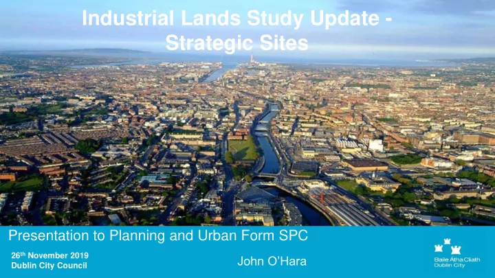

Industrial Lands Study Update - Strategic Sites Presentation to Planning and Urban Form SPC 26 th November 2019 John O’Hara Dublin City Council
Z6/Z7 Study Context Objective CEE04 - Dublin City Development Plan 2016 – 2022 (i) To carry out a targeted survey of those industrial estates with likely redevelopment potential and to make recommendations on how that redevelopment potential might be best achieved. (ii) To carry out a study on the potential of lands zoned for enterprise and employment space, the adequacy of such potential supply, and the issue of under-utilised/vacant land.
Z6/Z7 Study Context Over 860 hectares of land is zoned for employment purposes (Z6 and Z7) throughout the City Land Use Zoning Objectives Land Use Zoning Objective Z6 ‘ To provide for the creation and protection of enterprise and facilitate opportunities for employment creation ’ Z6 Lands - c. 600 ha representing 6% of the City Council’s administrative area Land Use Zoning Objective Z7 ‘ To provide for the protection and creation of industrial uses and facilitate opportunities for employment creation ’ Z7 Lands – c. 256 ha representing 2.5% of the City.
Drivers for Change Compact Growth and Urban Identification of Strategic Core Strategy Consolidation and Re- Consolidation through the Development Areas / The policies and Intensification of reusing of large and small Other strategic sites to objectives in this plan infill/brownfield sites to brownfield land / infill sites, provide high density and come forward through the promote the and underutilized lands at ongoing provision of intensification and people intensive uses location well served by brownfield / infill consolidation of Dublin city within the existing built up public transport. intensification. areas of Dublin and Suburbs. Focus within the canals and the M50 ring.
The Z6/Z7 Study • 82 Study areas / land banks • 863 hectares in total • 5 different categories of lands
Categories of industrial lands Initial outcomes Category 1: Small Scale Sites All small sites recommended for Small land banks with issues of urban blight / underutilization; variation rezoning would allow for redevelopment Category 2: Medium Scale Sites Sites identified for rezoning with Slightly larger land bank but operating at low volume with remaining sites to be reviewed as capacity to intensify – rezoning would allow for intensive mixed part of the Development Plan use development review process Category 3: Economically Strategic Sites Existing Z6 and Z7 zonings Land banks of strategic importance to the economy and the unchanged Z6/Z7 zoning to remain; includes Z7 Lands - Dublin Port and St. James Gate and Z6 Lands – key office employment Category 4: Large Sites needing Framework Plans etc. Subject to further detailed study Large scale regeneration area for the provision of new housing and employment (45% of Total Z6 lands) Category 5: Other Miscellaneous Sites To be reviewed as part of the Zoning no longer good reflection of current use Development Plan review process
Larger Z6/Z7 sites which will be subject to More Detailed Plans: 1. Dublin Industrial Estate lands (45.50 ha) 2. Jamestown Business Park & Finglas Business Centre lands (43.11 ha) 3. Oscar Traynor Road/ Malahide Road lands (43.16 ha) 4. Naas Road/ Kylemore Road lands (140.22 ha)
1. Dublin Industrial Estate, Ballyboggan Road KEY ISSUES: • Large site close to the City- good cycling and walking connections • Luas and heavy rail commuter service • Significant ownership fragmentation • Challenge of surface water management and protection of adjoining water bodies- River Tolka and Royal Canal • Need for expanded community & educational facilities • Importance of retention of mixed uses and employment use in more intensive setting
2. Jamestown Business Park & Finglas Business Centre KEY ISSUES: • Underutilised lands with levels of vacancy • Close to Finglas village • Potential of Luas extension to this area • Need for community facilities, possible school and open space • Pylons and ESB substation on lands • New road connections needed • Key role in aiding regeneration of Finglas Village
3. Malahide Road /Oscar Traynor Road lands KEY ISSUES • Intensive mix of uses on parts of the site, with mostly retail and some vacancy on the Malahide Road • On Bus Connects routes • Significant development in adjoining areas to north (Belmayne/Belcamp) and other sites in the area • Impact on Santry River • Balancing of redevelopment with catering for key local employment area
4. Naas Road/ Kylemore Road lands KEY ISSUES: - Low density employment uses - Very large sites adjacent to commuter rail service and Grand Canal - Adjacent to major lands in South Dublin County Council zoned regeneration - URDF funding for undertaking key baseline research approved - Large scale power lines across the lands - Significant issues on water services, flooding and surface water management including flooding - Need for a range of new community and amenity spaces - Need for a partnership approach with South Dublin County Council - New Luas line to Lucan through lands
Next Steps • Mechanisms for effective delivery • Impact on the review of the upcoming City Development Plan and the future content of the Draft Plan in 2021 • Timelines & Project management
Recommend
More recommend