FireSat – A UK-Africa collaboration for enhanced detection of fires using nanosatellite technology 12 th December 2017
Presentation outline • Project partners • International Partnership Programme • Project breakdown • Knowledge Transfer • FireSat • background • Platform • Payload • Constellation • Development timelines • The Advanced Fire Information System • Programme impact
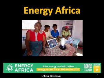
UK-Africa collaboration
Introduction to the UK Space Agency’s International Partnership Programme • 5-year, £152 million programme • UK space sector’s research and innovation strengths to deliver sustainable economic or societal benefit to emerging and developing economies around the world • Projects run by industry, academia, and non-profit entities • Uses space solutions to make positive impact on those living in international partner countries • Increasing capacity of developing nations to respond to specific challenges
Project outline UN SDG Knowledge FireSat M & E Transfer Integration of Platform Launch MSc/PhD data with AFIS Missions Lab Platform Payload & Training UK Hardware Africa Integration Collaboration
Project outline Phase 1 – Technology Demonstration - Use of ZACube-2 Phase 2 – Scale up - IPP funding
Knowledge transfer – Missions Lab
Knowledge transfer – MSc • UN Sustainable Development Goals to illustrate the application of satellite applications • EO, Navigation and Communications, Data Science, Entrepreneurship & Space Systems (optional) • Aims to encourage students towards creating new services and companies • Course is well suited to markets without a mature space sector • Remote learning and CPD • Available from September 2019 – applications from early 2019 • Joint PhD Programmes also available
FireSat - background • Frequency, severity and damages from global wildfires are increasing annually • From 1979 to 2013 fire weather seasons have lengthened across 29.6 million km 2 of Earths vegetated surface, which results in an 18.7% increase in global average fire season length • Doubling of global burnable area and increased global frequency of long fire weather seasons (53.4% Average annual burned area between 1960 and 2000 from 1996 to 2013
FireSat - background The ‘fire continent’ - 70% of total global wildfires Global climate vulnerability to wildfires 30.6% South Africa at Extreme risk 31.3% South Africa at High risk CSIR national veld fire risk assessment report
Early detection Early detection Fire detection methods – variation in spatial and temporal resolution
FireSat platform
FireSat platform 3U Body OBC w/ GPS 3U EPS 30Whr 10Mbps
FireSat platform • On-Board Computer (OBC) • UHF Transceiver (UTRX) • High-Speed S-Band Transmitter (HSTX) • Antenna FlatSat testing – November 2017
FireSat payload Grass fire at 8 km
FireSat constellation 10000 GOES MetOp MSG 1000 TET-1/BIROS Spatial resolution (m) Terra/Aqua 1 x FireSat 100 6 x FireSat Used by AFIS Landsat 8 10 Not used by AFIS 1 0.1 1 10 100 1000 Temporal resolution (revisit rate, hours) Temporal vs Spatial resolution for fire detection from space
Development timelines Jan 2018 February 2017 • Initial • Systems • Launch Engineering, Design • Critical • Integration Design, and Review Design and Testing Assembly Review November May 2018 March 2017 2016
The Advanced Fire Information System
Programme impact
Thank you for listening Pam Anderson Systems Engineer enquiries@clyde.space
Recommend
More recommend
Unleash a World of Digital Possibilities—Browse, Share, and Explore Content Without Boundaries