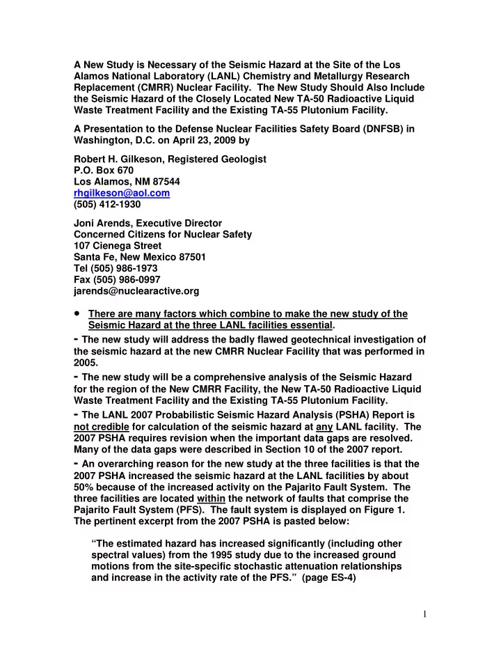
SLIDE 1 A New Study is Necessary of the Seismic Hazard at the Site of the Los Alamos National Laboratory (LANL) Chemistry and Metallurgy Research Replacement (CMRR) Nuclear Facility. The New Study Should Also Include the Seismic Hazard of the Closely Located New TA-50 Radioactive Liquid Waste Treatment Facility and the Existing TA-55 Plutonium Facility. A Presentation to the Defense Nuclear Facilities Safety Board (DNFSB) in Washington, D.C. on April 23, 2009 by Robert H. Gilkeson, Registered Geologist P.O. Box 670 Los Alamos, NM 87544 rhgilkeson@aol.com (505) 412-1930 Joni Arends, Executive Director Concerned Citizens for Nuclear Safety 107 Cienega Street Santa Fe, New Mexico 87501 Tel (505) 986-1973 Fax (505) 986-0997 jarends@nuclearactive.org
There are many factors which combine to make the new study of the
Seismic Hazard at the three LANL facilities essential.
- The new study will address the badly flawed geotechnical investigation of
the seismic hazard at the new CMRR Nuclear Facility that was performed in 2005.
- The new study will be a comprehensive analysis of the Seismic Hazard
for the region of the New CMRR Facility, the New TA-50 Radioactive Liquid Waste Treatment Facility and the Existing TA-55 Plutonium Facility.
- The LANL 2007 Probabilistic Seismic Hazard Analysis (PSHA) Report is
not credible for calculation of the seismic hazard at any LANL facility. The 2007 PSHA requires revision when the important data gaps are resolved. Many of the data gaps were described in Section 10 of the 2007 report.
- An overarching reason for the new study at the three facilities is that the
2007 PSHA increased the seismic hazard at the LANL facilities by about 50% because of the increased activity on the Pajarito Fault System. The three facilities are located within the network of faults that comprise the Pajarito Fault System (PFS). The fault system is displayed on Figure 1. The pertinent excerpt from the 2007 PSHA is pasted below: “The estimated hazard has increased significantly (including other spectral values) from the 1995 study due to the increased ground motions from the site-specific stochastic attenuation relationships and increase in the activity rate of the PFS.” (page ES-4) 1
SLIDE 2
- The “hotel concept” open floor plan for the new CMRR Nuclear Facility
increases the danger for building failure from an earthquake. The pertinent excerpt from the DNFSB April 16, 2008 Staff Issue Report is pasted below:
- “NNSA [National Nuclear Security Administration] has mandated
that the laboratories of the [new CMRR] nuclear facility have a flexible, open floor plan to accommodate as-yet unknown future
- missions. This “hotel concept” prevents the addition of shear walls
through the laboratory wings and has resulted in major seismic design challenges. Project personnel had been using a preliminary estimate of seismic motions for the facility until LANL completed its update of the probabilistic seismic hazard analysis; however, they did not anticipate that the final seismic motions, particularly vertical motions, would be in resonance with various sections of the nuclear facility. The laboratory portion of the [new CMRR] nuclear facility has been most problematic, with the fundamental frequency
- f the floor and ceiling matching that of the input seismic motions”
[emphasis added]. (page 5)
- Congress requires the DNFSB to certify that the design of the new CMRR
Nuclear Facility will resolve seismic issues. The pertinent excerpt from the DNFSB NINETEENTH ANNUAL REPORT TO CONGRESS is pasted below:
- “The Duncan Hunter National Defense Authorization Act for Fiscal
Year 2009, Public Law 110-417, enacted a limitation on funding for the Chemistry and Metallurgical Research Replacement Project at Los Alamos National Laboratory until the Board [i.e., the DNFSB] and the National Nuclear Security Administration (NNSA) each certify that certain design issues [including seismic issues] reported by the Board have been resolved.” (page 7)
- The DNFSB also has concern for seismic issues at the new TA-50
Radioactive Liquid Waste Treatment Facility. The pertinent excerpt from the DNFSB NINETEENTH ANNUAL REPORT TO CONGRESS is pasted below:
- “Radioactive Liquid Waste Treatment Facility Replacement: The
Board determined that the weak integration of the safety and design process and weak federal oversight resulted in problems with safety basis development, material selection, determination of seismic design requirements [emphasis added], and configuration management.” (page 16)
- Concerning the existing TA-55 Plutonium Facility, the DNFSB
NINETEENTH ANNUAL REPORT TO CONGRESS stated, “The Board identified the need for NNSA to focus on rapidly improving deficiencies in safety systems” (page 11). A DNFSB letter dated May 30, 2008 stated “The 2
SLIDE 3 Board reminds NNSA that the Plutonium Facility continues to operate with a safety basis that was approved more than a decade ago.”
- After careful study of 1). the concerns of the DNFSB and Congress,
2). the great uncertainty and data gaps in the LANL 2007 PSHA Report and 3). the badly flawed geotechnical investigation performed at the site of the new CMRR Nuclear Facility in 2005, the finding of the authors of this presentation is that sufficient knowledge does not exist at this time to resolve the seismic issues. The issues require a new comprehensive study
- f the seismic hazard and it is very important for the new study to
encompass the seismic hazard of the three closely located LANL nuclear facilities – the new CMRR Nuclear Facility, the new TA-50 Radioactive Liquid Waste Treatment Facility, and the existing TA-55 Plutonium Facility. The factors that require the new study are presented below. An overarching factor is that the 2007 PSHA Report and the 2005 geotechnical investigation at the location of the new CMRR Nuclear Facility did not incorporate the important new geologic knowledge that was gained from the installation of a large network of monitoring wells across the 43-square mile LANL Site.
- The new geologic knowledge shows the great complexity of the
geologic setting in the region of the new CMRR Nuclear Facility, the new Radioactive Liquid Waste Treatment Facility and the existing Plutonium Facility.
- Indeed, the new geologic knowledge shows the great complexity of
the geologic setting across the 43-square mile LANL Site. This complexity was not addressed in the 2007 LANL PSHA Report. The unpredictable geologic setting requires DOE to focus on rapidly performing site-specific geotechnical investigations at all of the existing critical LANL facilities including the new CMRR Nuclear Facility, the new TA-50 Radioactive Liquid Waste Treatment Facility, the existing Plutonium Facility and other existing facilities including the Weapons Engineering Tritium Facility, the Main Office Complex, the Library, and the LANL personnel offices in refurbished former public schools.
- Complex Geologic Setting. The great complexity in the geologic setting
across LANL is illustrated by the set of eight cross-sections in the LANL Hydrogeologic Synthesis Report that was published in 2005. LA-14263-MS. The cross-sections summarize the knowledge gained from the installation
- f a large network of monitoring wells. The 2007 PSHA report made a
mistake to not incorporate the new geologic knowledge that shows the great complexity for calculation of the seismic hazard at LANL. The eight cross-sections are in Figures 2-12 through 2-19. The locations of the 3
SLIDE 4 cross-sections are displayed on Figure 2-11. The locations of wells and testholes close to the new CMRR Facility are displayed on Figure 3.
- Assumed Properties of the Reference Rock. The failure of the 2007 PSHA
Report to recognize and address the great uncertainty in the “reference rock datum” below LANL is an illustration of the need for DOE to focus on rapidly improving the many deficiencies in the 2007 PSHA report.
- The deficiencies in both the 2007 PSHA Report and in the geotechnical
investigation at the new CMRR Nuclear Facility for the “reference rock datum” are evident in the excerpts pasted below from the PSHA Report: “For this study, we are most interested in obtaining a reasonably reliable estimate of VS [shear velocity] for dacite, which underlies much
- f LANL because it represents the reference rock datum (Section 4.3).
Only one estimate of dacite VS was obtained in the CMRR boreholes (DSC-1B) and no velocity measurements are available from any other hole at LANL. The DSC-1B VS value of 2950 ft/sec is not regarded as reliable because the dacite was only penetrated to a depth of 25 ft at the bottom of the borehole (Bruce Redpath, Redpath Geophysics, personal communication, 2006). The most similar geologic material that has any VS or VP [compressional velocity] measurements is the Cerros del Rio basalt. Based on gross similarities in physical properties, we believe that VS values corresponding to the higher VP values for the Cerros del Rio basalt (i.e., 9,000 to 10,000 ft/sec) would be representative of the VS for the dacite (J. Gardner, LANL, personal communication, 2006). Assuming Poisson’s ratios of 0.25 to 0.30 typical of rock would indicate corresponding VS values for the fastest basalt ranging from 4,800 to 5,800 ft/sec. Thus we adopted a lognormal average of about 5,300 ft/sec for the VS of the dacite.” (page 4-6) “Section Ten – Recommendations for Future Studies. Conduct Vs [shear velocity] measurements of dacite. There is no reliable VS data for the dacite (Section 4.2.3) and thus velocity data would confirm the value used in this study.[Emphasis added]. Measuring the velocity of the dacite beneath the laboratory requires deep boreholes and so although not ideal, shallow velocity surveys where the rock outcrops is probably the only economical alternative.” (page 10-1) The authors of this presentation have many concerns described below for the failure of the 2007 PSHA and the geotechnical investigation at the new CMRR Nuclear Facility to assess the seismic hazard at LANL without accurate knowledge of the shear velocity of the “reference rock datum.” The use of an assumed value for the shear velocity of the reference rock was a mistake and is a serious problem that must be resolved by the DNFSB in their review of the design of the new CMRR Nuclear Facility. 4
SLIDE 5
- First, the low value of 2950 ft/sec measured for the shear velocity of the
dacite below the new CMRR Nuclear Facility may be accurate. The reason that the low velocity may be accurate is because the LANL cross-section in Figure 2-13 shows that the new CMRR Nuclear Facility is located near the eastern leading edge of the dacite lava flow. In addition, the comparison of the cross-sections in Figures 2-13 and 2-14 indicate that the dacite below the new CMRR Facility was deposited close to the southern boundary of the lava flow. Note that the dacite in not present on Figure 2-14. The depositional setting of the dacite near flow boundaries will result in large changes in seismic properties over short distances. The location of the new CMRR Nuclear Facility near flow boundaries may be the reason for the low shear velocity that was measured in the only borehole drilled into the dacite for the geotechnical investigation to assess the seismic hazard at the new CMRR Facility.
- Second, the cross-sections in Figures 2-13 and 2-14 show the great
complexity of the geologic setting in the region of the new CMRR Nuclear Facility, the new TA-50 Radioactive Liquid Waste Treatment Facility and the existing TA-55 Plutonium Facility. For reference, the locations of many of the wells on the cross-sections are displayed on Figure 3 which shows the location of the new CMRR Facility. The importance of the three closely located facilities to the ongoing mission at LANL requires that a careful and comprehensive geotechnical investigation be performed to assess the seismic hazard at the three facilities. We recommend:
- 1). The new geotechnical investigation must include an appropriate
number of testholes that are drilled through the complete thickness of the dacite reference rock at locations close to the three facilities.
- 2). The new geotechnical investigation must include accurate
measurement of the shear velocity and compressional velocity at a close- spaced depth interval through the total depth of the new testholes.
- 3). The new geotechnical investigation must include an appropriate
number of testholes at appropriate locations to define the gap (if any) between the Tschicoma Dacite and the Cerros del Rio Basalt. The assumed gap between the two flows is displayed on Figure 2-13.
- 4). The new geotechnical investigation must include an appropriate
number of testholes to map the southern boundary of the dacite flow.
- 5). The new geotechnical investigation must include a careful study of all
information from the installation of monitoring wells near TA-50 and TA-55. Figure 3 is a map showing the locations of monitoring wells and testholes.
- 6). The new geotechnical investigation must include a study of the
airborne geophysical study that was performed site-wide at LANL after the Cerro Grande Fire. The airborne study may provide important information
- n the southern extent of the Rendija Canyon and Guaje Mountain Faults
and the angle of dip on the faults in the Pajarito Fault System. 5
SLIDE 6
- Third, the 2007 PSHA made a serious mistake to consider the dacite to be
the “reference rock datum” site-wide at LANL. The set of eight cross- sections and Figure 2-8 show that the Cerros del Rio Basalt is the dominant reference rock below LANL and in many locations both the Cerros Del Rio Basalt and the Tschicoma Dacite are absent. Furthermore, the cross- sections show that the depth to the top of the reference rock and the thickness of the reference rock varies greatly across LANL. In addition, Figure 2-7 shows that LANL now speculates that the dacite below the new CMRR Nuclear Facility may be from the Cerros del Rio lava
- flow. Accordingly, there is great uncertainty for the properties of the
“reference rock datum” and the available information shows the properties will vary greatly over short distances across LANL. The 2007 PSHA doesn’t present a credible process for accurate knowledge of the seismic hazard at the “reference rock datum.”
- Fourth, the LANL Hydrogeologic Synthesis Report presents contradictory
information on the source of the lava flows beneath LANL, and specifically at the location of the new CMRR Nuclear Facility. The cross-section in Figure 2-13 shows the dacite below the new CMRR Facility is from a Tschicoma lava flow from the west of LANL. However, Figure 2-7 shows the dacite below the new CMRR Facility and below TA-50, TA-55 and TA-3 to be from the Cerros del Rio Lava from the east of LANL. The uncertain source of the dacite below the new CMRR building is illustrated by the following excerpt from the 2005 LANL Hydrogeologic Synthesis Report:
- ”The Tschicoma Formation thins eastward under the western Pajarito
Plateau where it interfingers with the Puye Formation. The Tschicoma Formation was encountered in wells TW-4, H-19, CDV-16-3(i) and CDV- R-37-2 in the western part of the Pajarito Plateau, but is absent in boreholes to the east, with the possible exception of thick dacite lava in boreholes EGH-LA-1, SHB-1, and I-1 [MCOI-1 on Figure 3]. These lavas may be assigned to the Tschicoma but their source and distribution is presently unknown” [emphasis added]. (page 2-23) Accurate knowledge of the source of the lava flows below the LANL facilities is essential to accurate knowledge of the seismic hazard. The marked difference in the seismic properties of the Tschicoma lava and the Cerros del Rio lava is illustrated by the following excerpt from the 2005 LANL Hydrogeologic Synthesis Report:
- “In major-element composition the dacitic components [of the Cerros
del Rio Lava] are very similar to partially contemporaneous dacitic lavas that occur within the highlands of the Tschicoma Formation to the west. However, dacites are less abundant than basalts within the Cerros del Rio and these thin [Cerros del Rio] dacitic lavas have relatively few of the common hydrous minerals (amphibole and biotite) that characterize most
- f the Tschicoma lavas. These distinctions are important because they
6
SLIDE 7 strongly affect the hydrogeologic character of the lavas. Lavas of the Cerros del Rio lie within suites of relatively thin (a few tens of feet), largely basaltic lava flows with laterally extensive flow boundary rubble zones that provide pathways for flow. Lavas of the Tschicoma Formation are far more massive, up to hundreds of feet thick, and are generally poorly transmissive (Griggs, 1964).” (page 2-24) The differences described above for the physical properties of the dacites from the Tschicoma and Cerros del Rio lava flows will also result in large differences in the seismic properties for the dacites which is shown by the low shear velocity that was measured in the test hole drilled into the dacite below the new CMRR Nuclear Facility.
- Fifth, the overall poor quality of the geophysical measurements in the
testholes drilled for the geotechnical investigation at the new CMRR Nuclear Facility were described in the 2007 PSHA Report.
- 1). The fact that the geotechnical investigation used an assumed value for
the shear velocity of the dacite was described above.
- 2). The poor quality of the OYO suspension measurements to measure
seismic velocities in the six test holes drilled in the footprint of the new CMRR Facility is in the excerpt pasted below from the 2007 PSHA report:
- “Because of the generally poor nature of the suspension data, it was
not used in the development of the base case velocity profiles used in this study.” (page 4-5)
- 3). The large “data gaps” and “uncertainty” in the geotechnical
investigation in the six boreholes drilled below the new CMRR Facility are further illustrated by the following excerpts from the 2007 PSHA report:
- “Whereas there is more uncertainty in the downhole results for the
shallow velocity zone (Qbt3L) than is usually encountered, additional measurements are not likely to provide greater resolution.” (page 4-7)
- The “shallow velocity zone (Qbt3L)” is a layer of volcanic tuff with an
anomalously low seismic velocity that is present at a short distance in the subsurface below the new CMRR Nuclear Facility. The low velocity layer varies in thickness from 50 to 75 feet. Accurate knowledge of the seismic properties of the low velocity layer is essential to determine the seismic hazard of the new CMRR Facility, especially given the finding that the fundamental frequency of the floor and ceiling in the “hotel concept” design of the laboratories in the new CMRR facility match that
- f the input seismic motions, and especially the vertical seismic
motions.
- The large data gaps in the geotechnical investigation that was
performed below the new CMRR Nuclear Facility are further illustrated by the fact that seismic profiles were collected at a depth greater than 7
SLIDE 8 150 feet below the footprint of the new CMRR Facility in only one of the five testholes. The depth to the top of the “reference rock datum” below the building was measured to be 695 feet in the only deep testhole DSC-1B.
- The finding that the vertical seismic motions are in resonance with
the design of the new CMRR Nuclear Facility requires the collection of accurate seismic profiles for shear wave and compressional velocities
- ver the total vertical distance in the geologic materials from
immediately below the building through the total thickness of the “reference rock datum.” The seismic profiles should be measured in several testholes at appropriate locations around the new CMRR Facility.
- Sixth, the large number of data gaps and the great uncertainty in the 2007
PSHA are illustrated by the recommendations for further studies that were presented in Section 10 of the report. In fact, the “recommendations for further study are proof that the 2007 PSHA Report did not produce usable analysis of the seismic hazard at LANL. Indeed, the recommendations in Section 10 identified the need for NNSA to focus on rapidly performing the recommendations for further studies and revising the 2007 PSHA. Section 10 from the 2007 PSHA is below.
SE CTIONTEN Recommendations for Future Studies
Based on the studies completed to date, the following are recommendations for future investigations. The results of such studies will aid in refining specific seismic source and site parameters, which have been incorporated into the PSHA, and reduce their associated uncertainties. Recalculate the hazard using the NGA [Next Generation of Attenuation] ground motion attenuation relationships. Four relationships are now available for use and they display significant differences with the earlier generation of relationships, i.e., the ones used in the current study (Section 6.1). It would be prudent to evaluate the impact of these new relationships on the LANL hazard after they have had time to be fully vetted.
- What is the status on vetting the new NGA ground motion attenuation
relationships? Conduct additional detailed/high-precision mapping and displacement measurements along the SCC [Santa Clara Canyon] segment of the PFS [Pajarito Fault System], similar to what has been done on the PAF [Pajarito Area Fault] segment of the PFS. The purpose of this would be threefold: (1) better define fault trace geometry for the SCC and verify the gap between the PAF and SCC; (2) better define long-term displacements and slip rates for the SCC; and (3) identify potential paleoseismic trenching sites.
- What is the status of the performance of additional detailed/high-
precision mapping and displacement measurements along the Santa 8
SLIDE 9 Clara Canyon and the Pajarito Area Fault segment of the Pajarito Fault System? Conduct paleoseismic trenching studies of the SCC to determine the timing and size of prehistoric surface-faulting earthquakes. This will help better define rupture models and scenarios for the PFS. It may also help better determine maximum magnitudes and recurrence intervals for rupture scenarios.
- What is the status of the performance of new paleoseismic trenching
studies of the Santa Clara Canyon and also new paleoseismic trenching studies of the Pajarito Area Fault segment of the Pajarito Fault System Reevaluate the entire dataset for the RGR [Rio Grande Rift] fault slip rate analysis using only data for complete seismic cycles and more complete documentation of long-term data (both displacements and applicable time periods). This more robust analysis will likely reduce slip rate uncertainties and result in a more symmetric RGR slip rate distribution.
- What is the status of the reevaluation of the entire dataset for the Rio
Grande Rift? Conduct additional studies to better constrain kappa. Kappa is a key parameter in assessing the hazard at LANL (Section 6.2). Focused efforts should be made to evaluate kappa using data from the LANL seismographic
- network. Improvements in the network may be necessary to improve data
quality [emphasis added].
- The 1995 Seismic Hazard Report described the failure of LANL to install
and operate a seismographic network to provide data for calculation of
- Kappa. The poor performance of LANL to install and operate the required
seismographic network was also the finding of the 2007 PSHA Report. The 2007 PSHA used an uncertain, assumed value for Kappa. What is the current status for the LANL seismographic network to provide high quality data for the calculation of Kappa? Conduct VS measurements of dacite. There is no reliable VS data for the dacite (Section 4.2.3) and thus velocity data would confirm the value used in this study. Measuring the velocity of the dacite beneath the laboratory requires deep boreholes and so although not ideal, shallow velocity surveys where the rock outcrops is probably the only economical alternative.
- What is the status of LANL/DOE operations to measure the shear velocity
- f the “reference rock datum” in testholes at many locations site-wide and
specifically at the location of the new CMRR Building? The complex change in the “reference rock datum” at LANL requires shear velocity measurements in many testholes drilled deep into the reference rock. 9
SLIDE 10
Figure 1. MAP OF THE PAJARITO FAULT SYSTEM AND ADJACENT SOUTHWESTERN SECTION OF THE EMBUDO FAULT SYSTEM 10
SLIDE 11
Source: LANL Hydrogeologic Synthesis Report – LA-14263-MS, December 2005
11
SLIDE 12
Source: LANL Hydrogeologic Synthesis Report – LA-14263-MS, December 2005
12
SLIDE 13
Source: LANL Hydrogeologic Synthesis Report – LA-14263-MS, December 2005
13
SLIDE 14
Source: LANL Hydrogeologic Synthesis Report – LA-14263-MS, December 2005
14
SLIDE 15
Source: LANL Hydrogeologic Synthesis Report – LA-14263-MS, December 2005
15
SLIDE 16
Source: LANL Hydrogeologic Synthesis Report – LA-14263-MS, December 2005
16
SLIDE 17
Source: LANL Hydrogeologic Synthesis Report – LA-14263-MS, December 2005
17
SLIDE 18
Source: LANL Hydrogeologic Synthesis Report – LA-14263-MS, December 2005
18
SLIDE 19
Source: LANL Hydrogeologic Synthesis Report – LA-14263-MS, December 2005
19
SLIDE 20
Source: LANL Hydrogeologic Synthesis Report – LA-14263-MS, December 2005
20
SLIDE 21
Source: LANL Hydrogeologic Synthesis Report – LA-14263-MS, December 2005
21
SLIDE 22 Figure 3. Map of wells and testholes near the new CMRR Nuclear Facility CMRR --------- SCALE 0---------------------------------- 5 ----------------------------------10,000 FEET
- MDA C is a legacy waste disposal site located east of the new CMRR Nuclear
Facility
- The existing Plutonium Facility is located off the map to the northwest of the
new CMRR Facility
- The existing TA-50 Radioactive Liquid Waste Treatment Facility and the
location of the new TA-50 Radioactive Liquid Waste Treatment Facility is shown on the map northeast of the new CMRR Facility
- The red oval shows the possible locations for a new monitoring well installed
east of MDA C. The new well has been installed. 22