Development of a fish habitat mapping tool to assess flow changes on - PowerPoint PPT Presentation
Development of a fish habitat mapping tool to assess flow changes on fish habitat utilisation Paul Gratton Introduction Details of sites and overview of development proposals Assessment methodology Scope Field data collection
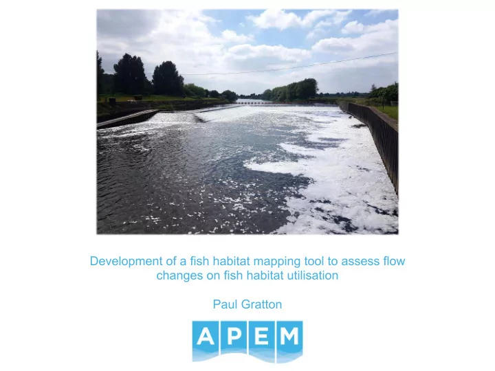
Development of a fish habitat mapping tool to assess flow changes on fish habitat utilisation Paul Gratton
Introduction • Details of sites and overview of development proposals • Assessment methodology • Scope • Field data collection • Data processing • Results • Conclusions and applications of methodology to other assessment areas
Site locations Nottingham
Importance of weir pools • High energy environments • Depositional features provide important spawning habitat
Stoke Weir – proposed HEP scheme
Stoke – abstraction regime • Scheme to be operated based on a hands-off level, equivalent to a hands off flow of ~3 m 3 /s • Maximum abstraction of 20 m 3 /s (10 m 3 /s per turbine) • Q99 at Stoke is 24.19 m 3 /s – HEP scheme would therefore reach maximum abstraction at <Q99 • Weir crests raised to increase head drop Proposed HEP Residual Reduction in River flow Percentile abstraction weir flow over-weir (m 3 /s) (m 3 /s) (m 3 /s) flow Q1 374.24 20 354.24 5% Q5 247.61 20 227.61 8% Qmean 86.35 20 66.35 23% Q50 59.44 20 39.44 34% Q75 39.01 20 19.01 51% Q95 28.14 20 8.14 71%
Assessment scope • Environment Agency and Natural England raised concerns regarding impacts on fish habitat • Understanding of potential geomorphological adjustments required • Hydraulic and habitat modelling assessment approach agreed, focusing on the following species/life stages: Life stage Species Adult Juvenile Spawning Barbel ✓ ✓ ✓ (rheophilic) Roach ✓ ✓ ✓ (eurytopic) ✓ Salmon ✓ ✓ Lamprey • Habitat assessed at flows of Q95, Q75, Q50, Qmean and Q5
Data needed for habitat assessment • Three key sources of data used to assess habitat quality: • Substrate Collection of data on-site • Depth Hydraulic modelling • Velocity
Sediment sampling • Sediment samples collected across each site • Samples dried and sieved to calculate particle size distributions • Results summarised as a D50 value for each point in millimetres
Hydraulic data and modelling • ADCP survey completed of all weir pools to capture channel bathymetry • 2D hydraulic models produced, calibrated against long term stage data • Modelling used to produce the following outputs: • Depth • Velocity • Depth averaged shear stress • Modelling results generated for baseline (existing scenario) and future HEP scenario
Stoke – 2D hydraulic modelling results - velocity Q95 before Q95 after
Stoke – 2D hydraulic modelling results - velocity Q75 before Q75 after
Stoke – 2D hydraulic modelling results - velocity Q50 before Q50 after
Stoke – 2D hydraulic modelling results - velocity Qmean before Qmean after
Stoke – 2D hydraulic modelling results - velocity Q5 before Q5 after
Stoke – 2D hydraulic modelling results - depth Q95 before Q95 after
Stoke – 2D hydraulic modelling results - depth Q75 before Q75 after
Stoke – 2D hydraulic modelling results - depth Q50 before Q50 after
Stoke – 2D hydraulic modelling results - depth Qmean before Qmean after
Stoke – 2D hydraulic modelling results - depth Q5 before Q5 after
Calculating habitat suitability • Habitat suitability indices used to convert depth, velocity and substrate into a combined habitat suitability value • Habitat suitability value = Depth suitability x velocity suitability x substrate suitability • E.g. cell with velocity of 0.3 m/s, depth of 0.6 m and D 50 of 60 mm = 0.9 x 0.8 x 1 = 0.72 Rheophilic spawning habitat
Habitat modelling results – rheophilic spawning Q95 - existing Q95 - future
Habitat modelling results – rheophilic spawning Q75 - existing Q75 - future
Habitat modelling results – rheophilic spawning Q50 - existing Q50 - future
Habitat modelling results – rheophilic spawning Qmean - existing Qmean - future
Habitat modelling results – rheophilic spawning Q5 - existing Q5 - future
Refinement of abstraction regimes • Changes made to abstraction regimes following initial modelling, focusing primarily on impacts at low flows (Q95/Q75) • Increase in the HOF passing over the weir • Weir crest raising delayed until moderate flows • Hydraulic modelling and fish habitat modelling completed for a second time to consider potential improvements from changes
Refinement of abstraction regime Q95 – original proposal Q95 – revised proposal
Refinement of abstraction regime Q75 – original proposal Q75 - revised proposal
Refinement of abstraction regime Qmean – original proposal Qmean – revised proposal
Geomorphology • Modelled boundary shear stress used to assess changes in mobility of bed material. • Boundary shear stress is the force per unit area (N m -2 ) exerted by the flow on the channel bed. • Bedload transport is a threshold phenomenon: occurs when boundary shear stress exceeds critical shear stress (i.e. the boundary shear stress required to entrain a grain of a given diameter). Critical shear stress ( 𝜐 "# ) can be calculated using Shields equation: • 𝜐 "# = 𝜄 𝜍 ( − 𝜍 𝐸 𝜄 = Shields parameter (assumed 0.06) • = gravitational acceleration (9.81 m s -2 ); 𝜍 ( = density of sediment (2650 kg • m -3 ); 𝜍 = density of water (1000 kg m -3 ) • 𝐸 = grain size (mm)
Geomorphology • Critical shear stress calculated for the D 50 particle size at each sediment sampling point. • Calculated critical shear stress compared with modelled boundary shear stress to assess whether the D 50 particle size would be above or below the threshold of motion for baseline and proposed conditions. • Results indicated minimal changes in weir pool geomorphology following HEP installation due to: 1. Low modelled boundary shear stress throughout most of the weir pool at all flows under both existing and proposed condition. 2. Coarse bed material (and therefore high critical shear stress). • Therefore, bed material movement is limited under both existing and proposed conditions.
Stoke – geomorphology Q95 before Q95 after
Stoke – geomorphology Q75 before Q75 after
Stoke – geomorphology Q50 before Q50 after
Stoke – geomorphology Qmean before Qmean after
Stoke – geomorphology Q5 before Q5 after
Other applications for modelling method • Assessments of water company abstractions as part of AMP7 WINEP investigations • Review of time-limited abstraction licences due for renewal • Use as a predictive tool in assessing risk of deterioration in WFD status under changes in abstraction • Drought permit/order applications as part of EAR process, particularly at high profile or designated sites
Thank you Paul Gratton Principal Fisheries Scientist p.gratton@apemltd.co.uk 0161 442 8938
Recommend


More recommend
Explore More Topics
Stay informed with curated content and fresh updates.