AmeriGEOSS: Overview of the Initiative Strengthening Disaster Risk - PowerPoint PPT Presentation
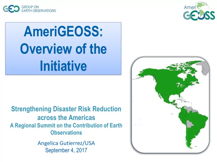
AmeriGEOSS: Overview of the Initiative Strengthening Disaster Risk Reduction across the Americas A Regional Summit on the Contribution of Earth Observations Angelica Gutierrez/USA September 4, 2017 AmeriGEOSS Initiative Born in October
AmeriGEOSS: Overview of the Initiative Strengthening Disaster Risk Reduction across the Americas A Regional Summit on the Contribution of Earth Observations Angelica Gutierrez/USA September 4, 2017
AmeriGEOSS Initiative Born in October 2014, launched in November 2015 Is a cooperative effort that: Reflects local, national, and regional interests of the GEO country- members for short and long-term planning, development, and implementation aligned with GEO activities. Is enabled by the institutional and technical capabilities of its country members and the resources of other global initiatives available for the benefit of the region. Seeks to increase institutional and personal capacity and engage experts, stakeholders, and decision makers in the process of decision making.
AmeriGEOSS Initiative • 16 Americas Caucus Member countries: – Ecuador – Argentina – Honduras – Bahamas – Mexico – Belize – Panama – Brazil – Paraguay – Canada – Peru – Chile – United States – Colombia – Uruguay – Costa Rica • Observers: – Bolivia and Guatemala
AmeriGEOSS Initiative Priority Areas • Food security and sustainable agriculture - Agriculture, associated with climate variability, climate change, and food security. • Disaster resilience - Disaster risk reduction, particularly for data exchange associated with early warnings, and for the generation of regional products of early warnings. • Water resource management - Associated with the management approach of water resources and data management and services. • Biodiversity and ecosystem sustainability - In the context of capacity building for better monitoring, management, and maintenance of ecosystems and biodiversity they support; and to predict future changes. • Foundational activities – Data systems infrastructure and capacity building.
Estructura de AmeriGEOSS Para la gestión de manejo de la Iniciativa se han creado grupos temáticos organizados y grupos de trabajo de coordinación que America’s Caucus – GEO Principals proporcionan el marco de coordinación para asegurar el éxito de esta iniciativa AmeriGEOSS Coordination Working Group (CWG) durante la próxima década. Foundational Agriculture and Disaster risk Water resources Ecosystems and Activities food security reduction WG WG Biodiversity WG WG WG 5
Disaster Resilience Working Group Activities • Support Sendai Framework: Sendai Framework for Disaster Risk Reduction as a first priority of understanding disaster risks, including floods, landslides, earthquakes, tsunamis, and volcanoes. • Prioritize disaster risks based on regional vulnerability assessment. • Assess and engage ongoing GEO activities for application to regional risks, e.g. the Geohazard Supersites and Natural Laboratories (GSNL) and GEO Data Access for Risk Management (GEO-DARMA) initiatives.
Foundational Activities Working Group Activities Objective: To coordinate and leverage existing and planned national, regional, and international activities to address data access and sharing, interoperability, infrastructure and capacity building needs in the Americas. Activities: – Increased use of GEONETCast-Americas. – Development and launch of the AmeriGEOSS Community Platform. – Build capacity in coordination with GEO and CEOS Working Group for Capacity Building and Data Democracy (WGCapD), and through Community of Hydrologic and Spatial Information for Latin America and the Caribbean (CIEHLYC). – NASA contribution through ARSET and DEVELOP capacity building programs
Foundational Activities Working Group Activities Meetings with participation of AmeriGEOSS Community: Fifth Regional Platform for Disaster Risk Reduction in the Americas - March 7-9, Montreal, Canada o AmeriGEOSS Exhibition Booth with display materials from multiple countries across the Americas. Global Meeting for Disaster Risk Reduction in Mexico in May 22-26th. Brazilian Symposium on Remote Sensing – SBSR in Santos, Brazil on May 28-31. o Special session: Treinamento Acesso e Uso de Imagens dos Satélites JPSS e GOES-R em Aplicações Ambientais.
Americas Caucus Member Countries Priorities and Highlights 9
Member Countries Disasters Priorities and Highlights Argentina Active participant in the International Charter Space and Major Disasters. Support to • capacity building activities in the region of Latin America and engagement of regional users under the Universal Access initiative to the Charter. Development of satellite based information for applications in emergency • management. L-band SAR Mission SAOCOM will be launched in 2017. • Main areas of work: Floods, Fires, Oil Spills, Landslides, Volcanic Eruptions and Health. Bahamas, Belize No updates • Bolivia* • Priority to identify technological tools that can be implemented and integrated into Early Warning Systems. • Priority to strengthen the capacity of hydrometeorological warning, prevention and mitigation of floods and droughts in vulnerable watersheds. * GEO Observer
Member Countries Disasters Priorities and Highlights Brazil Brazil, through CONAB (National Food Supply Company), is fully engaged • with GEOGLAM and takes part in the monthly meetings of the GEOGLAM crop monitor for AMIS, providing the Brazilian information to the board. Capacity Building : CONAB provided two instructors for AmeriGEOSS • Week (June 2016 ) for training on examples and applications of products generated by GLAM platform in Brazil. • Brazil intends to approach Chinese counterparts to seek ways on how we could jointly offer CBERS data to the effort. Canada RADARSAT-2 Mission data access through the Committee on Earth • Observation Satellites. RADARSAT Constellation Mission (RCM) – Launch in 2018. •
Member Countries Disasters Priorities and Highlights Chile Working a lot on applications for disaster management. Have great • experience with the disasters charter that is now supporting the universal access system. Mission with two SAR satellites developing a system for emergency • management. • Capacity building activities focused on earthquakes, tsunami, volcanic activities, wildfires; and in the case of floods, integration and management of data, past and present scenarios and response protocols, and their variations from dry and wet areas, given the diverse Chilean geography. Colombia UNGRD • • Taller de entrenamiento del proyecto Charter; 12 y 13 de julio de 2016 en la UNGRD; 184 profesionales capacitados en Colombia por expertos de la NASA y USGS. • Activación del Charter ante evento de Inundación en Mocoa, Putumayo el sábado 1º de abril de 2017.
Member Countries Disasters Priorities and Highlights Costa Rica Update? •
Member Countries Disasters Priorities and Highlights Ecuador We conduct activities towards the delivery of data and hydrometeorological • information (meteorological and hydrological forecasting, early warning systems, hydro-meteorological, hydrological forecasts of the most important rivers in Ecuador, among others) for disaster management. This information is referred to the National Secretariat for Risk Management and to the decentralized autonomous governments. The support of other applications for disaster management is necessary, and • will be useful to the already developed experience and to be part of the International Disaster Charter and the universal access system. It is a priority to participate in the information provided by the two SAR satellites to develop an emergency management system. • It is important to note the need to continue supporting the implementation of the DEWETRA program, already initiated by INAMHI in Ecuador. • Ecuador is interested in participating in exchange programs with experts in the handling of spatial images applied to risk management, as well as training workshops.
Member Countries Disasters Priorities and Highlights Guatemala* No update. • Honduras • No update. Mexico Interinstitutional collaborative platform for disaster risk management, including • prevention, real-time response and recovery (>15 participating government entities). Development of a Caribbean-Central American platform (open geoportal) for • disaster risk management, to include geodetic, physical/environmental, socio- demographic & economic layers (within joint International Development Cooperation Projects (AMEXCID, INEGI, CENAPRED, CEPREDENAC, CDEMA). Panama • No update. * GEO Observer
Member Countries Disasters Priorities and Highlights Paraguay (Guyra Paraguay – GP) GP will continue its monitoring of water-floods and fire-heat focus in the • Chaco region. GP will continue its land use change monitoring for the Chaco. • • Information System for adaptation to climatic events in agriculture, hydrology and health. Peru (Space Agency of Peru, CONIDA) Priority of identification of Populated Rodents exposed to natural hazards • Priority of flooding • • Priority of drought (Sequias) • Priority of mass movements
Recommend


More recommend
Explore More Topics
Stay informed with curated content and fresh updates.