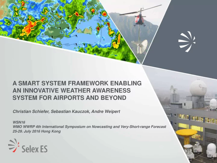

A SMART SYSTEM FRAMEWORK ENABLING AN INNOVATIVE WEATHER AWARENESS SYSTEM FOR AIRPORTS AND BEYOND Christian Schiefer, Sebastian Kauczok, Andre Weipert WSN16 WMO WWRP 4th International Symposium on Nowcasting and Very-Short-range Forecast 25-29. July 2016 Hong Kong
BUILDING A NEW ATM SYSTEM IN EUROPE Single European Sky Air Traffic Management Research European Commission Budget of 2.1b€ ~300 Projects Eurocontrol Industry 16 Work Packages Overall Goals Deployment Capacity Improving Phase Development Increasing Safety Phase 2016-2020 Definition Greener Cutting ATM Sky Costs Phase 2009-2016 2005-2008 Implement results of development Develop new standards, operational Create European procedures & technologies ATM Master Plan
WHY IS A NEW MET SYSTEM APPROACH NEEDED? • MET plays a key role in aviation For airport operations, Weather is the main source for delays! Source: Eurocontrol, Directorate Network Management Monthly Network Operations Report
WHY IS A NEW SYSTEM APPROACH NEEDED (2)? • Needs to reduce the weather impact on ATM are identified: MET capabilities Improved MET products in terms of accuracy, update rate and reliability New MET products to serve all MET phenomena properly by using new MET Sensors capabilities MET data availability and provision A services oriented approach guarantees access and tailor-made data for each Users (SWIM concept) MET Translation & Presentation A tailor-made provision for a common understanding between Users Enhanced MET Products and/or pure Alerts and Warnings presentation for a complete “MET-Picture” to support the decision making process
A SMART SYSTEM FRAMEWORK AS A SOLUTION • Key Features of System Framework Flexibility of MET input Using Data Distribution Services (DDS) technology ensures a service oriented architecture Interoperability to the SESAR System Wide Information System (SWIM) A highly configurable web-based graphical interface Just a standard Browser is needed Using open source service Open Street Map / GeoServer for the geographical mapping Representation of MET from abstract to any details General System Architecture thanks to a multi layer structure
THE FIRST DEPLOYMENT INSIDE SESAR • The Framework Set-up Braunschweig Airport/ Germany 02-05.2015 AWOS Sensors (Yellow Markers) • 2 Ceilometers (Runway heads) • 3 Transmissiometers (Runway heads and middle) • 2 Anemometers (Runway heads, 10 m wind) • Thermometer (2 m temperature) • Pressure sensor • Humidity sensor Raymetrics 3D-scanning Ceilometer Leosphere Wind Cube 400S 3D scanning Doppler Lidar Selex ES 50DX mobile polarimetric X-Band weather Radar Selex ES RS3DP Compact Solid State polarimetric X-Band Radar Axis Fish Eye Camera (M3027-PVE) FLIR Infrared (IR) Camera (A315) Nowcast Lightning Data Numerical Weather Prediction Model (COSMO DE)
THE FIRST DEPLOYMENT INSIDE SESAR (2) • MET Products Generation based on Data fusion and Sensor Synergies Cloud base Cloud amount Cloud amount opt. Camera & IF Camera Camera & Ceilometer Ceilometer & Doppler Lidar Thunderstorm Runway oriented Windshear Radar & Lightning Radar & Lidar
THE FIRST DEPLOYMENT INSIDE SESAR (3) • MET Products Portfolio Wind Winter Weather • Low Level Windshear • Snow • Runway oriented shear • Snowfall probability • Low Level Turbulence • Freezing rain • Surface wind speed & direction • Freezing rain probability fall amount observation • Surface wind gust observation • Surface Wind Forecast Visibility • Wind speed & direction aloft • Storm Nowcast • RVR • Cloud base height • Cloud amount Convection • Surface Visibility • Ceiling or Vertical Visibility • Precipitation type • Quantitative precipitation intensity • Precipitation amount Standard MET • Precipitation duration • 2 m air & dew point temperature • Liquid precipitation probability • Relative humidity • Probabilities for precipitation intensityf • Air pressure (QNH & QFE) • Nowcasting • Runway surface temperature • Lightning • Low level temperature inversion
THE FIRST DEPLOYMENT INSIDE SESAR (4) • MET System Specification Observation (in-situ & remote Sensors) • ~20 Sensors integrated • Sensor specific parameters (range, update rate etc.) • Sensor Network integrated (Lightning) • amount Nowcast (X-Band Weather Radar) • ~100m horizontal resolution • 100km range • 1h nowcast horizon • 5 min update rate • for precipitation amount • Lightning Forecast (COSMO DE) • 2,8Km horizontal resolution • 3h update rate • 27h forecast horizon • Obscuration phenomena
WEATHER DECISION SUPPORT DISPLAY Forecast Nowcast- Bar Wheel “Now”-Button Sensor List of current Alerts “Clickables” Runway extensions Geospatial Element
BEYOND AVIATION…. Technology • Service oriented architecture via DDS • Open Street Map Geo-Server • Flexible of MET Input Sources Meteorology • Providing MET Observations, Tactical Flood Weather Nowcasts & Forecasts Warning Hydrology Others… for special System Events • Configurable MET Alerts and Warnings • Data Fusion capability Visualization • Visualization via a standard Browser • Applicable to every Location • Multi-Layer GUI
OUTLOOK • Further Developments 4D Trajectory integrated Weather objects (SESAR 2020 ) Met Hazards Geo Ref. Volumes (Space and time) correlated to flight path New Products based on Requirements 3D Weather Objects 3D Convection Short-term Forecast of 3D Convection 3D Windfield Short-term Forecast of 3D Windfield Customized services
Christian Schiefer c.schiefer@selex-es-gmbh.com Selex ES GmbH Raiffeisenstrasse 10 41470 Neuss, Germany Tel: +49 (0) 2137 782-0 www.selex-es.de
Recommend
More recommend