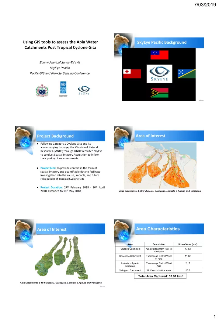

7/03/2019 Using GIS tools to assess the Apia Water SkyEye Pacific Background Catchments Post Tropical Cyclone Gita Ebony-Jean Lafotanoa- Ta’avili SkyEye Pacific Pacific GIS and Remote Sensing Conference Area of Interest Project Background ● Following Category 1 Cyclone Gita and its accompanying damage, the Ministry of Natural Resources (MNRE) through UNDP recruited SkyEye to conduct Spatial Imagery Acquisition to inform their post cyclone assessments ● Project Aim: To provide context in the form of spatial imagery and quantifiable data to facilitate investigation into the cause, impacts, and future risks in light of Tropical Cyclone Gita ● Project Duration: 27 th February 2018 - 30 th April 2018. Extended to 18 th May 2018 Apia Catchments L-R: Fuluasou, Gasegase, Loimata o Apaula and Vaisigano Area Characteristics Area of Interest Area Description Size of Area (km 2 ) Fuluasou Catchment Area starting from Tiavi to 17.62 Vaisigano Gasegase Catchment Tuamasaga District West 11.52 of Apia Loimata o Apaula Tuamasaga District West 2.17 Catchment Apia Vaisigano Catchment Mt Vaea to Mulivai Area 26.6 Total Area Captured: 57.91 km 2 Apia Catchments L-R: Fuluasou, Gasegase, Loimata o Apaula and Vaisigano 1
7/03/2019 Methodology Project Deliverables/Outputs 1. Data Collection/Equipment Output 1: Digital Imagery and Point Cloud Data for ● Undertook aerial mapping of catchment areas using DJI Phantom 4 2018: Orthorectified, corrected to control points for, Pro Drone and Sensefly Ebee Fixed Wing Drone. Resolution: Between resampled to the same resolution 2 and 8 cm GSD 2. Data Processing/Tools used ● Software: Output 2: Capacity Building: Training of relevant staff in Pix4D Mapper the use of products as a monitoring, assessment and Global Mapper 19 reporting tool and the use of SkyEye products for future QGIS 2.18.18 works 3. Processing & Analysis ● Analyse vegetation, tree damage, landslides, roads and development, Output 3: Project Reporting: Produce a Report on generate terrain, surface and water network models works undertaken, findings, analysis, recommendations. ● Orthorectified images (adjusted for camera tilt, perspective to get true aerial view and therefore be able to measure true distances), rectified images to GCPs Methodology Highlights Methodology Highlights For Accurate Comparison: More Examples: ● SkyEye images resampled to 2015 resolution (20cm GSD) to allow accurate comparison between the two. Fuluasou River: 2015 vs 2018 Area in Vaisigano: 2015 vs 2018 Methodology Highlights Methodology Highlights Combining and Compressing Data for easier handling and use - taking into account Local Capacity: ● Combining and compressing using ecw format of 2015 Aerial Imagery into single imagery per catchment for easier use ● Compressing 2018 Orthorectified Imagery using ecw format for easier use/handling Vaisigano River Example: 2015 vs 2018 ● Combining and compressing of MNRE Lidar data per catchment to .LAZ format for easier handling/use 2
7/03/2019 Methodology Highlights Lastly... ● Combining and compressing of 2018 Point Cloud ● Regarding the use of Spatial Data: Set up a central Data for easier handling and use portal for storage and access of water catchment Data Package: spatial data for ease of access and easier/effective data management. ● Packaged data all processed data into an easy to use QGIS (Open Source) Desktop Package for easy ● Local Knowledge: SkyEye being a local company, of use we experienced the flooding and understand what is at stake. Knowing the local area enables faster response time to complete the project but also faster response in terms of local support. Fa’afetai lava 3
Recommend
More recommend