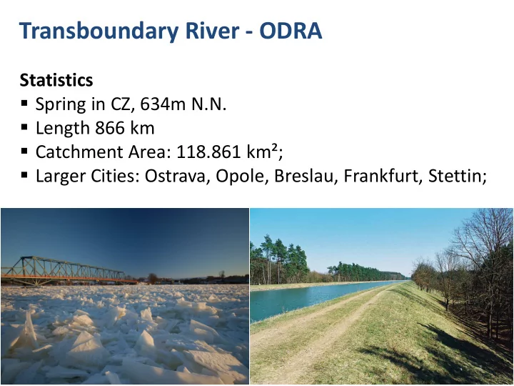

Transboundary River - ODRA Statistics Spring in CZ, 634m N.N. Length 866 km Catchment Area: 118.861 km²; Larger Cities: Ostrava, Opole, Breslau, Frankfurt, Stettin; 1
Transboundary River - ODRA Geography From Ostrava (Moravian Mountains/CZ, 130km) via Wrozlaw (Breslau) to DE/PL; South of Ratzdorf, at km 542 the River Neisse flows into the Oder and creates the transboundary river ; Tributaries: Old Oder, The Welse (North of Schwedt) Oder-Spree-Canal (at Eisenhüttenstadt) and Oder- Havel-Canal (famous boat lift in Niederfinow); https://youtu.be/N0udg_qlgf4?t=28 Dietmar KOCH, Uppsala 2015 2
Cooperation ICPO, PL-CZ-DE Established in 1996, latest topics: Joint Implementation of WFD and Directive on Communication on Flood Risk Management Germany holds the current presidency; Relation to Marine Strategy Framework Directive is being prepared; Joint Modeling based on MONERIS MoRE Polish-German border river commission, 4 WGs: coop. of administrations , communities and regions; Publications: Flood risk man. 2014, River Man. Plans 2015. Dietmar KOCH, Uppsala 2015 3
Parameter tn/2012 2 37363,7003 BOD5 PLC Data 3 BOD7 42968,2553 4 1,1131 Cd CDExxx STATION_CODE 7 10,3955 Cr 8 33,4067 Cu 10 0,18617 Hg opposite Widuchowa, OD_0090 (last station 11 29,6575 Ni STATION_NAME before Odra splits into 12 1408,6047 NNH4 two arms) 13 102,4885 NNO2 15 6813,9073 NNO3 SUBCATCHMENT_ 16 24765,3439 SCDE00035 NTOT CODE 18 13,0221 Pb RIVER_CODE R6 19 331,7354 PPO4 20 1758,5828 PTOT SUBREGION_CODE BAP SPM 21 - TOC 22 - 23 142,1777 27 Point Sources > 2.000 Zn flow [m³ /s] 32,7979 Ratzdorf 259,2082 Kiez 4 466,6918 opposite Widuchova Dietmar KOCH, Uppsala 2015
Monitoring Monitoring Areas in Brandenburg Monitoring points substances Monitoring points water flow Monitoring point substances without flow data Unmonitored parts of monitored rivers Monitored areas Dietmar KOCH, Uppsala 2015 5
Transboundary River Shared INPUT to the Baltic Sea DE PL Oder SUM EZG nach BB 4.667 River catchment areas 2.401 Uecker shape file 6B 122.664 110.373 monitored Binnengew. shape 6K = Stettiner Haff 691 7.648 unmonitored Küstengew. ca. 50% von 6K auf deutscher 346 Seite ODER Flussgebiet nach 123.355 118.021 Oder gesamt SUM WRRL, incl. Uecker 6B+6K deutscher Anteil an der 4.643 3,79% Oder 9.602 km 2 7,7 % incl. Neisse? Oderkommission 81% PL Sharing of pollution load 5% DE ohne Neisse to Odra lagoon 15% CZ Map3_HELCOM+Odra+PL catchments.qgs Dietmar KOCH, Uppsala 2015 6
CARTs per country to be achieved by 2021 Country/Source Nitrogen Phosphorus (tonnes) (tonnes) Denmark 2,890 38 Estonia 1,800 320 Finland1 2,430+600* 330+26* Germany1 7,170+500* 110+60* Latvia 1,670 220 Lithuania 8,970 1,470 Poland2 43,610 7,480 Russia 10,380* 3,790* Sweden 9,240 530 Waterborne transboundary 3,230 800 Dietmar KOCH, Uppsala 2015 7
Conclusions Verify reduction requirements stemming from the German contribution to the river Odra inputs, based on ongoing modeling approaches with MONERIS and MoRE. Some MoRE results: Germany will call for a meeting of IKSO / Polish-German border river commission with relevant water management bodies (SN, BB, MV) to discuss reduction potentials and measures. Dietmar KOCH, Uppsala 2015 8
Cooperation ICPO, PL-CZ-DE http://www.mkoo.pl/index.php?lang=EN Dietmar KOCH, Uppsala 2015 9
Recommend
More recommend