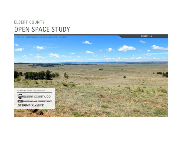

OVERVIEW • What is an Open Space Study and Why Now • Who Was Involved and Process • The Case for Open Space • Layer Upon Layer • Priorities and Approaches • Q & A
WHAT IS AN OPEN SPACE STUDY? It is a … • Tool for Elbert County to better understand areas that contain high open space value in order to protect your region’s rural character • Method of identifying opportunities and guidance for future open space conservation, habitat protection, and recreation connectivity • Resource for landowners to understand options in face of changing economies and growth pressures
WHAT IS AN OPEN SPACE STUDY? It is not a … • Plan for public acquisition of private lands • Method of identifying individual parcels • Means of restricting private property rights or development potential
WHY NOW? • Community development pressures • Predicted to be fastest growing county in Colorado over next 5 years – potentially doubling in population by 2030 • Residential subdivision development serving Denver, Parker, Castle Rock, and Colorado Springs • Energy development pressures • Largest wind energy project in Colorado – 300-400 turbines (440 ft tall) and 90 miles of transmission lines (130 ft tall) – approximately half in eastern Elbert County • Traditional oil and gas exploration (southern end of Niobrara / Denver-Julesburg Basin) • Opens new funding opportunities and aligned with Comprehensive Plan update process
WHO WAS INVOLVED • Elbert County Planning Department • Douglas Land Conservancy (non-profit 501(c)3) • Design Workshop (planning consultant) • Stakeholder Focus Groups
WHO WAS INVOLVED • Douglas Land Conservancy • Non-partisan, non-profit land trust dedicated to the protection and conservation of the natural character, habitat, and open space of the central front range region of Colorado, including Douglas County and surrounding areas • Made up of concerned citizens and based in Castle Rock since 1987 • Recognizing the importance of a regional approach in land conservation has recently broadened its focus to support surrounding counties, including Jefferson and Elbert • In 2014, awarded a grant by a local family foundation to help develop the open space vision study
FOCUS GROUP MEETINGS (JUNE 2016) • Recreation, Education, and Activities • Peaceful Valley Scout Ranch, Magness Adventure Camp, Plains Conservation Center, Douglas/Elbert Horse Council, 4H • Agricultural Working Lands and Natural Resources • Colorado Cattleman’s Association, Farm Bureau, Colorado Open Lands, Colorado Parks and Wildlife, U.S. Soil Conservation Service, NRCS, Conservation Fund, Malone Foundation, Nature Conservancy, Kiowa Conservation Board • Community Development • Town of Elizabeth (Parks and Recreation, Community Development), Kiowa Public Works, Simla Public Works
PROCESS • Data Gathering and Preliminary Analysis • County Tour and Reconnaissance • Stakeholder Engagement (Focus Group Meetings) • Revised Analysis and Development of Priorities • Documentation of the Study
THE CASE FOR OPEN SPACE AGRICULTURAL WORKING LANDS RECREATION WILDLIFE / HABITAT SCENIC QUALITY
THE CASE FOR OPEN SPACE • Economic • Preserve existing agricultural economies • Build on equine facilities ($125M between Elbert and Douglas Counties) • Maintain or enhance property values (10-15%) • Capitalize on recreation/tourism economy ($21B statewide) • Community • Identity and continuation of rural way of life • Citizen’s health and wellness • Connection to nature for children • Environmental • Wildlife habitat • Water resources protection (surface and aquifer) • Scenic value (open plains, pine forests, Pikes to Longs)
LAYER UPON LAYER • Gather and analyze multiple layers of GIS data and information from local, state, and federal sources • Natural Features and Agricultural Working Lands • Scenic Quality and Visibility • Character of Parcel (size and adjacency) • Assign ranking of Low, Medium, or High to different characteristics • Example: Wildlife Nesting/Calving Sites = High, Winter Range = Medium, Overall Range = Low • Each layer is individually weighted and “sandwiched” with the others to equal 100%
LAYER UPON LAYER | natural features and agricultural working lands
LAYER UPON LAYER | natural features and agricultural working lands
LAYER UPON LAYER | scenic quality and visibility
LAYER UPON LAYER | scenic quality and visibility
LAYER UPON LAYER | character of parcel
LAYER UPON LAYER | character of parcel
LAYER UPON LAYER | open space suitability composite
PRIORITIES AND APPROACHES • Categories of conservation priorities were evaluated and assigned to each area of high value (not exclusive of each other) • Various suggested approaches to achieve the priorities are recommended
PRIORITIES AND APPROACHES
PRIORITIES AND APPROACHES
PRIORITIES AND APPROACHES
PRIORITIES AND APPROACHES
PRIORITIES AND APPROACHES
PRIORITIES AND APPROACHES
PRIORITIES AND APPROACHES
Thank You! Questions?
Recommend
More recommend