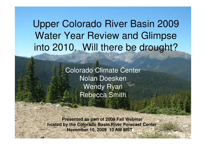

Upper Colorado River Basin 2009 Water Year Review and Glimpse into 2010. Will there be drought? Colorado Climate Center Colorado Climate Center Nolan Doesken Wendy Ryan Rebecca Smith Presented as part of 2009 Fall Webinar hosted by the Colorado Basin River Forecast Center November 10, 2009 10 AM MST
Outline • Drought Conditions Update • Water Year 2009 Snowpack Accumulation and Melt • Water Year 2009 Temperature Departures • Water Year 2009 Precipitation Analysis • Water Year 2009 Precipitation Analysis • Water Year 2010 Precipitation Tracking • Water Year 2009 Streamflow Example • Water Year 2009 Evaporation Comparison • Water Year 2009 Reservoir Levels and October Conditions • Hand off to Klaus for predictive information
Status at beginning of 2009 Water Year Drought Monitor September 30, 2008 D0 D1 Drought - D2 Drought - D3 Drought – D4 Drought - Abnormally Dry Moderate Severe Extreme Exceptional
Fractio tion 0.1 0.2 0.3 0.4 0.5 0.6 0.7 0.8 0.9 0 1 1890 1892 1895 1897 1900 1902 1905 1907 1910 1912 Fraction of Colorado in Drought 1915 1917 1920 1922 1925 1927 Based on 3 month SPI 1930 1932 (1890 - September 2009) 1935 1937 1940 1942 1945 1947 Year 1950 1952 1955 1957 1960 1962 1965 1967 1970 1972 1975 1977 1980 1982 1985 1987 1990 1992 1995 1997 2000 2002 2005 2007
Fractio tion 0.0 0.1 0.2 0.3 0.4 0.5 0.6 0.7 0.8 0.9 1.0 1890 1892 1895 1897 1900 1902 1905 1907 1910 Fraction of Colorado in Drought 1912 1915 1917 1920 1922 Based on 48 month SPI 1925 1927 1930 1932 (1890 - September 2009) 1935 1937 1940 1942 1945 1947 Year 1950 1952 1955 1957 1960 1962 1965 1967 1970 1972 1975 1977 1980 1982 1985 1987 1990 1992 1995 1997 2000 2002 2005 2007
Location of Selected SNOTEL Stations Showing 2009 Accumulation and Melt
Lake Irene – Elevation 10,700’
Stillwater Creek – Elevation 8,720’
Berthoud Summit – Elevation 11,300’
Middle Fork Camp – Elevation 8,940’
Upper San Juan – Elevation 10,200’
Water Year 2009 - Current 8.0 6.0 re Departure (deg F) 4.0 2.0 0.0 -2.0 -2.0 Temperature -4.0 -6.0 -8.0 -10.0 Oct Nov Dec Jan Feb Mar Apr May Jun Jul Aug Sep Oct Eastern Plains Foothills Mountains Western Valleys
PRISM 12-month precipitation as percent of average: average: September 2009
Grand Lake 1 NW 2008-2009 Water Year 30 Year Averages-1971-2000 Period of Record Average - 1941 - 2002 2008-2009 Water Year Accumulated 50 45 40 ecipitation (Inches) 35 30 25 25 Accumulated Prec 20 15 10 5 0 T V C N B R R Y N L G P T V C N B R R Y N L G P T C O E A E A P A U U E C O E A E A P A U U E C U U O D F A M J S O D F A M J S O N J M J A N J M J A Months
Dillon 1E 2008-2009 Water Year 30 Year Averages-1971-2000 Period of Record Average - 1906 - 2002 2008-2009 Water Year Accumulated 50 45 40 recipitation (Inches) 35 30 25 25 Accumulated Prec 20 15 10 5 0 N R G P N R G P T V C B R Y N L T V C B R Y N L T C U E C U E C O E A E A P A U U O E A E A P A U U S S O N D J F M A M J J O N D J F M A M J J O A A Months
Montrose #2 2008-2009 Water Year 30 Year Averages-1971-2000 Period of Record Average - 1893- 2002 2008-2009 Water Year Accumulated 50 45 40 ecipitation (Inches) 35 30 25 25 Accumulated Prec 20 15 10 5 0 N R L G P N R L G P T V C B R Y N T V C B R Y N T C O E A E A P A U U U E C O E A E A P A U U U E C S S O N D J F M A M J J A O N D J F M A M J J A O Months
Mesa Verde NP 2008-2009 Water Year 30 Year Averages-1971-2000 Period of Record Average - 1893- 2002 2009 Water Year Accumulated 50 45 40 ipitation (Inches) 35 30 Accumulated Precipi 25 20 15 10 5 0 V B R R Y G P V B R R Y G P T C N N L T C N N L T U U C O E A E A P A U E C O E A E A P A U E C U U F M J S F M J S O N D J M A J A O N D J M A J A O Months
Cheyenne Wells 2008-2009 Water Year 30 Year Averages-1971-2000 Period of Record Average - 1971 - 2002 2008-2009 Water Year 50 45 40 ipitation (Inches) 35 30 Accumulated Precip 25 20 15 10 5 0 OCT NOV DEC JAN FEB MAR APR MAY JUN JUL AUG SEP OCT NOV DEC JAN FEB MAR APR MAY JUN JUL AUG SEP OCT Months
Boulder 2008 - 2009 Water Year 2008-2009 Water Year 30 Year Averages-1971-2000 Period of Record Average - 1894-2002 50 45 40 cipitation (inches) 35 30 25 25 Accumulated Preci 20 15 10 5 0 OCT NOV DEC JAN FEB MAR APR MAY JUN JUL AUG SEP OCT NOV DEC JAN FEB MAR APR MAY JUN JUL AUG SEP OCT Months
Colorado River below Baker Gulch Near Grand Lake 600 WY 2009- current Discharge (cfs) Historic Mean Discharge (cfs) 500 400 rge (cfs) Discharge 300 300 200 100 0 9/9/2008 10/29/2008 12/18/2008 2/6/2009 3/28/2009 5/17/2009 7/6/2009 8/25/2009 10/14/2009 12/3/2009 Date
October Total Flow Colorado River Below Baker Gulch (cfs) 90 80 70 60 harge (cfs) 50 Discha 40 30 20 10 0 3 5 7 9 1 3 5 7 9 1 3 5 7 9 1 3 5 7 9 1 3 5 7 9 1 3 5 7 9 5 5 5 5 6 6 6 6 6 7 7 7 7 7 8 8 8 8 8 9 9 9 9 9 0 0 0 0 0 9 9 9 9 9 9 9 9 9 9 9 9 9 9 9 9 9 9 9 9 9 9 9 9 0 0 0 0 0 1 1 1 1 1 1 1 1 1 1 1 1 1 1 1 1 1 1 1 1 1 1 1 1 2 2 2 2 2 Year
Accumulated Pan Evaporation 2009 Growing Season Compared to Normal: Grand Junction 6ESE and Fort Collins 60 Grand Junction 6ESE Average Evaporation 50 Grand Junction 6ESE 2009 Evaporation Fort Collins Average Evaporation ration (in) 40 Fort Collins 2009 Evaporation Pan Evaporati 30 20 10 0 May Jun Jul Aug Sep Month
Summary • 2009 good year for water in most areas of Colorado -- Excellent growing season precipitation east of the mountains. • Large early snowmelt (May), secondary late June peak flows especially northern basins June peak flows especially northern basins • Reservoirs filled early -- ended the Water Year near average in most areas • W. Colorado tending drier than average with noticeably below average summer and early autumn 2009 precipitation, especially lower elevations. Need to keep a close eye on SW Colorado for developing drought conditions.
Recommend
More recommend