The use and evaluation of GloFAS for operational flood forecasting - PowerPoint PPT Presentation
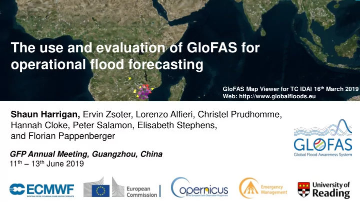
The use and evaluation of GloFAS for operational flood forecasting GloFAS Map Viewer for TC IDAI 16 th March 2019 Web: http://www.globalfloods.eu Shaun Harrigan, Ervin Zsoter, Lorenzo Alfieri, Christel Prudhomme, Hannah Cloke, Peter Salamon,
The use and evaluation of GloFAS for operational flood forecasting GloFAS Map Viewer for TC IDAI 16 th March 2019 Web: http://www.globalfloods.eu Shaun Harrigan, Ervin Zsoter, Lorenzo Alfieri, Christel Prudhomme, Hannah Cloke, Peter Salamon, Elisabeth Stephens, and Florian Pappenberger GFP Annual Meeting, Guangzhou, China 11 th – 13 th June 2019
GloFAS operational chain (supported 24/7 since April 2018) Hydro-met. Initial Conditions - ERA5-T, ENS-Crtl. Meteorological Post-processing Hydrological Web Interface Forecast Forcing - probability of Modelling - visualisation, - ECMWF ENS ( 46r1 ): exceedance at background - Daily 00UTC - HTESSEL, Lisflood different lead time, information - 51 members routing (~10 km) graphs, maps - Extended to 30d LT Input (static) Flood Thresholds Input Datasets - reference discharge Observations reanalysis - topography, soil, river - Satellite and in-situ (GloFASv2-ERA5) network etc. October 29, 2014 EUROPEAN CENTRE FOR MEDIUM-RANGE WEATHER FORECASTS 2
New meteorological model cycle (46r1) operational today! Anomaly correlation of 500 hPa Geopotential reaching 85% • Major data assimilation upgrade • Many new products available (e.g. EFI Water Vapour Flux) day • Watch webinars here: 3 EUROPEAN CENTRE FOR MEDIUM-RANGE WEATHER FORECASTS October 29, 2014
GloFAS upgraded to v2 on 14 November 2018 • A.) Scientific developments: – 1.) Global calibration of Lisflood routing & GW (Hirpa et al., 2018, JoH) – 2.) GloFASv2-ERA5 discharge reanalysis (1981 to NRT) – 3.) Improved initialisation of real-time forecasts (ERA5-T, 2-5 day latency) • B.) User enhancements: – 1.) Version numbering system – 2.) Availability of datasets (reforecasts and reanalysis) ahead of launch date – 3.) More comprehensive documentation (see: http://www.globalfloods.eu/) October 29, 2014 EUROPEAN CENTRE FOR MEDIUM-RANGE WEATHER FORECASTS 4
GloFASv2 Evaluation Datasets Datasets GloFASv2 GloFASv1 - 1997-2016 - 1997-2016 - Initialised 2 per wk. - Initialised 2 per wk. from Reforecasts from ERA5 ERA-Interim/L (ECMWF IFS 43r1/43r3) - 11 ens. members - 11 ens. members - Global 0.1° grid - Global 0.1° grid - Calibrated - Not calibrated GloFASv2-ERA5 Discharge reanalysis Not used (1981-2017) Discharge observations Yes Yes October 29, 2014 EUROPEAN CENTRE FOR MEDIUM-RANGE WEATHER FORECASTS 5
Forecast performance GloFAS v2 versus v1, w.r.t. obs. v2 performance at 10 day LT as good as v1 at 5 day LT Pearson Correlation Lead time (days) Correlation(ensMean, obs.) 0=None; 1=Perfect October 29, 2014 EUROPEAN CENTRE FOR MEDIUM-RANGE WEATHER FORECASTS 6
Overall ensemble forecast skill of GloFASv2 CRPSS Lead time (days) CRPSS = 1 – ( 𝐝𝐬𝐪𝐭_𝐠𝐝)/𝐝𝐬𝐪𝐭_𝐜𝐟𝐨𝐝𝐢 ) (w.r.t. Reanalysis) October 29, 2014 0=No Skill; 1=Perfect skill EUROPEAN CENTRE FOR MEDIUM-RANGE WEATHER FORECASTS 7
… spatial distribution of skill CRPSS = 1 – ( 𝐝𝐬𝐪𝐭_𝐠𝐝)/𝐝𝐬𝐪𝐭_𝐪𝐟𝐬𝐭𝐪𝐬𝐩𝐜 ) (w.r.t. Reanalysis) 0=No Skill; 1=Perfect skill CRPSS CRPSS 1 day 5 day lead lead CRPSS CRPSS 10 day 30 day lead lead October 29, 2014 EUROPEAN CENTRE FOR MEDIUM-RANGE WEATHER FORECASTS 8
Ensemble skill for high flow events (Q10 threshold) 5 day lead Perfect discrimination ROC Area Skill Score ROCSS = 2 × ROCA – 1 (w.r.t. obs.) 0=No Skill; 1=Perfect skill October 29, 2014 EUROPEAN CENTRE FOR MEDIUM-RANGE WEATHER FORECASTS 9
CEMS in action during Malawi & Mozambique floods Flood Forecast from GloFAS CEMS Rapping Mapping October 29, 2014 10
Using GloFAS forecasts to aid decision makers • DfID (UK) requested emergency reports to aid response to TC Idai humanitarian disaster • ECMWF, Uni. Reading, Uni. Bristol • TC Idai (7 reports between 21 st and 1 st April): • TC Kenneth (5 reports between 24 th April and 3 rd May) October 29, 2014 EUROPEAN CENTRE FOR MEDIUM-RANGE WEATHER FORECASTS 11
Global flood forecast guidance & impact going operational! Aristotle multi-hazard activation Likelihood prepare of impact monitor act High X monitor prepare nil Medium nil nil monitor Low Required Resources Sub- National Inter- national national October 29, 2014 EUROPEAN CENTRE FOR MEDIUM-RANGE WEATHER FORECASTS 12
Summary GloFAS Map Viewer: http://www.globalfloods.eu/ 1.) GloFASv2 operational since 14 November 2018 (Datasets freely available 😁 ) 2.) GloFASv2 more skilful than v1 in majority of catchments (extend lead time) 3.) GloFASv2 ensemble forecast evaluation, skilful against persistence + climatology 4.) GloFASv2 skilful during high flow events 5.) Flood forecast guidance & impact going operational at the global scale 6.) The road towards GloFAS 3.0 – Lorenzo Alfieri’s talk tomorrow! Questions? Shaun Harrigan shaun.harrigan@ecmwf.int
Extra slides…
Performance of GloFASv2-ERA5 discharge reanalysis correlation Hydrological performance with KGE mod (Gupta et al., 2009; Kling et al., 2012) bias See Zsoter et al. (2019) JHM! variability KGE mod KGE mod (sim., obs.) 0=No Skill; 1=Perfect skill October 29, 2014 EUROPEAN CENTRE FOR MEDIUM-RANGE WEATHER FORECASTS 15
GloFAS Hydrological Model – HTESSEL + LISFLOOD routing • Runoff from 18-km H-TESSEL • 10-km resolution routing module • Calibrated at ~1300 locations using KGE Improvement KGE GloFAS v2 compared with GloFAS v1 (Hirpa et al., 2018, Journal of Hydrology) October 29, 2014
Q3: GloFASv2 Evaluation: Best benchmark to use? Tougher to beat CRPSS = 1 – ( 𝐝𝐬𝐪𝐭_𝐠𝐝)/𝐝𝐬𝐪𝐭_𝐜𝐟𝐨𝐝𝐢 ) (w.r.t. Reanalysis) 0=No Skill; 1=Perfect skill 1 day 10 day 30 day lead lead lead October 29, 2014
GloFAS discharge observations network 20 yr reforecast period (1997-2016) Observations maintained by Joint Research Centre (JRC) [2041 stations with at least 1 data entry] Sources include: GRDC, National Hydro. Met. Services, GloFAS partners] October 29, 2014
Forecast Bias (reanalysis) 1 day 5 day lead lead 10 day 30 day lead lead October 29, 2014 EUROPEAN CENTRE FOR MEDIUM-RANGE WEATHER FORECASTS 19
Recommend
More recommend
Explore More Topics
Stay informed with curated content and fresh updates.
