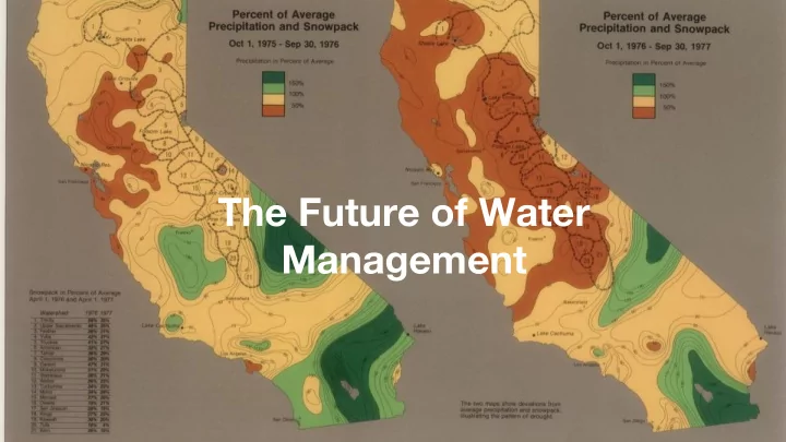
Powered by The Future of Water Management
Powered by Life beyond the 100th meridian 2
Powered by Our state’s water system was design a generation ago for a state half its current size 3
Powered by 4
Powered by “It’s a different world …we have to act differently” -Governor Brown 5
Powered by California’s water industry isn’t wired to adapt to climate change With 1000’s of local water agencies, digital integration is necessary so California can adapt to an uncertain future 6
What is the California Data Collaborative? Launched Jan 2016 by water ● agencies for water agencies. Goal: Leverage modern data ● science to ensure water reliability Powered by ARGO, a 501(c)3 ● public data infrastructure non-profit
SCUBA Strategic California UrBan water Analytics
Powered by “We not only have the opportunity to collaborate on tools and research we develop together, we have the chance to partner with talented and innovative stakeholders from around the world to assist us in using data to make better water management decisions.” — Elizabeth Lovsted, Director of Water Supply Planning, EMWD Digital infrastructure optimizing existing water resources Physical infrastructure to tap into new water resources
Supporting water managers into an uncertain future
Powered by Multiple benefits: modeling water rates
Powered by $20 million Amount ARGO’s platform saved Moulton Niguel Water District by improved water demand forecasting 12
Powered by Case Study: Snowpack
Powered by Climate change
Real time estimation of snow over the Sierra Nevada Gonzalo Cortés - UCLA
1 Prior (Model) Snow simulations Posterior (from model) are (Model + conditioned on satellite) observed data from satellites observed data. 2 Result are historical spatial estimates of SWE for 1984-2017 (Landsat era), constrained by
3 Historical Sierra Nevada reanalysis + real-time model implementation: Real-time water resource availability today 4 Real time California-wide assessment of all different types of storage.
Powered by Case Study: Stormwater
Powered by Climate change
Powered by Multiple benefits: mapping urban drool
Powered by Case Study: Lawns!
Powered by Climate change
Google Street View Landscape Survey Survey ● Using Google Street View, virtually walk every street in the study area, creating a record for any front yard where a lawn is not the primary landscape type. ● Also record data for front yards with lawns when the secondary landscape type is drought-tolerant. ● Geocode each record, generating a latitude and longitude for each address.
Powered by Parcel level landscape area data across CA
Market transformation is a generational process that requires ongoing measurement
FlipMyLawn.com
Powered by Thanks! Reach out @patwater
Business model: quasi-governmental nonprofit managing California’s water usage data like a utility bit.ly/manage_data_like_water
Recommend
More recommend
Unleash a World of Digital Possibilities—Browse, Share, and Explore Content Without Boundaries