the Convection-Permitting Model at JMA Tadashi Fujita, Yoshihiro - PowerPoint PPT Presentation
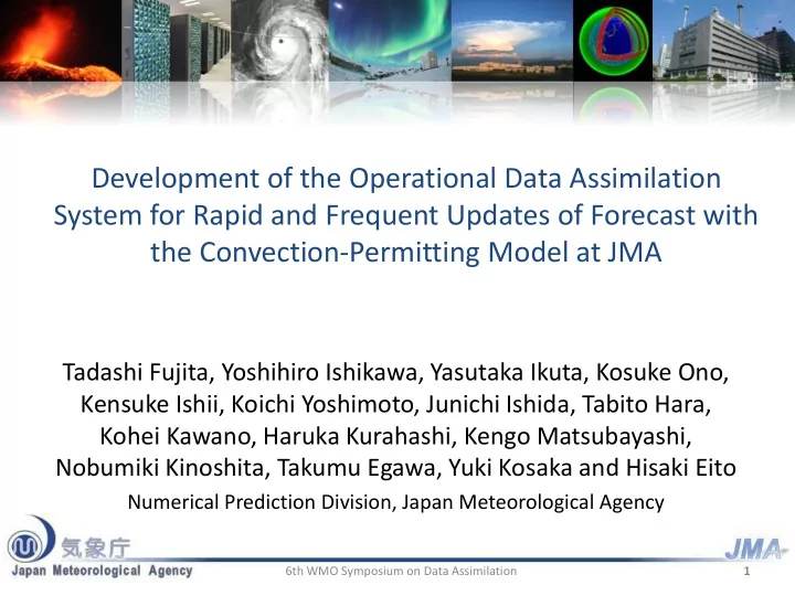
Development of the Operational Data Assimilation System for Rapid and Frequent Updates of Forecast with the Convection-Permitting Model at JMA Tadashi Fujita, Yoshihiro Ishikawa, Yasutaka Ikuta, Kosuke Ono, Kensuke Ishii, Koichi Yoshimoto,
Development of the Operational Data Assimilation System for Rapid and Frequent Updates of Forecast with the Convection-Permitting Model at JMA Tadashi Fujita, Yoshihiro Ishikawa, Yasutaka Ikuta, Kosuke Ono, Kensuke Ishii, Koichi Yoshimoto, Junichi Ishida, Tabito Hara, Kohei Kawano, Haruka Kurahashi, Kengo Matsubayashi, Nobumiki Kinoshita, Takumu Egawa, Yuki Kosaka and Hisaki Eito Numerical Prediction Division, Japan Meteorological Agency 6th WMO Symposium on Data Assimilation 1
Local NWP System (LA + LFM) Objectives: providing information for aviation weather forecast and • disaster prevention, with emphasis on forecasting severe events High resolution NWP: Grid spacing of 2km (the finest in the JMA’s • operational NWP system) High frequency operation: 24 times a day (hourly) • In operation from Aug. 2012 • Local NWP System Local Forecast Model (LFM) Global NWP System Local Analysis (LA) Global Spectral Model (GSM) Global Analysis (GA) Meso-Scale NWP System Meso-Scale Model(MSM) Meso-Scale Analysis (MA) Resolution 2km Resolution 5km Domain 1581 x 1301 Resolution ~20km covering the whole Japan 2 6th WMO Symposium on Data Assimilation
Local NWP System (LA + LFM) 3 6th WMO Symposium on Data Assimilation
Features of the Local NWP System • High resolution Local(2km) – Explicit representation of spatial and temporal variations at fine scale – More realistic terrain help resolve terrain induced phenomena mitigate representativeness error in use of surface observations High mountains and valleys are • High frequency more realistically resolved. – Frequently provide an enhanced forecast with information from the Meso(5km) latest observations. – Hourly operation of rapid forecasts using an efficient system. 6th WMO Symposium on Data Assimilation 4 4
Features of the Local NWP System High Resolution LFM predicts two line shaped heavy precipitation areas. High resolution helps better representing the strong vertical transportation of convection. observation 14 Jul. 2012 01UTC 1-hour accumulated precipitation 6th WMO Symposium on Data Assimilation 5 5
Features of the Local NWP System High Frequency Operation Da12 Da00 Global Mesoscale Local Da18 Da06 4D-Var 4D-Var Ea00 Ea06 Ea12 Ea18 ~20km Ef00 Ef06 Ef12 Ef18 4D-Var Ma00 Ma03 Ma06 Ma09 Ma12 Ma15 Ma18 Ma21 5km Mf00 Mf03 Mf06 Mf09 Mf12 Mf15 Mf18 Mf21 La La La La La La La La La La La La La La La La La La La La La La La La 3D-Var 00 03 07 08 10 11 13 14 16 17 18 21 01 02 04 05 06 09 12 15 19 20 22 23 Lf Lf Lf Lf Lf Lf Lf Lf Lf Lf Lf Lf Lf Lf Lf Lf Lf Lf Lf Lf Lf Lf Lf Lf 00 01 02 03 04 05 06 07 08 09 10 11 12 13 14 15 16 17 18 19 20 21 22 23 2km 00 03 06 09 12 15 18 21 00 Time ( UTC ) Long cutoff-time: keeping Da: Global Cycle Analysis quality of the entire system. Local NWP System : High Frequency Operation Short cutoff-time: keeping Ea: Global Early Analysis • distribution of products on Hourly update of forecasts initialized using the Ef: Global Forecast schedule. latest observations. Ma:Mesoscale Analysis Mf: Mesoscale Forecast • LFM Results become available by initial time +70 La: Local Analysis min. (compared to +150min for MSM) 6th WMO Symposium on Data Assimilation 6 Lf:Local Forecast
Features of the Local NWP System High Frequency Operation Updates of Forecasts valid at 7/11 18UTC from different initial times (1h accumulated precipitation) Lead Time observation 470min 410min 210min 170min 110min 50min 390min 350min 230min 290min Frequent updates reflecting newly received observations. Results available by initial time + 70min . LFM FT=4 FT=2 FT=5 FT=3 FT=6 FT=9 FT=8 FT=7 FT=7 MSM 3 hourly updates . Results available by FT=6 FT=9 Initial time +150min . 6th WMO Symposium on Data Assimilation 7
LA system • assimilate the latest observations through 3h analysis cycle (iterate 3D-Var + 1-hour forecasts) • use MSM forecast (initialized with 4D-Var) as the first guess • Data Cut off time: 30 minutes, Resolution: 5km, 50 vertical levels 3h before LFM initial time 8 6th WMO Symposium on Data Assimilation
LA system Observations Assimilated to Initialize JMA Operational Forecast Models • LA makes extensive use of surface observations. • Remote sensing data are used as important sources of detailed information for forecasting high impact events. ・ Development is in progress for introduction of satellite data (Brightness Temperature and Atmospheric Motion Vector). Extensive use of data with high temporal resolution (rapid scan satellite data, etc.) is considered to be an important challenge in the future. G: Global Analysis, M: Meso-scale Analysis, L: Local Analysis 6th WMO Symposium on Data Assimilation 9 ( ) : under development for introduction
LA system: Distribution of Assimilated Observation Data 30 Sep. 2013 00UTC Doppler radar Surface Radar reflectivity (AMeDAS, SYNOP, Wind Profiler SHIP, DRIFTER) TEMP, PILOT Ground-based GNSS 10 6th WMO Symposium on Data Assimilation Aviation
LA system Use of radar reflectivity observation Estimated RH PDF for different values of Ze MSM Radar obs. Radar simulator Ze-RH Database Ze RH Kernel Density Estimation of PDF + Maximum Likelihood Estimation RH pseudo obs. 3DVAR LF1 Altitude 3000m Ze Y. Ikuta, 2012: CAS/JSC WGNE Res. Activ. Atmos. without Radar Ze with Radar Ze OBSERVATION Oceanic Modell., 42, 01.05-01.06. 3h accumulated precipitation 27 Jul. 2011, 18UTC
Ongoing Development: Updates of 1h accumulated enhancement of LA cycle Precipitation Forecasts (all valid at 06 Jul. 2012 11UTC from different initial Test to enhance resolution Observation times) of the last 1h forecast. old forecast new forecast Operational System LA 2km FT=1 5km FT=2 FT=3 Operational LFM Test System Incremental approach LA 2km FT=3 FT=1 FT=2 5km Test LFM Contribute to improve spin-up of precipitation forecast, mitigating shock from different resolutions.
Ongoing Development: asuca-Var asuca-3DVar applied to the Local NWP Test system JMA has started to develop a new framework of asuca-Var + asuca(5km) => asuca(2km) forecast and analysis systems. asuca: new dynamical core Physics Library: a repository of various physical process routines with unified specification asuca-Var : Variational data assimilation system Forecast comparable to the operational one based on “asuca” Operational system JNoVA + JMA-NHM(5km)=> JMA-NHM(2km) asuca Physics Library (NL,TL,AD) (NL,TL,AD) asuca-Var core 3D-Var 4D-Var Selector switch is +Hybrid implemented Interface for asuca-Var core is each observed specialized to Observation Obs. operator element handle optimization (NL,TL,AD) and related processes Wrapper for External packages (NL,TL,AD) each package ex.: RTTOV organized design and coordinated development of 1h precipitation 11 Jul. 2012, 22UTC Non-linear, Tangent-linear and Adjoint codes
Ongoing Development Use of Satellite Brightness Temperature Data bg asuca-3DVar Assimilation Experiment / Increment q q sat v v Altitude 8000m GPS TPW MTSAT-2 Clear Sky Radiance MTSAT-2 contributes to greatly increase humidity information over the sea. Example of MTSTAT-2 Jacobian altitude (km) MTSAT-2 dTb/dqv dTb/dT GPS
Summary The Local NWP is the finest resolution system in the JMA’s operational NWP system, aimed at providing information on aviation forecast and disaster prevention. The convection-permitting resolution of LFM allows enhanced prediction of high impact events. The system is featured with high frequency and rapid updates of forecasts using the latest observations. Use of radar obs. etc. contributes to a better forecast of high impact events. Various developments are in progress to improve the Local NWP system. These includes: • enhancement of the LA cycle (high resolution 1h-forecast in the last part of the cycle), contributing to improve spin-up of precipitation forecast. • development of a new framework of forecast and analysis systems (asuca and asuca-Var), achieving a comparable performance with the current operational Local NWP system. • introduction of satellite observations (TB, AMV), contributing to greatly increase observation coverage. 6th WMO Symposium on Data Assimilation 15
Recommend
More recommend
Explore More Topics
Stay informed with curated content and fresh updates.
