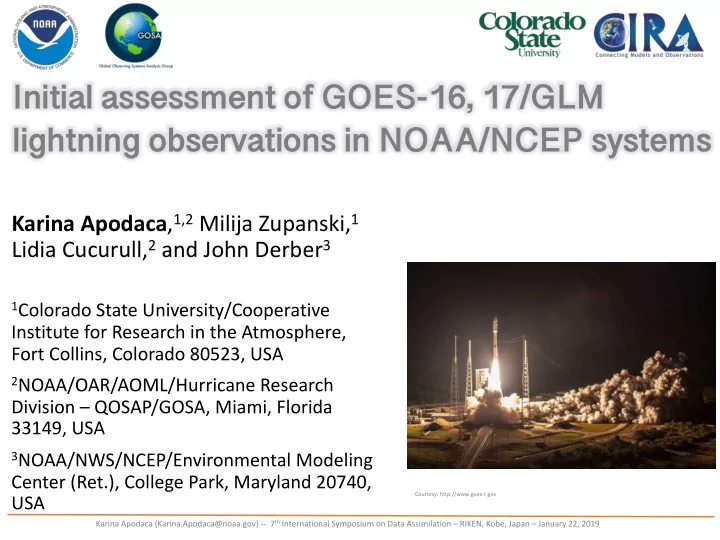

Initial assessment of GOES-16, 17/GLM lightning observations in NOAA/NCEP systems Karina Apodaca , 1,2 Milija Zupanski, 1 Lidia Cucurull, 2 and John Derber 3 1 Colorado State University/Cooperative Institute for Research in the Atmosphere, Fort Collins, Colorado 80523, USA 2 NOAA/OAR/AOML/Hurricane Research Division – QOSAP/GOSA, Miami, Florida 33149, USA 3 NOAA/NWS/NCEP/Environmental Modeling Center (Ret.), College Park, Maryland 20740, USA Courtesy: http://www.goes-r.gov Karina Apodaca (Karina.Apodaca@noaa.gov) -- 7 th International Symposium on Data Assimilation – RIKEN, Kobe, Japan – January 22, 2019
Improving Predictability of High Impact weather... A NO AA ’s grand challenge! NOAA • Data flowing from a new generation of observing system missions have the potential for improving environmental analyses and prediction in operations • The impact of new observation types in operational systems has to be thoroughly assessed before inclusion in the operational data stream at NOAA/NWS/NCEP
NOSC/QOSAP Relevant Research Areas • A primary objective of the NOAA Observing Systems Council (NOSC)/ Quantitative Observing Systems Assessment Program (QOSAP) is to evaluate the impact of observations via OSSE’s and OSE’s in NOAA’s global and regional operational forecasting models for the atmosphere and oceans • NOSC/QOSAP also supports the development and evaluation of new observation operators that can improve initial conditions and prediction capacity in operations
New GOES-16, 17/GLM lightning assimilation in GSI • NOSC/QOSAP has tasked to further develop and evaluate the impact of the new variational GOES/GLM lightning observation operator in FV3GFS • The GOES/GLM has been included in the NOAA’s operationally used GSI-based Global Data Assimilation System (GDAS) DA software in October, 2018 Assimilated observation: cumulative count of geo- located groups of flashes, over a typical data assimilation window, per unit area: FR = No. lightning flashes / time . area Courtesy: goes-r.gov
Nonlinear observation operator for lightning in GSI/GDAS This new lightning assimilation capability in GSI/GDAS is • suitable for global and regional analysis and prediction Based on the relationship between lightning, vertical • velocity and cloud hydrometeor content (total or speciated) Follows a variational framework by including a nonlinear • observation operator, subsequent linearization (TL), and development of an adjoint model The algorithm starts with the calculation of vertical • updraft speed via the continuity equation ⎡ ⎤ ∂Φ σ ∂Φ w = 1 ∂ t = 1 g v i ∇ σ Φ + ! ⎢ ⎥ ∂ σ g ⎣ ⎦ ! !
Nonlinear observation operator for lightning in GSI/GDAS The algorithm branches out to global or regional CAM- scale DA via logical flags prescribed on a namelist FR = h updraft = α [ w max ] β For the global model Barthe et al., 2010 ( h updraft ) is the observation operator α and β are empirical parameters (satellite climatologies) and w max is the maximum vertical velocity For global GSI analysis, the NL lightning FR observation operator is a function of standard CV’s in DA h updraft = α [ w max ( p s , T , q , u , v )] β
Nonlinear observation operator for lightning in GSI/GDAS For CAM-scale GSI analysis, the lightning flash section of the algorithm FR = h threat = r ⋅ h flux + (1 − r ) ⋅ h integral McCaul et al., 2009 Is a combination of the upward flux of graupel h flux = k 1 ⋅ ( wq g ) m and gridded-vertically integrated ice-phase hydrometeors ∑ (graupel, ice, and snow) h integral = k 2 ⋅ ( q g + q s + q i ) ρ Δ z All hydrometeors are mixed phase r is a linear interpolation coefficient , ρ is air density that can be inferred using T , P , and q , and Δ z is layer thickness. k 1 and k 2 are empirical parameters Suitable for lightning formation in continental convection Advantage: Relationship between large scale dynamics and cloud microphysical fields
Background state, first guess, and Jacobian To read the value of each background field (T, Q, Qice, Qsnow, Qgraupel, U, V) at observation location and to compute their perturbed state (Jacobians) we use a 12-point halo: λ • Guess grid used for finite difference approximation derivation and for interpolation. i6 i8 • i1 to i12 are the model grid i2 i4 i10 i12 points surrounding an + i1 i11 i9 i3 observation + . i5 i7 λ and ϕ are model latitudes • and longitudes. φ
Tangent Linear (TL) For cost function minimization we need to take the gradient (TL) wrt the control variables using finite a difference approximation [ ] β − 1 δ w ( T K , q K , u K , v K ) δ f = αβ w max Similarly, the CAM-scale branch includes a more complex equation for the TL, with the gradient of flash rate being a function of (T, Q, Qice, Qsnow, Qgraupel, U, V) First variation yields the elements of the observational Jacobian matrix for all CV’s
Adjoint (AD) model [ ] f = R − 1 y − h ( x ) δ ˆ The AD simply follows from the TL: • For GSI global analysis , the AD produces gradients of specific humidity, temperature, and the horizontal wind components ', 𝜀𝑣 𝜀𝑟, % 𝜀𝑈 ), 𝜀𝑤 ) • For CAM-scale GSI analysis , the AD produces gradients of specific humidity, temperature, the horizontal wind components, and cloud ', 𝜀𝑣 hydrometeors 𝜀𝑟, % 𝜀𝑈 ), 𝜀𝑤 ), 𝜀𝑟 ) ice , 𝜀𝑟 ) snow , 𝜀𝑟 ) graup • Lightning flash rate observations can impact the analysis increments of environmental variables that support storm formation and cloud- scale variables
Additional features CLOUD MASK to perform calculations only where clouds are present (threshold of total hydrometeor content or in mixed- phase clouds) We end up with an 2D field of lightning flash rate at the surface w max VarBC-type bias correction for innovation statistics based on optimal parameter estimation
Verification of the lightning assimilation Observed Geo-located Lightning Strikes • (Left) Raw surface-network lightning observations • (Right) gridded lightning flash rates used in assimilation by GSI
Impacts to the Analysis Analysis increments of temperature, humidity and wind between a control and a light DA experiments
Impacts to the Analysis 24-hr accumulated precipitation, valid at 2013-08-27_12:00:00. Maximum precipitation near the Arizona-Nevada border coincides with the • region of positive analysis increment in specific humidity The assimilation of lightning observations has a positive impact in the initial • conditions of the GFS model.
Single-OBS test – in CAM scale weather Source: Apodaca and Zupanski, 2018 • Analysis increments of (a) temperature, (b) humidity, and ( c ) wind at 850 hPa • Lobes of positive and negative impacts at either side of the observation, anti-correlation of Q and T and cyclonic circulation • Explicit quantification of control variable updates highlighting impacts to the pre-storm environment
Updates to cloud hydrometeor control variables Pressure (h Pa) (a) (b) (c) Source: Apodaca and Zupanski, 2018 The assimilation of lightning data impact cloud • hydrometeors – shown: ice, snow, rain mixing ratios as shown in vertical profiles (CONV+LIGHT) red lines, produced less (a) snow and • (b) ice, but more rain mixing ratio as compared to (CONV-only)
Preparation for NCEP/FV3GFS • In non-hydrostatic models w is prognostic, we’ll still calculate w to keep a larger analysis halo due to the finite difference derivation method for vertical and horizontal advection in the continuity equation • By doing an extension to the EnKF in hybrid 4DEnVar might impact other fields through cross covariances/correlations (TBD) • Current operational microphysics scheme in FV3GFS GFDL (5-class, single moment), prognostic, but hydrometeors are not feed back to the model, yet • NCEP is testing other “complex” microphysics schemes (6-class, double moment, e.g. Thompson, Morrison) • If hydrometeor “feeding” to the model global occurs, we can adapt the regional lightning operator to the global system, for now, it’s a viable candidate for lightning DA in CAM-scale efforts (rapid refresh)
Summary and future work • First version of the GLM assimilation in the operational GDAS since October 2018 • Variational assimilation capable of directly updating 4 to 7 control variables • OSE (data denial type) simulations, in cycling experiments with FV3GFS, initially (C384/C192, deterministic/EnKF and 20 member ensemble). Future (C768/C384) • Determining optimal configuration of operational observations and optimization of the observation operator • Initial testing with a frozen version of next implementation of FV3GFS, planned for January 2019?
ありがとう Thanks! Acknowledgements - ISDA scientific program and local organizing committees - Work under the auspices of NOAA - NOSC/QOSAP Psalm 20:4
Recommend
More recommend