
SLIDE 1
How do we assess resilience?
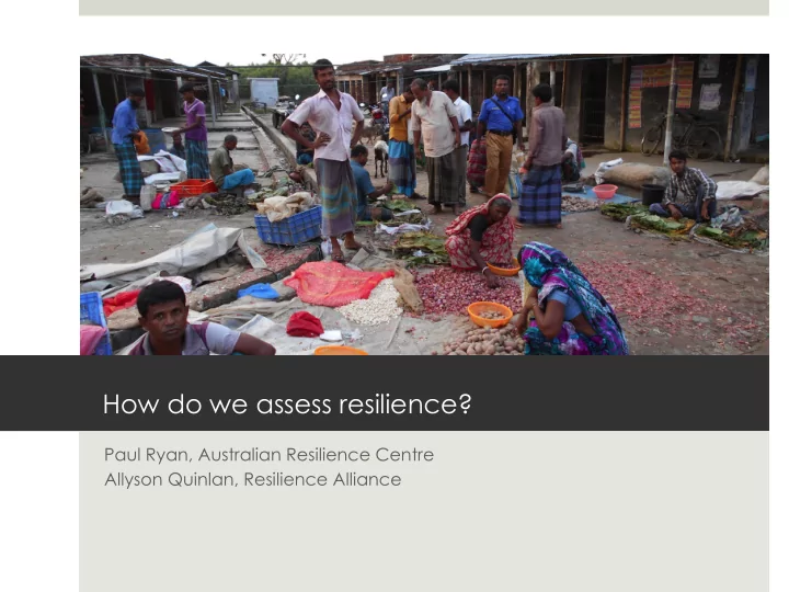
Paul Ryan, Australian Resilience Centre Allyson Quinlan, Resilience Alliance
How do we assess resilience? Paul Ryan, Australian Resilience Centre - - PowerPoint PPT Presentation
How do we assess resilience? Paul Ryan, Australian Resilience Centre Allyson Quinlan, Resilience Alliance Introduction q Presenters q Structure of this weeks session q Overview (Paul) Conceptual framing Overview of resilience assessment
Paul Ryan, Australian Resilience Centre Allyson Quinlan, Resilience Alliance
Stabilize Change Stabilize Change
q Social-ecological
ü people and place are tightly enmeshed ü co-evolving, complex adaptive systems ü non-linear dynamics – unexpected interactions, change and unintended consequences ü multi-scale – influenced by scales above and below
q Participatory approach – agency based approach, people within the system understand the system best q Iterative process – you never get it right first time round! q Not a set recipe – always have to adjust the process for context q Consider ethics, power and gender in process design
Resilience assessment and implementation
q Objective: to develop a sufficient understanding (conceptual model)of the basic structure and function of the system to allow deeper analysis in the next phase ü boundaries and scales, climate, ecosystems, natural disturbance regimes ü land uses, relationship between people and landscape, values, benefits, goods and services generated, governance, tenure, ü aspirations – what do stakeholders want the system to be like? Are their aspirations being met? ü Drivers, trends and shocks that impact on aspirations, values and benefits ü Key issues (in context of aspirations, drivers and shocks) are described
Modified from Chapin et al. 2012
q Objective: to design interventions and an implementation process that builds knowledge (tests assumptions and strengthens evidence) and builds capacity of actors within the system to adapt
ü designing adaptive, learning implementation approach ü develop design and filtering criteria to ensure interventions are effective, efficient, achievable (technically, socially and economically feasible), minimize unintended consequences ü design pilots or trials to test the interventions ü design scaling up and out process ü design implementation to be safe fail, transparent, ethical and fair
Moderate Condition
State and Transition Models Terrestrial rangeland function
Do nothing Do nothing
Good Condition
Characteristics: High functioning ecosystem - high capacity to retain and utilise moisture and nutrients. Low cover of increaser species. High endemic native plant species diversity with good structure. Soils surface stable with high resistance to wind and water erosion. High endemic native pasture biomass, nutrient and carbon cycling, production system that responds well to rainfall and has high vigour. A heterogeneous landscape with high habitat complexity and
High perennial base and high faunal
fauna, ecological fire management plan. Vibrant and engaged communities; economically viable, sustainable farm production systems. Cultural heritage values maintained and protected by vegetation management. To maintain state:
Degraded Condition Irreversible State
Characteristics: Patchy functioning with decreasing patch sizes and increasing fetch (base areas). Active instability of soil surface with visible signs of erosion. Evidence of overgrazing (TGP) with reduction in desirable shrub/ pasture species and low vigour. High recruitment of undesirable woody shrubs. Low capacity to respond to rainfall. Loss of regeneration from adult plants and more from seed. Low structural diversity and species diversity. Increaser species evident, tending to monoculture. Declining economic viability and low capacity for practice change with reduced management
To maintain state: Characteristics: Leaky landscape with high runoff and low nutrient cycling. Very low levels of groundcover, low pasture biomass and low recruitment of desirable canopy species and chenopods. Unstable soil surface prone to wind and water erosion. Low perennial base and low grazing production. High abundance of exotic and annual species; extensive areas of monoculture plants visible. System disturbance by exotic pest species. Loss of topsoil and high amount of wind erosion. Bare ground dominant aesthetic feature. Low viability production system. Ecological fire management unviable due to low fuel load. Loss of families from the landscape, off farm employment, minimal capacity to undertake farm practice change requiring capital input; may observe demographic
threatened by erosion. To maintain state: Characteristics: Change to vegetation communites species composition e.g loss of Murray pine from woodland community. Loss of species from system. Uncontrolled herbivore grazing. Demographic change. To change state: High risk revegetation program as rainfall needed to achieve required scale, knowledge transfer and improved competency of landholders incl. economic benefits of changed practices. Do something Do something Limited TGP, Increasing feral herbivores and native herbivores, poor management of domestic stock, over use of fire, poor use of water points, poor management decision timing. Improved grazing practices - e.g.resting pastures during flowering and seeding times, management of water point - turn off and on, stock husbandry and grazing regimes, rangeland rehabilitation methods where economically feasible including woody shrub control, pest animal control (goats, foxes) Absence of TGP management, high numbers of feral herbivores, poor management of domestic stock, sacrifice paddocks for key breeding animals. Destocking, herbivore control, feedlots (short term), broad scale low cost INS control methods, time lag required for recovery, knowledge transfer to landholders
changed practices. Vegetation Communities Chenopod Mallee Chenopod Shrubland Belah Rosewood Murray Pine – Callitris Woodland East West Dune Mallee (& deep sand Mallee) Indicators See pg 83 of CAP key Indicators of veg. condition 70% groundcover measured in Feb each year Species diversity Habitat complexity Regeneration largely from adult plants Indicators <30% groundcover Erosion feature - rills and pedastooling Regeneration largely from seeds Do nothing
Drivers Threats Controlling variable(s) Threshold/Tipping Point Priority Actions Macro/high level scale (difficult to influence) - pushes the system towards or away from a threshold Micro/low level scale (can be influenced) - pushes the system towards or away from a threshold Aspect of the system that can change and move direction of the system towards or away from a threshold Point when crossed moves the system into another state or existance Actions that are the most appropriate to prevent a system from crossing a threshold Climate Wind soil erosion Financial viability % of specific groundcover level relevant to veg type in a particular month of the year Knowledge transfer Legislation Farm management Knowledge gaps Population demographic changes Grazing pressure Commodity Prices Overgrazing (TGP) Ecological fire management Mining Pest animals and plants Feral pest animal control - coordinating pest animal control Fires Overuse of fire Financial support for practice change Structural native veg loss Research and Development Monocultures Waterpoint management Weed control - ID of species Plant ID using phone app from Plants of Western NSW Short-term feedlots (drought funding) Mitigating threats to erosion at Cultural Heritage Sites Education and involvement at social engagements