H5, Evening School #2: Introduction to Satellite Applications to - PowerPoint PPT Presentation
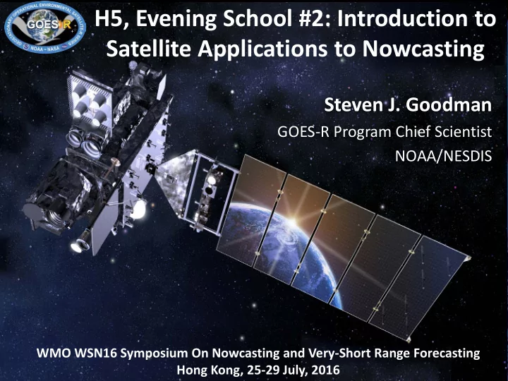
H5, Evening School #2: Introduction to Satellite Applications to Nowcasting Steven J. Goodman GOES-R Program Chief Scientist NOAA/NESDIS WMO WSN16 Symposium On Nowcasting and Very-Short Range Forecasting 1 Hong Kong, 25-29 July, 2016 Outline
H5, Evening School #2: Introduction to Satellite Applications to Nowcasting Steven J. Goodman GOES-R Program Chief Scientist NOAA/NESDIS WMO WSN16 Symposium On Nowcasting and Very-Short Range Forecasting 1 Hong Kong, 25-29 July, 2016
Outline • Overview of New GEO Ring Capabilities • Conceptual Models and Archetypes • Pre-storm Boundaries and Convective Initiation • Satellite Cloud-Top Features • Extreme Thunderstorms • Training Resources 2
Advanced Baseline Imager Spectral Bands AHI ABI AHI ABI Approximate Central Approximate Central Type Nickname Band Band Wavelength ( μm ) Wavelength ( μm ) 1 0.47 0.47 1 Visible Blue 2 0.51 Visible Green 3 0.64 0.64 2 Visible Red 4 0.86 0.86 3 Near-Infrared Veggie 1.4 4 Near-Infrared Cirrus 5 1.6 1.6 5 Near-Infrared Snow/Ice 6 2.3 2.2 6 Near-Infrared Cloud Particle Size 7 3.9 3.9 7 Infrared Shortwave Window 8 6.2 6.2 8 Infrared Upper-level Water Vapor 9 6.9 6.9 9 Infrared Mid-level Water Vapor 10 7.3 7.3 10 Infrared Lower-level Water Vapor 11 8.6 8.4 11 Infrared Cloud-Top Phase 12 9.6 9.6 12 Infrared Ozone 13 10.4 10.3 13 Infrared “Clean” Longwave Window 14 11.2 11.2 14 Infrared Longwave Window 15 12.4 12.3 15 Infrared “Dirty” Longwave Window 16 13.3 13.3 16 Infrared CO 2 Longwave 4
Visible and near-IR channels on the ABI Sample use only, many other uses The ABI visible and near-IR bands have many uses . 5
GOES-R ABI Weighting Functions Water Vapor Bands- 8, 9, 10
The IR channels on the ABI Sample use only, many other uses ABI has many more bands than the current operational GOES imagers. 7
Challenges and Opportunities for Nowcasting with the New Generation Geo Satellities Decision Aids • Cloud and Moisture Imagery (cloud top features, overshooting tops, synthetic imagery, RGBs, environment) • Super Rapid Scan Imaging • Fused Products (satellite, radar, lightning, in-situ, NWP) • Probabilistic High Impact Hazards (tornado, hail, wind, flood, lightning, fire, volash, fog, aircraft turbulence and icing) Data Assimilation • Radiances, T,q profiles • High density AMVs • Total Lightning Storm Scale NWP- WoF •
Grid-Based Obs & The Threat Grid Useful Effective Verification Probabilistic Guidance Forecaster Tools Output Response Threats Integrated Social Sciences 1 2 3 4 5 6 7
Forecasting a Continuum of Environmental Threats (FACETs): The NOAA Next-Generation Hazardous Watch/Warning Paradigm • A science-driven paradigm delivering a continuous stream of high-res, probabilistic hazard information extending from days to within minutes of event. • Optimized for user-specific decision-making through comprehensive integration of social/behavioral sciences. Integrated Social/Behavioral/Economic Sciences 10 Adapted from Lazrus (NCAR)
Facet #1: Grid-Based Probabilistic Threats Grid-Based Probabilistic Threats 30-Minute Threat: Tornado Probability 1 Valid 10:00 p.m. - 10:30 p.m. CDT Last updated: 2 minutes ago • Probabilistic Hazard Information (PHI) – Forecasters convey threat probability on grids. – NOT (explicitly) watches or warnings, but…
Facet #1: Grid-Based Probabilistic Threats Grid-Based Probabilistic Threats 30-Minute Threat: Tornado Probability 1 Valid 10:00 p.m. - 10:30 p.m. CDT Last updated: 2 minutes ago • Legacy products Proximity (Yellow) (warnings/watches) result Alert?? from pre-determined thresholds. • Opens the door for new products and services. • For ALL weather hazards (not just tornadoes)!! “Byproduct” Tornado Warning
Warning-on-Detection v.s. Warn-on-Forecast Nowcasting v.s. NWP The quoted NWP models are not initialized with radar and/or other high- res data observing explicit weather and/or their resolution is too low Properly initialized NWP models should out-perform extrapolation/statistical nowcasting models from time zero Fast nowcasting systems are useful for very short ranges because they are fast, not because they are intrinsically (Jim Wilson 2006) better
Jim Wilson, NCAR
Convective Modes for Severe Storms Supercell, Squall Lines QLCS - Quasi-Linear Convective Systems
Conceptual Model
Conceptual Models Many long-lived multicell convective systems have a propensity to take lives and damage property with high winds, hail, and tornadoes. Damage often occurs over a broad swath encompassing multiple county warning areas. Danger to public in these situation is obvious and often more extreme, impact-wise, than a single tornado storm. Challenges for a warning forecaster on the threat assessment level include: • Recognition of the intensity of these type of events • Determination of duration and movement, and • Determination of all the threats associated with these type of events. Note that there are can be significant differences in the evolution of multicell systems based on the strength of the cold pool, ambient shear, and attendant RIJ.
GOES-14 Super Rapid Scan 1-min Imagery of a QLCS GOES-14 IR brightness temperature, GOES-R overshooting cloud top (OT) detection algorithm output, cloud-top height derived from the length of shadow produced by OT penetration above the surrounding anvil, WSR-88D derived vertically-integrated liquid (VIL) and precipitation echo top height, and total lightning from the Northern Alabama Lightning Mapping Array (NALMA) and Earth Networks Total Lightning Network (ENTLN). 19
GOES-14, 1 min rapid-scan of Florida Sea Breeze GOES-14 SRSOR Vis and IR incorporated into SPC operational NAWIPS “The 1-min data gives a more continuous depiction of how meteorological features are evolving, versus the ‘snapshot’ approach of coarser temporal resolution T. Schmit, D. Lindsey images.”
Mesoscale and Satellite Cloud Top Features colliding boundaries initiate thunderstorms GOES-14 1-min Imagery Forecasters can monitor the interactions between air masses, outflow boundaries and storms leading to increased situational awareness and confidence Overshooting Top Outflow boundary Vortex cloud streets (horizontal rolls) 25
26
Nowcasting requires detailed information on mesoscale thermodynamic structure of atmosphere, cloud type and vertical wind shear • Vertical shear – Cloud motion and height – Moisture motion Important for Nowcasting • Evolving instability field Convection and Severe Weather – Surface heating – Detailed moisture field – Evolving instability • Vertical wind shear • Thunderstorm cold pool production • Evolving instability field – Sounder in synergy with imager • Updraft strength • Strength of storm – IR top temperature and characteristics produced cold pool – Overshooting top height • Updraft strength – Updraft efficiency (height and instability) • Anvil characteristics • Anvil characteristics & storm environment interaction – Growth and detailed upper level atmospheric Development motion and water vapor behavior Temperature structure – Imager and sounder with spectral fidelity • Storm-environment • Rotating overshooting top – Rapid scan imager interaction • Storm damage • Cloud top rotation – Combined polar and geostationary imager products • Storm damage
Overshooting Tops Overshooting Tops What do they mean?
Overshooting Top (OT) • Indication of a very strong updraft • 71% had a CG strike within 10 km (Bedka et. Al 2010) • 55% of severe reports were near overshoots and 75% of those overshoots occurred before the report (Dworak et. Al 2012)
OT Detection • Small clusters (< 15 km in diameter) where IR BT’s are significantly colder than the surrounding anvil cloud. • Typically > 6.5 K colder than anvil BT’s (Bedka et. Coldest pixel al 2010) Colder than ET • Make sure cloud top is above equilibrium level
CTT Cooling Rate Pre-Anvil • Relatively strong CTC precede significant radar signatures (Hartung et al. 2013) • Can provide lead time in favorable environments • Future increased resolution will improve detection and accuracy
Observed IR Cloud Top Features • Enhanced-V • Cold Area (CA) • Close-in Warm Area (CWA) • Warm-cold couplet • Distant Warm Area (DWA) McCann (1983): Storms with enhanced-V have about 70% probability of producing severe weather. Median lead time from the onset of the V to the first severe weather is about 30 minutes. Adler et al. (1985): 75% of storms with the-V feature have severe weather, but 45% of severe storms don’t have this feature
Model simulation of storm top temperature fields Courtesy Pao Wang
Tornadic Storm: Denver International Airport DIA Dan Lindsey - CIRA
1-min meso-scale AMVs 21-May-2014 C. Velden, CIMSS
Recommend
More recommend
Explore More Topics
Stay informed with curated content and fresh updates.
