+ Glacier Bay National Park Alaska Mapping Executive Committee - PowerPoint PPT Presentation
+ Glacier Bay National Park Alaska Mapping Executive Committee (AMEC) Juneau, AK August 29, 2018 2 Agenda Welcome and Introductions James Reilly, USGS and Tim Gallaudet, DOC AMEC Theme Status Report - Kevin Gallagher, USGS
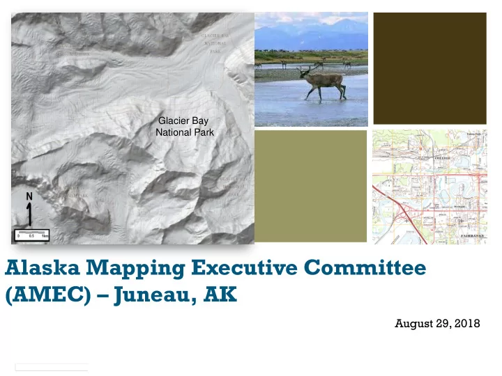
+ Glacier Bay National Park Alaska Mapping Executive Committee (AMEC) – Juneau, AK August 29, 2018
2 Agenda Welcome and Introductions – James Reilly, USGS and Tim Gallaudet, DOC AMEC Theme Status Report - Kevin Gallagher, USGS IfSAR Success Story and Lessons Learned – Fugru, InterMap, Dewberry State of Alaska Report - Steve Masterman, State of Alaska Alaska Regional Mapping Coordination – Aimee Devaris, USGS 3D Nation Update – Ashley Chappell, NOAA Break Alaska Terrestrial Hydrography Report – Kacy Krieger, University of Alaska-Anchorage GRAV-D and Shoreline Mapping Update - Juliana Blackwell, NOAA Alaska Coastal Mapping Strategy and Implementation – Nicole Kinsman, NOAA USACE Topographic/Bathymetric Mapping in Alaska – Chris Macon, USACE Discussion and Wrap Up - Kevin Gallagher, USGS Closing Comments – James Reilly, USGS and Tim Gallaudet, DOC
Status of Actions from April Meeting 3 - IfSAR was fully funded and collected for the Yukon Delta, the Alaska Peninsula, and the National Petroleum Reserve – Alaska. - Over $865,000 was contracted toward AK terrestrial hydrography edits. - The Technical Subcommittee investigated options for collecting lidar for the Kodiak Island Archipelago. Potential partners may develop a 3DEP lidar proposal depending on FY2019 budget appropriations.
Status of Actions from April Meeting 4 - Lidar and imagery-derived high resolution elevation options for the 1002 area within the Arctic National Wildlife Refuge were investigated, but no immediate action was taken. - USGS, USFWS, and the Alaska Hydrography Technical Working Group are coordinating wetland and surface water mapping. - The Alaska Mapping Technical Subcommittee and the Alaska Geospatial Council are reviewing State and Federal agency mapping requirements to identify future AMEC priority layer(s). A joint recommendation to AMEC is expected at the spring 2019 AMEC meeting.
Data Acquisition Accomplishments 5 August 2018 Theme, Metric 2013 Goal Status % IFSAR 98% coverage Elevation Complete in 4 years acquired acquired % NHD Hydrography Complete in 6 years 25% updated updated 100% complete; % of State Transportation Complete in 5 years ongoing completed maintenance 100% Mainland % GRAV-D Mainland by 2019 complete, Gravity acquired Aleutians by 2021 Aleutians remain Complete in 5 years % AK with budget Shoreline shoreline increase, longer 55.5% Mapping updated term if no budget increase
Alaska IfSAR Status August 2018 6 98% now fully funded and collected. 78% available. 20% in work.
Alaska US Topo August 2018 7 72% Statewide coverage achieved.
Alaska’s IFSAR Mapping Success Story Alaska Mapping Executive Committee (AMEC) August 29, 2018 David F. Maune, Ph.D., PSM, PS, GS, SP, CP, CFM Dewberry Engineers, Inc. 8401 Arlington Blvd., Fairfax, VA 22031 (703) 849-0396 8
Vision started with the ASMC, 2008 – The DEM layer is foundational 1. Intro to DEMs, 3-D Surface Modeling, Tides 2. Vertical Datums 3. Accuracy Standards 4. National Elevation Dataset 5. Photogrammetry 6. IFSAR 7. Topographic & Terrestrial Lidar 8. Airborne Lidar Bathymetry 9. Sonar 10. Enabling Technologies 11. DEM User Applications 12. DEM Quality Assessment 13. DEM User Requirements 14. Lidar Processing & Software 15. Sample Elevation Datasets Alaska DEM Whitepaper 9
Alaska DEM Whitepaper – The Problem Some mountains in the NED were Rivers should flow through mapped a mile in wrong location. valleys – not uphill Failed imminent International Civil Aviation Organization (ICAO) and FAA minimum requirements for commercial overflights 10
Alaska DEM Whitepaper ─The Mid -Accuracy Solution 11
Consensus points from NDEP and NDOP Alaska DEM Funding & Implementation Plan; Program Mgt. 12
2009: Dewberry Team unsolicited proposal to USGS Fugro proposed that it map the 23% of the state that is most difficult (pink), with Intermap mapping the less-difficult 77% of the state (green). Our combined statewide total cost estimate equaled $77.3M 13
Yellow numbers are priorities Pilot cells 70 km 2 overlap on both sides provided to Dewberry 147 th JOA surveyed large meridian number of checkpoints in forested overlap 14
Satellite image draped over IFSAR ─ Mt. Hayes Satellite imagery now fits IFSAR data from Intermap and Fugro 15
Port Clarence Hi -Res NHD & NHD Plus Pilot Study Used IFSAR for NHD, NHD Plus, transportation update & orthos 16
How to produce cloud -free hi-resolution color orthos 5-m RapidEye 62.5-cm color orthophotos, no clouds; could be 1-meter or other resolution 62.5-cm ORI 17
As of August 2018, 98% complete by area Intermap (pink) has Fugro (blue) has completed ~ 75% of AOR completed ~ 23% Only the 2% brown areas remain for 2019 acquisition, including Far Islands, Kodiak and Western Aleutians But the remaining areas are the most expensive and will cost >10% of the total 18
IFSAR Mapping Partnership Contributions Land Ownership % of Land % of dollars To minimize costs and Owned paid acquire data more cost- State of Alaska 24.1% 21.44% effectively, Fugro, Intermap BLM 22.1% 5.25% and Dewberry acquired F&WS 21.1% 1.53% data on speculation, valued NPS 14.1% 4.90% at nearly $17M (areas were subsequently funded) AK Native Corps 10.5% 0.00% USFS 6.0% 2.87% We paid for lobbyists at Other Private 1.6% 0.00% state & federal levels DOD 0.5% 3.86% USGS 0.0% 54.20% USGS knew to the penny what Dewberry paid its NRCS 0.0% 5.95% subcontractors TOTALS 100.0% 100.00% Total to date: $62.237 M, incl. USGS management fee 19
Cost Summaries Dewberry USGS 2018 Cost to Date $60.667 M $62.237 M 2019 Type II, all Remaining Islands $7.829 M ? Estimated Total when Complete $68.496 M ? • Dewberry’s 2009 Cost Estimate: $77.300 M , based on assumption of most efficient acquisition areas, which did not happen • Even with large blocks acquired on spec, W. and E. Aleutians and Far Islands would have been less expensive if acquired in the same year, or in the same year as adjacent acquisition areas • The Dewberry team is very proud of initiatives we have taken to minimize costs, every step of the way. 20
Dual Band IFSAR ▪ Dual-band radar collected simultaneously from both sides of the aircraft ▪ Acquisition at an altitude of 32,000-39,000’ ▪ Profiling lidar for on-board ground control X-band (3 cm wavelength) P-band (85 cm wavelength) Profiling LiDAR (3 Returns, 3 Intensities) 21
Areas Mapped Total area delivered: 353,744 km 2 22 2 To change footer text go to Insert > Header & Footer www.fugro.com
Example Flight Plans Southcentral Alaska (2010) Kenai Peninsula, Alaska (2014) 23 3 To change footer text go to Insert > Header & Footer www.fugro.com
Success Stories – IFSAR Overcollects ▪ Efficient flight plan ▪ Temporal continuity ▪ Cell price list ▪ Partner collaboration ▪ Partner budget planning Blue cells represent the original tasking; red cells represent overcollects 24 4 To change footer text go to Insert > Header & Footer www.fugro.com
Success Stories ▪ Search and rescue: F-22 Raptor Crash in 2010. Fugro provided unscheduled emergency delivery of IFSAR data to help assess avalanche danger for recovery crews. The data proved essential in assessing potential avalanche danger for recovery crews on the scene. ▪ Ice thickness mapping: While mapping in high elevations and over glaciers, Fugro determined that P-band radar could penetrate deep into snow and ice. This discovery led to a new mapping capability developed in partnership with oil and gas majors and the University of Alaska Fairbanks to characterize ice type and thickness for engineering purposes, safety of offshore operations, and scientific pursuits. 5 To change footer text go to Insert > Header & Footer www.fugro.com 25
Recognition of Excellence Based on the ice thickness mapping technique born from the Alaska elevation mapping program,Fugro won the 2015 Governor’s North Star Award for International Excellence in the category of scientific exchange. The year prior, Fugro was awarded a Spotlight on Arctic Technology at the annual Arctic Technology Conference. 26 6 To change footer text go to Insert > Header & Footer www.fugro.com
Cultural Feature Detection andAnalysis 27 7 To change footer text go to Insert > Header & Footer www.fugro.com
More Value to Be Explored New application of existing data 1. Intertidal zone topography from existing raw data can be extracted and used to improve coastal zone dataset 2. X- and P-band data can be made available for further ice thickness analyses over some of the most important glaciers and icefields in the world 3. Tighter hydro specification can be compiled from existing data 28 8 To change footer text go to Insert > Header & Footer www.fugro.com
What’s next? Near term data needs: 1. Oil and Gas industry 2. Transportation infrastructure 3. Coastal zone State of Alaska ASTAR Project Alaska’s North Slope – Home to one of the largest oil fields in North America 29 9 To change footer text go to Insert > Header & Footer www.fugro.com
Recommend


More recommend
Explore More Topics
Stay informed with curated content and fresh updates.