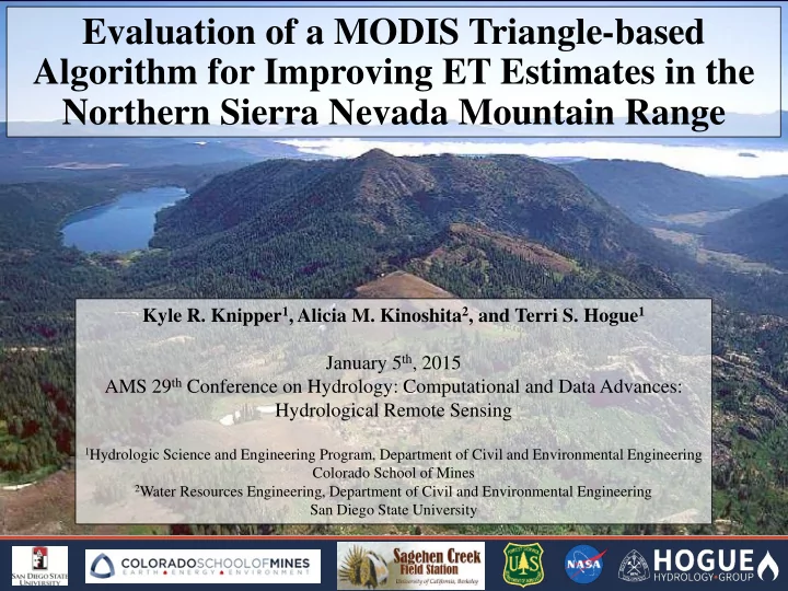

Evaluation of a MODIS Triangle-based Algorithm for Improving ET Estimates in the Northern Sierra Nevada Mountain Range Kyle R. Knipper 1 , Alicia M. Kinoshita 2 , and Terri S. Hogue 1 January 5 th , 2015 AMS 29 th Conference on Hydrology: Computational and Data Advances: Hydrological Remote Sensing 1 Hydrologic Science and Engineering Program, Department of Civil and Environmental Engineering Colorado School of Mines 2 Water Resources Engineering, Department of Civil and Environmental Engineering San Diego State University
Motivation • Disturbances (urbanization, wildfire, and climate change) alter landscapes, land- atmosphere interactions and hydrologic behavior • Remote sensing provides key information about pre- and post-disturbance environments • Critical for spatial and temporal monitoring of long-term response Goal • Develop and test popular remote-sensing based ET methods to obtain an ET product feasible for operational use in altered systems where little gaged data exists • SSEB op (Operational Simplified Surface Energy Balance) (Senay et al., 2013) • MODIS MOD16* (Mu et al., 2007) • MODIS Triangle Method (Wang et al., 2001; Kim and Hogue, 2013) Approach – MODIS Triangle Method • MODIS products are used in developed independent, stand-alone algorithms and detection methods for: o Net Radiation (SW and LW parameters) (Kim and Hogue, 2008) o Evapotranspiration (ET) (Kim and Hogue, 2012a, 2012b, 2013) • Algorithms and methods are applied over a small region in the Northern Sierra Nevada Mountain Range 1
Motivation • Disturbances (urbanization, wildfire, and climate change) alter landscapes, land- atmosphere interactions and hydrologic behavior • Remote sensing provides key information about pre- and post-disturbance environments • Critical for spatial and temporal monitoring of long-term response Goal • Develop and test popular remote-sensing based ET methods to obtain an ET product feasible for operational use in altered systems where little gaged data exists • SSEB op (Operational Simplified Surface Energy Balance) (Senay et al., 2013) • MODIS MOD16* (Mu et al., 2007) • MODIS Triangle Method (Wang et al., 2001; Kim and Hogue, 2013) Approach – MODIS Triangle Method • MODIS products are used in developed independent, stand-alone algorithms and detection methods for: o Net Radiation (SW and LW parameters) (Kim and Hogue, 2008) o Evapotranspiration (ET) (Kim and Hogue, 2012a, 2012b, 2013) • Algorithms and methods are applied over a small region in the Northern Sierra Nevada Mountain Range *Product downloaded from Montana’s Numerical Terradynamic Simulation Group 2 (ftp.ntsg.umt.edu/pub/MODIS/Mirror/MOD16/)
Motivation • Disturbances (urbanization, wildfire, and climate change) alter landscapes, land- atmosphere interactions and hydrologic behavior • Remote sensing provides key information about pre- and post-disturbance environments • Critical for spatial and temporal monitoring of long-term response Goal • Develop and test popular remote-sensing based ET methods to obtain an ET product feasible for operational use in altered systems where little gaged data exists • SSEB op (Operational Simplified Surface Energy Balance) (Senay et al., 2013) • MODIS MOD16* (Mu et al., 2007) • MODIS Triangle Method (Wang et al., 2001; Kim and Hogue, 2013) Approach – MODIS Triangle Method • MODIS products are used in developed independent, stand-alone algorithms and detection methods for: o Net Radiation (SW and LW parameters) (Kim and Hogue, 2008) o Evapotranspiration (ET) (Kim and Hogue, 2012a, 2012b, 2013) • Algorithms and methods are applied over a small region in the Northern Sierra Nevada Mountain Range 3
Estimation of ET (LE) ( − ) 4
LE = ( − ) Estimation of ET (LE) All values can be estimated on a regional scale for all sky conditions using only satellite based data 5
LE = ( − ) Estimation of ET (LE) MODIS Products 𝑺 𝒕 (𝟐 + 𝐝𝐩𝐭 𝟑𝒜 ) 𝑻𝑿 ↓ = MYD03 𝟑(𝟐. 𝟏𝟗𝟔 𝐝𝐩𝐭 𝒜 + 𝟏. 𝟏𝟏𝟐𝒇 𝟏 𝟑. 𝟖 + 𝐝𝐩𝐭 𝒜 + 𝟏. 𝟑) Geolocation 𝑨 = 𝑨𝑓𝑜𝑗𝑢ℎ 𝑏𝑜𝑚𝑓 𝑔(𝑏𝑗𝑠 𝑢𝑓𝑛𝑞. , 𝑒𝑓𝑥 𝑞𝑝𝑗𝑜𝑢 𝑢𝑓𝑛𝑞. ) 𝑓 0 = 𝑥𝑏𝑢𝑓𝑠 𝑤𝑏𝑞𝑝𝑠 𝑞𝑠𝑓𝑡𝑡𝑣𝑠𝑓 MYD05 𝑫 𝒑𝒒𝒖 Water Vapor 𝑫𝑫 = 𝟐 − 𝑫 𝒈 + 𝑫 𝒈 𝐟𝐲𝐪 𝐝𝐩𝐭 𝒜 MYD06 𝐷 𝑔 = 𝑑𝑚𝑝𝑣𝑒 𝑔𝑠𝑏𝑑𝑢𝑗𝑝𝑜 Cloud Fraction 𝐷 𝑝𝑞𝑢 = 𝑑𝑚𝑝𝑣𝑒 𝑝𝑞𝑢𝑗𝑑𝑏𝑚 𝑢ℎ𝑗𝑑𝑙𝑜𝑓𝑡𝑡 Cloud Optical Thickness Net Radiation (Rn) Surface Temperature 𝟓 + 𝟐 − 𝛇 𝐛 𝛇 𝐝 𝐔 𝐝 𝟓 𝐌𝐗 ↓ = 𝛇 𝐛 𝐔 𝐛 𝐒 𝐨𝐟𝐮 = 𝐓𝐗 ↓ 𝟐 − 𝑩𝒎𝒄 𝑫𝑫 + 𝑴𝑿 ↓ −𝑴𝑿 ↑ MYD07 𝜁 𝑏 = 𝑏𝑗𝑠 𝑓𝑛𝑗𝑡𝑡𝑗𝑤𝑗𝑢𝑧 Total Ozone (Bisht and Bras, 2010; 𝜁 𝑑 = 𝑑𝑚𝑝𝑣𝑒 𝑓𝑛𝑗𝑡𝑡𝑗𝑤𝑗𝑢𝑧 Air Temperature Dew-Point Temperature 𝑈 𝑏 = 𝑏𝑗𝑠 𝑢𝑓𝑛𝑞𝑓𝑠𝑏𝑢𝑣𝑠𝑓 Kim and Hogue, 2008, 2013) 𝑈 𝑑 = 𝑑𝑚𝑝𝑣𝑒 𝑢𝑓𝑛𝑞𝑓𝑠𝑏𝑢𝑣𝑠𝑓 MYD11 Emissivity 𝟓 𝐌𝐗 ↑ = 𝛇 𝐭 𝐔 𝐭 LST 𝜁 𝑡 = 𝑡𝑣𝑠𝑔𝑏𝑑𝑓 𝑓𝑛𝑗𝑡𝑡𝑗𝑤𝑗𝑢𝑧 𝑈 𝑡 = 𝑡𝑣𝑠𝑔𝑏𝑑𝑓 𝑢𝑓𝑛𝑞𝑓𝑠𝑏𝑢𝑣𝑠𝑓 6
LE = ( − ) Estimation of ET (LE) MODIS Products 𝑺 𝒕 (𝟐 + 𝐝𝐩𝐭 𝟑𝒜 ) 𝑻𝑿 ↓ = MYD03 𝟑(𝟐. 𝟏𝟗𝟔 𝐝𝐩𝐭 𝒜 + 𝟏. 𝟏𝟏𝟐𝒇 𝟏 𝟑. 𝟖 + 𝐝𝐩𝐭 𝒜 + 𝟏. 𝟑) Geolocation 𝑨 = 𝑨𝑓𝑜𝑗𝑢ℎ 𝑏𝑜𝑚𝑓 𝑔(𝑏𝑗𝑠 𝑢𝑓𝑛𝑞. , 𝑒𝑓𝑥 𝑞𝑝𝑗𝑜𝑢 𝑢𝑓𝑛𝑞. ) 𝑓 0 = 𝑥𝑏𝑢𝑓𝑠 𝑤𝑏𝑞𝑝𝑠 𝑞𝑠𝑓𝑡𝑡𝑣𝑠𝑓 MYD05 𝑫 𝒑𝒒𝒖 Water Vapor 𝑫𝑫 = 𝟐 − 𝑫 𝒈 + 𝑫 𝒈 𝐟𝐲𝐪 𝐝𝐩𝐭 𝒜 MYD06 𝐷 𝑔 = 𝑑𝑚𝑝𝑣𝑒 𝑔𝑠𝑏𝑑𝑢𝑗𝑝𝑜 Cloud Fraction 𝐷 𝑝𝑞𝑢 = 𝑑𝑚𝑝𝑣𝑒 𝑝𝑞𝑢𝑗𝑑𝑏𝑚 𝑢ℎ𝑗𝑑𝑙𝑜𝑓𝑡𝑡 Cloud Optical Thickness Net Radiation (Rn) Surface Temperature 𝟓 + 𝟐 − 𝛇 𝐛 𝛇 𝐝 𝐔 𝐝 𝟓 𝐌𝐗 ↓ = 𝛇 𝐛 𝐔 𝐛 𝐒 𝐨𝐟𝐮 = 𝐓𝐗 ↓ 𝟐 − 𝑩𝒎𝒄 𝑫𝑫 + 𝑴𝑿 ↓ −𝑴𝑿 ↑ MYD07 𝜁 𝑏 = 𝑏𝑗𝑠 𝑓𝑛𝑗𝑡𝑡𝑗𝑤𝑗𝑢𝑧 Total Ozone (Bisht and Bras, 2010; 𝜁 𝑑 = 𝑑𝑚𝑝𝑣𝑒 𝑓𝑛𝑗𝑡𝑡𝑗𝑤𝑗𝑢𝑧 Air Temperature Dew-Point Temperature 𝑈 𝑏 = 𝑏𝑗𝑠 𝑢𝑓𝑛𝑞𝑓𝑠𝑏𝑢𝑣𝑠𝑓 Kim and Hogue, 2008, 2013) 𝑈 𝑑 = 𝑑𝑚𝑝𝑣𝑒 𝑢𝑓𝑛𝑞𝑓𝑠𝑏𝑢𝑣𝑠𝑓 MYD11 Emissivity 𝟓 𝐌𝐗 ↑ = 𝛇 𝐭 𝐔 𝐭 LST 𝜁 𝑡 = 𝑡𝑣𝑠𝑔𝑏𝑑𝑓 𝑓𝑛𝑗𝑡𝑡𝑗𝑤𝑗𝑢𝑧 𝑈 𝑡 = 𝑡𝑣𝑠𝑔𝑏𝑑𝑓 𝑢𝑓𝑛𝑞𝑓𝑠𝑏𝑢𝑣𝑠𝑓 MOD13/MYD13 NDVI 𝐇 = 𝐔 𝐭 Ground Heat Flux (G) 𝐁𝐦𝐜 (𝟏. 𝟏𝟏𝟒𝟗𝐁𝐦𝐜 + 𝟏. 𝟏𝟏𝟖𝟓𝐁𝐦𝐜 𝟑 )(𝟐 − 𝟏. 𝟘𝟗𝐎𝐄𝐖𝐉 𝟓 ) MYD43 (SEBAL; Bastiaanssen et al., 1998) 𝑈 𝑡 = 𝑡𝑣𝑠𝑔𝑏𝑑𝑓 𝑢𝑓𝑛𝑞𝑓𝑠𝑏𝑢𝑣𝑠𝑓 Albedo 𝐵𝑚𝑐 = 𝐵𝑚𝑐𝑓𝑒𝑝 7
Recommend
More recommend