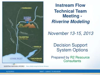
Combining Ocean, Wave, Hydrologic, Riverine Flow Models at a Local - PowerPoint PPT Presentation
N A T I O N A L O C E A N I C A N D A T M O S P H E R I C A D M I N I S T R A T I O N Office of Water Prediction Combining Ocean, Wave, Hydrologic, Riverine Flow Models at a Local and Regional Scale Along the East Coast of the United
N A T I O N A L O C E A N I C A N D A T M O S P H E R I C A D M I N I S T R A T I O N Office of Water Prediction Combining Ocean, Wave, Hydrologic, Riverine Flow Models at a Local and Regional Scale Along the East Coast of the United States Trey Flowers, Hendrik Tolman, Thomas Graziano, Edward Clark, Roham Bakhtyar, Nicole Kurkowski, Kazungu Maitaria, Saeed Moghimi, Beheen Trimble, Panagiotis Velissariou November 13, 2019 1
N A T I O N A L O C E A N I C A N D A T M O S P H E R I C A D M I N I S T R A T I O N Problem ▪ US East Coast is highly vulnerable to coastal floods and waves ▪ 80-90% of the deaths due to TCs are caused by fresh water flooding and storm surge (NOAA-HRD) ▪ Currently, linkages between inland forecast points and National Weather Service (NWS) estuary-ocean models have not been made; thus, accurate streamflow, stage, and velocity guidance in the coastal zone is not currently available ▪ Accurate model derived flood/inundation maps are needed to assess storm wind vs. water-specific losses Over 100 million people live in the red space near the coast (transition zone) do not get an integrated flood forecast today. 2
N A T I O N A L O C E A N I C A N D A T M O S P H E R I C A D M I N I S T R A T I O N Solution ▪ Goal: Provide accurate flood/inundation simulations at the transition zone ▪ Solution: Develop a computational framework that combines • Ocean Model: Advanced Circulation Ocean Model (ADCIRC) • Wave Model: WAVEWATCH III • Hydrologic Model: National Water Model (NWM) • Hydrodynamic/Hydraulic Model: DFlow FM ▪ Approach • Local Scale • Regional Scale • Atlantic and Gulf Coasts ▪ Validation • Super Storm Sandy (2012) • Hurricane Irene (2011) • Hurricane Isabel (2003) 3
N A T I O N A L O C E A N I C A N D A T M O S P H E R I C A D M I N I S T R A T I O N Local Scale Model - Location Delaware Bay • 250 km of lower Delaware River • 150/0 Km offshore of river mouth 2D/1D Coupled Model 4
N A T I O N A L O C E A N I C A N D A T M O S P H E R I C A D M I N I S T R A T I O N Local Scale Model - Results Isabel (2003): Delaware Bay/River Basin Sandy (2012): Delaware Bay/River Basin Water Level (m) Water Level (m) 5
N A T I O N A L O C E A N I C A N D A T M O S P H E R I C A D M I N I S T R A T I O N Local Scale Model – Validation of Results Hurricane Isabel (2003): D-Flow FM vs HEC-RAS and ADCIRC Water level (m) prediction comparison with NOAA observed data during Hurricane Isabel 2003 for Ship John. 6
N A T I O N A L O C E A N I C A N D A T M O S P H E R I C A D M I N I S T R A T I O N Local Scale Model - Summary ▪ Results • Water levels were generally accurate • Hydrodynamic predictions, especially in upstream reaches of Delaware River, were highly dependent on streamflow discharges and less on meteorological inputs • Coupled NWM/D-Flow/ADCIRC framework has advantages over existing river hydraulic models, particularly in storm events. ▪ Challenges / Lessons Learned • Bay-Delta and coastal ocean must be modeled in one computational domain to accurately describe highly interconnected hydrodynamics, sediment transport, and subsequent ecological process in these regions 7
N A T I O N A L O C E A N I C A N D A T M O S P H E R I C A D M I N I S T R A T I O N Regional Scale Model - Location From Sandy Hook, NJ to Savannah, GA Regional-Scale Domain 2D/1D Coupled Model 8
N A T I O N A L O C E A N I C A N D A T M O S P H E R I C A D M I N I S T R A T I O N Regional Scale Model - Results Hurricane Isabel (2003) Atmospheric Pressure Water Level 9
N A T I O N A L O C E A N I C A N D A T M O S P H E R I C A D M I N I S T R A T I O N Regional Scale Model – Validation of Results Hurricane Isabel (2003) Duke, NC Beaufort, NC Washington, DC Baltimore, MD Water level (m) prediction (red) comparison with NOAA observed data (blue). 10
N A T I O N A L O C E A N I C A N D A T M O S P H E R I C A D M I N I S T R A T I O N Regional Scale Model - Summary ▪ Results • 1D/2D hydrodynamic coupling was more robust, resulting in more accurate simulation of water levels in bay and tributaries than the Local Scale Model • Water level were generally accurate; the model can capture the peaks, especially for Isabel and Irene • Hydrodynamic predictions are dependent on atmospheric forcing ▪ Challenges / Lessons Learned • Input uncertainties/errors (e.g., bathymetry, wind, cross-section profiles, NWM discharges) • High resolution topo-bathymetry data is required to capture correct channel geometry • Spatial variability of roughness needs to be optimized 11
N A T I O N A L O C E A N I C A N D A T M O S P H E R I C A D M I N I S T R A T I O N Closing Statement 12
Recommend
More recommend
Explore More Topics
Stay informed with curated content and fresh updates.
