AOMSUC-10 Training events, Melbourne, 2-3 Dec. 2019 1 / 84 - PowerPoint PPT Presentation
AOMSUC-10 Training events, Melbourne, 2-3 Dec. 2019 1 / 84 Contents How to monitoring, detection and analysis of weather phenomena using GEO-KOMPSAT-2A(GK2A) data and RGB composites 1 2 AOMSUC-10 Training events,
AOMSUC-10 Training events, Melbourne, 2-3 Dec. 2019 1 / 84 국가기상위성센터
Contents How to monitoring, detection and analysis of weather phenomena using GEO-KOMPSAT-2A(GK2A) data and RGB composites 1 2
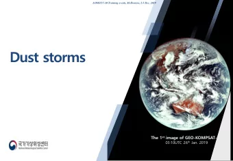
AOMSUC-10 Training events, Melbourne, 2-3 Dec. 2019 The 1 st image of GEO-KOMPSAT-2A 03:10UTC 26 th Jan. 2019
24hours RGBs [Ash clouds] [IR+VIS composite] [Airmass] [Dusts] [Day/nighttime fog] Daytime RGBs [cloud phase] [Snow/fog] [Convection] [True color] [Natural color] 4
Channel Combination Color interpretation palette 5
• Daytime only, requires solar reflectance information • Not effective for observing or discriminating types of weather other than convection • Yellow is indicative of small ice particles. Small ice particles can form in non-severe Cb clouds: - in Cb clouds with cold(high) cloud base (short time from cloud base to spontaneous freezing level) - Pileus cloud on top of developing thunderstorms. These thunderstorms need not necessarily be severe - in mountain wave clouds or in highly “polluted” clouds. Dust carried aloft can lead to long lived, small ice particles • Pixel color impacted by sun/satellite viewing angles - Yellow can be falsely increased due to sun glint in the 3.9 channel. - Pixel color fades during dawn/dusk when the sun angle is low. NOTE SLIDE Source from “UNDERSTANDING CONVECTIVE CLOUDS THROUGH THE EYES OF (MSG): Cloud Particle Size”. J.Kerkmann EUMETSAT 6
Channel Combination Low level louds Thin high level (water droplets) clouds(ice particle) Snow Thin high level clouds(ice particle) Glaciating clouds Thick high level Thin high level clouds(ice particle, louds (ice particle ,yellow) red-orange) Thik high level Low water clouds Snow clouds(ice particle) (water droplets, cyan, lavender) Glacating clouds (green) 7
Channel Combination 9
Distinguish dust signals distinctly from surrounding phenomena by displaying complementary colors (Dusts : pinkish, clouds: greenish, land/ocean : bluish colors) Weak dust signals over marine are also well detected continuously 10
AOMSUC-10 Training events, Melbourne, 2-3 Dec. 2019 The 1 st image of GEO-KOMPSAT-2A 03:10UTC 26 th Jan. 2019
A) VIS(0.64µm) B) NIR(1.6µm) C) Enhanced IR(10.4µm) F) Day Microphysics RGB E) Convection RGB D) Cloud Phase RGB 12
14
What make the difference between VIS(0.64µm) and NIR (1.6µm ) images? - Different reflectivity of ice/snow and water clouds between VIS and NIR VIS(0.64µm) NIR(1.6µm) Ice clouds Stronger absorption by ice than water • Ice cloud appears darker than water clouds • These properties are exploited in the creation of some RGB images 15
Why the brightness of ice clouds are different ? Absorption by water & ice NIR(1.6µm) water < ice 4 2 1 Source : EUMETSAT Reflection at 3.9um : water & ice 3 As particle size increased, Reflection decreased Absorption increased 1.6um images became darker 05:30UTC 27 th Sept. 2019 Source : COMET Program Socrative Question 2 . Where is the smallest ice particles present ? A . 1 B . 2 C. 3 D . 4 16
Socrative Question 3 . Which products give you more microphysical information of clouds? A) Enhanced IR B) NIR(1.6µm) (10.5µm) C) Cloud phase RGB D) Convection RGB 17
☞ Cloud phase RGB differentiate water and ice clouds ☞ Convection RGB give information of ice/water, small/large particle size and intensity of convection Cloud phase RGB Convection RGB Low, water clouds(cyan) Low to mid, water clouds(light blue) 5 5 2 2 Weak convection, glaciating clouds 4 moderate convection, Large ice particle (green) 4 thin high-level clouds large ice particle (red) with ice particles (orange) (red-orange) Low to mid water clouds Low, water clouds(cyan) Strong convection, Thick high level clouds (light blue) 3 3 5 5 small ice particles(yellow) with ice particles(yellow) Weak convection, large 2 glaciating clouds(green) 2 ice particle(red) 4 thin cirrus, small ice particles 4 thin high-level clouds with ice particles (purple) (red-orange) 18
Rapidly developing thunderstorm(RDT) ( 04:30UTC, 27 SEP 2019) Convection RGB KMA radar rainrate(mm/hr) 대류운 RGB Weak convection, Large ice particle 2 moderate convection, 4 large ice particle 2 3 Strong convection, 3 small ice particle ☞ RDT identify, monitor and tracking intense convective clouds based on the training data over the Korean Peninsular using high spatio-temporal resolution satellite data, radar reflectivity, lightening and model stability data . 19
Recommend
More recommend
Explore More Topics
Stay informed with curated content and fresh updates.


