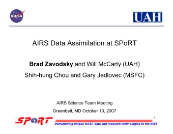
AIRS Data Assimilation at the Regional Scale Brad Zavodsky & - PowerPoint PPT Presentation
Earth Science Office Science Mission Directorate UAH UAH UAH National Aeronautics and Space Administration National Aeronautics and Space Administration AIRS Data Assimilation at the Regional Scale Brad Zavodsky & Will McCarty
Earth Science Office Science Mission Directorate UAH UAH UAH National Aeronautics and Space Administration National Aeronautics and Space Administration AIRS Data Assimilation at the Regional Scale Brad Zavodsky & Will McCarty University of Alabama in Huntsville Huntsville, Alabama Shih-hung Chou, Gary Jedlovec, & Bill Lapenta NASA / Marshall Space Flight Center Huntsville, Alabama AIRS Science Team Meeting – March 2007 transitioning unique NASA data and research technologies to the NWS
Earth Science Office Science Mission Directorate UAH UAH UAH National Aeronautics and Space Administration National Aeronautics and Space Administration Outline • SPoRT AIRS assimilation focuses on short-term regional forecasts—compliments work at JCSDA • Profile Assimilation • Lessons Learned from Case Study • Analysis Impact (v4.13; GSFC) • v4/v5 Profile Comparison w/ Rawinsonde (v4.0, v5.0; JPL) • Near-Real-Time (NRT) Assimilation plans • Radiance Assimilation • Determination of Uncontaminated Channels • Validation with MODIS/CloudSat transitioning unique NASA data and research technologies to the NWS
Earth Science Office Science Mission Directorate UAH UAH UAH National Aeronautics and Space Administration National Aeronautics and Space Administration Motivation for Profile Assimilation at SPoRT • AIRS profiles complement traditional upper-air observations in data sparse regions (e.g. ocean). • Hyperspectral nature of AIRS sounder allows for highest vertical resolution of any current remote sensing system • L2 profiles provide a data set to add information to initialize forecast models in data-void regions without running complex RTA within analysis • What follows is an overview of work done with v4, some preliminary work with v5, and an overview of upcoming real- time work transitioning unique NASA data and research technologies to the NWS
Earth Science Office Science Mission Directorate UAH UAH UAH National Aeronautics and Space Administration National Aeronautics and Space Administration Insights from Previous Case Study Work • Short WRF forecast initialized with NAM used as background for ADAS analysis; 48-hour WRF forecasts for Nov. 2005 east coast storm • AIRS profiles (v4.13) have a positive impact on the initial conditions of the model (next slide) but have varying results on regional forecasts with improvements at some forecast times at some levels • AIRS impact on forecast depends on case study, use of QIs, assimilation time (model adjustment), and model resolution L L L L L L Surface analysis 11/20/05 12 UTC Surface analysis 11/20/05 12 UTC Surface analysis 11/21/05 12 UTC Surface analysis 11/21/05 12 UTC Surface analysis 11/22/05 12 UTC Surface analysis 11/22/05 12 UTC WRF Domain for Nov. 2005 Case Study WRF Domain for Nov. 2005 Case Study transitioning unique NASA data and research technologies to the NWS
Earth Science Office Science Mission Directorate UAH UAH UAH National Aeronautics and Space Administration National Aeronautics and Space Administration Initial Assessment of V5 Profiles: Sept. 8, 2006 • Substantially more full, high quality retrievals over land (Midwest) • Data removed mainly in cloudy regions • V5 quality control adds data over land, near clouds, and above clouds GOES-11 IR Image AIRS V5 PBest from JPL Focus Day AIRS V4 RetQAFlag from DAAC AIRS V5 PBest transitioning unique NASA data and research technologies to the NWS
Earth Science Office Science Mission Directorate UAH UAH UAH National Aeronautics and Space Administration National Aeronautics and Space Administration Impact of AIRS Profiles on Initial Conditions 07Z BKGD 07Z BKGD 20 November 2005 WAL 20 November 2005 MHX 07Z AIRS 07Z AIRS 07Z ADAS 07Z ADAS 00Z RAOB 00Z RAOB 12Z RAOB 12Z RAOB AIRS detects AIRS correctly lowering of shows mid- moist layer AIRS shows troposphere (00-12Z) moistening with cooling (00-12Z) time (00-12Z) AIRS correctly detects 850 – 700 hPa dry layer transitioning unique NASA data and research technologies to the NWS
Earth Science Office Science Mission Directorate Land Soundings (LandFrac ≥ 0.50) UAH UAH UAH National Aeronautics and Space Administration National Aeronautics and Space Administration Detroit, MI (DTX): 5 km Greensboro, NC (GSO): 0 km T appears more consistent with RAOBs for v5 throughout atmosphere 00Z RAOB 00Z RAOB 12Z RAOB 12Z RAOB V4 AIRS V4 AIRS V5 AIRS V5 AIRS q doesn’t perfectly depict moisture for all cases Too dry below 800 hPa for both V4 and V5; slight degradation in V5 transitioning unique NASA data and research technologies to the NWS
Earth Science Office Science Mission Directorate Water Soundings (LandFrac = 0.0) UAH UAH UAH National Aeronautics and Space Administration National Aeronautics and Space Administration Key West, FL (EYW): 69 km Wallops Island, VA (WAL): 58 km 00Z RAOB 00Z RAOB 12Z RAOB 12Z RAOB V4 AIRS V4 AIRS Smaller change V5 AIRS V5 AIRS between v4 and v5 in T and q (mostly positive compared to RAOBs) transitioning unique NASA data and research technologies to the NWS
Earth Science Office Science Mission Directorate UAH UAH UAH National Aeronautics and Space Administration National Aeronautics and Space Administration Real-Time Assimilation • Single case studies are not necessarily representative (statistically significant) of overall model performance • Looking to test sensitivity and feasibility (e.g. make future forecasts or initial conditions available to WFOs) of AIRS data in real time; not trying to run optimal operational configuration • CNTL: control; use no AIRS data • AIRS: use QIs and error profile information to select only the highest quality data • Use real time assimilation to select focus days for further study 1 st AIRS Looking for cases with 2 nd AIRS 2 nd AIRS available valid surface feature like this available* 0600 0900 1200 1 st AIRS valid NAM data 0900 analysis Desired available 0700 analysis L complete WRF forecast initializatio complete complete as next n time WRF bkgd NAM forecast WRF bkgd ready ready for 0700 cycle begins for 0900 ADAS ADAS transitioning unique NASA data and research technologies to the NWS
Earth Science Office Science Mission Directorate UAH UAH UAH National Aeronautics and Space Administration National Aeronautics and Space Administration Outline • SPoRT AIRS assimilation focuses on short-term regional forecasts—compliments work at JCSDA • Profile Assimilation • Lessons Learned from Case Study • Analysis Impact (v4.13; GSFC) • v4/v5 Profile Comparison w/ Rawinsonde (v4.0, v5.0; JPL) • Near-Real-Time (NRT) Assimilation plans • Radiance Assimilation • Determination of Uncontaminated Channels • Validation with MODIS/CloudSat transitioning unique NASA data and research technologies to the NWS
Earth Science Office Science Mission Directorate UAH UAH UAH National Aeronautics and Space Administration National Aeronautics and Space Administration Motivation for Radiance Assimilation at SPoRT Technique • Like profiles, radiances can be used to used for supplement rawinsondes in data sparse regions IFOV2 • Traditional cloud detection approaches may be too conservative for mesoscale variability important for regional assimilation studies • Additional cloud-free channels may add mesoscale detail • Enhanced CO 2 sorting technique is applied to AIRS radiances to this end (Will McCarty, JCSDA) • What follows is a brief description of this technique and some validation against MODIS and CloudSat observations transitioning unique NASA data and research technologies to the NWS
Earth Science Office Science Mission Directorate UAH UAH UAH National Aeronautics and Space Administration National Aeronautics and Space Administration Determination of Usable Channels in IFOV2 • CO 2 sorting technique (Holz et al. 2006) adapted to clear cloudy distinguish between contaminated and uncontaminated IFOV IFOV radiances • Clear spectrum generated using forward RT calculation; sorted with cloudy spectra by BT to determine separation point between clear and cloudy channels separation point • SPoRT sorting technique (left figure) compares well to the CO 2 slicing CTP (right figure) transitioning unique NASA data and research technologies to the NWS
Earth Science Office Science Mission Directorate UAH UAH UAH National Aeronautics and Space Administration National Aeronautics and Space Administration MODIS CTP vs. AIRS Usable Channels (2006 Dec. 4) MODIS CTP Channels for Assimilation (%) • Visible agreement is seen between the MODIS CTPs and AIRS usable channels • Higher % of usable channels in clear regions, lower % as clouds get higher transitioning unique NASA data and research technologies to the NWS
Earth Science Office Science Mission Directorate UAH UAH UAH National Aeronautics and Space Administration National Aeronautics and Space Administration AIRS/MODIS/CloudSat Intercomparison CloudSat Reflectivity CloudSat Reflectivity CloudSat Reflectivity AIRS p sp Separation Point Pressure MODIS CTP MODIS CTP • Pressure corresponding to brightness temperature of first uncontaminated channel • Not a CTP! Technique sees broken clouds that neither CloudSat nor MODIS pick up transitioning unique NASA data and research technologies to the NWS
Recommend
More recommend
Explore More Topics
Stay informed with curated content and fresh updates.
