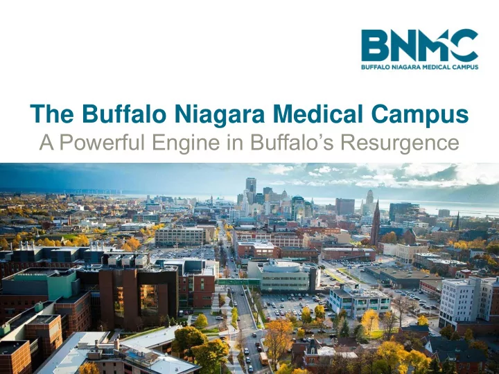

The Buffalo Niagara Medical Campus A Powerful Engine in Buffalo’s Resurgence
Buffalo’s Innovation District
Our BNMC Team Workforce & Procurement Transportation, Neighborhoods & Access & Safety Housing Working together to change our city's future Energy Infrastructure Innovation Food & Active Living Youth & Education
Anchor institutions and the community working in collaboration to advance a shared vision. - 9m sq.ft. of facilities (up from 4.5m sq. ft. in 2006) - 150+ private and public companies today - $1.4b in public & private investment in infrastructure over past 10 years - 16,000 employees today, up from 7,000 in 2002 - 1.5m patients and visitors annually
Transportation Management Association
Transportation Management Association State Agencies Local Government Regional Transit Authority Regional Planning Organizations Nonprofit Organizations Anchor Institutions
Transportation Management Association Mission To provide patients, visitors, employees, students and neighbors with efficient access to the Medical Campus through the collaborative management of a comprehensive, multi-modal, and customer-focused transportation and parking system.
Active Parking Management
Transit Oriented Development
Complete Streets
Shared Mobility
EV Infrastructure
TDM Strategies
Planning for the Future 2016 Buffalo Bicycle Master Plan – Main Street Cycle Track
Planning for the Future 2017 BNMC Comprehensive Traffic Study – Main St as Priority Corridor
Planning for the Future 2019-2020 Buffalo Middle Main Street Project $13 million of multi-modal streetscape improvements
Main Street SMART Corridor Plan Funded by: NYSERDA/NYSDOT PON 3345: Making Transportation Smart and Sustainable Primary Goal: Create a greener, safer, more efficient, and connected multi-modal transportation system for the future Main Street Corridor through Smart Cities and Internet-of-Things applications.
Main Street SMART Corridor Plan Steering Committee: BNMC-TMA Member Organizations and Utility Companies Project Management Team: &
SMART Corridor Focus Areas • Complete Streets • Traffic, Curbside, Parking Management • Mobility as a Service (MAAS) • Connected/ Autonomous Vehicles • Public Safety, Emergency Services • Inclusive/ Universal Design • Energy, Lighting & Utilities; EV Charging; Green Infrastructure • Data Management/ Exchange • Focus on Implementation Funding Models • Legal & Policy Issues •
Main Street SMART Corridor Plan Scope of Work: Task 1: Review Existing Plans and Conditions Task 2: Research Best Practices, Opportunities and Challenges We Are Here… Task 3: Develop Smart Corridor Recommendations
Columbus, OH 4 Emerging Technologies • Smart Columbus Operating System- web based data management and open-data platform • Columbus Connected Vehicle Environment (CVE) • Enhanced Human Services (Hubs) • Electric Vehicle Infrastructure $40M grant leveraged with $510M in additional funding
Columbus, OH Smart Columbus Sandbox • Open data made available through Sandbox • Users can also upload their own data • Data is broken down into degrees of privacy; some requires “scrubbing”
Kansas City, MO • 2.2- mile streetcar corridor • $50M TIGER Grant & public/ private partnership with Cisco and Sprint - $15.7M • Cisco and Sprint receive exclusive access to data usage • RFP to attract additional investors • Partnered with Rockhurst University on open data portal (series of “How To” videos) • Wiki format on what data is usable
Atlanta, GA • 2.3- mile North Avenue Corridor • Hundreds of sensors; video detection system for real-time traffic management, adaptive signal timing, and framework for CV/AV • Users can sign into app as driver, pedestrian, cyclist, transit users to get real-time info • Digital Mobility Center (City of Atlanta)
Atlanta, GA • Partnership with Georgia Tech (GT can analyze data) • North Ave project is $3M, funded thru Atlanta’s Smart City Project ($250M bond) • Additional ½ cent local options tax raised $300M for Atlanta Smart City Project • Looking to leverage PPP – City is establishing “backbone” with public funds; draw private investment in technologies that utilize “backbone” • Issued RFP for local investors
Applying SMART City Technologies to Main St Framework Begins with Smart Street Lights Lighting Traffic/ Curbside/ Parking Management Weather/ Environment Safety & Security EV Charging/ e-Mobility WiFi/ Info/ 5G
Smart Street Lights Traffic Management
Smart Street Lights Parking Management
Smart Street Lights Pedestrian Safety
Traffic/ Curbside/ Parking Management • Real-Time and Dynamic • Adaptive Signal Timing • Everything is Connected • Identification of Incidents • Flex Zones
Complete Streets Spragins Street Smart Cycle Track, Huntsville, AL • Street lights contain sensors that detect bicyclists and trigger traffic signals to provide priority • Can provide real time bicycling conditions, counts, peak periods
CV/ AV and MAAS • Smart Street Lights lay the foundation for additional components • Communication Onboard and Along the Street • Mobility Hub
Pilot Universally Designed Intersection Main Street & Summer St/ Best St • Use tactile and mobile technologies to navigate intersections • NYC pilot- 7th & 23rd • Communication to mobile devices
Energy & Utilities • Smart Streetlights • Utility and stormwater sensors • Identifying peak demands • EV charging • WiFi and 5G (and beyond)
Applying SMART City Technologies to Main St • Unified approach amongst stakeholders • Main Street as pilot/ future proof • Data Management could be housed in NITTEC • Leverage initial investment with public/ private funding • RFI’s • Value in data/ information and infrastructure • Use UB CV/AV pilot to establish policy for CV/AV and privacy • Data Management Plan/ Data Privacy Plan
Recommend
More recommend