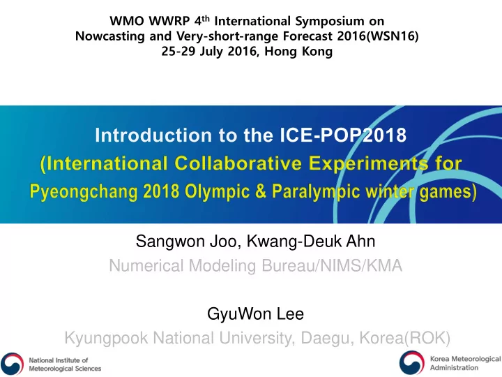
Sangwon Joo, Kwang-Deuk Ahn Numerical Modeling Bureau/NIMS/KMA - PowerPoint PPT Presentation
WMO WWRP 4 th International Symposium on Nowcasting and Very-short-range Forecast 2016(WSN16) 25-29 July 2016, Hong Kong Sangwon Joo, Kwang-Deuk Ahn Numerical Modeling Bureau/NIMS/KMA GyuWon Lee Kyungpook National University, Daegu, Korea(ROK)
WMO WWRP 4 th International Symposium on Nowcasting and Very-short-range Forecast 2016(WSN16) 25-29 July 2016, Hong Kong Sangwon Joo, Kwang-Deuk Ahn Numerical Modeling Bureau/NIMS/KMA GyuWon Lee Kyungpook National University, Daegu, Korea(ROK)
History of ICE-POP 2018 Propose RDP at SSC/WWRP/WMO (Nov. 2014) RDP/FDP Kick-off meeting (Oct. 2015.) Naming, structure WG Participants: 6 countries, (7 institutions) Submit Conceptual Paper to WWRP/WMO (Nov. 2015) WMO endorse ICE-POP 2018 (Dec. 2015) Present ICE-POP 2018 in NMRWG/WWRP (Dec. 2015) Observation WG meeting (Mar. 2016) Participants: US NASA, UCLM(Spain), EC(Canada), US CSU Observation Network(Field Campaign) with participants’ instruments Build Korea Trust Fund for ICE-POP2018 at WMO(Jun 2016) [ Paricipants by country ] NWP physics/Verification meeting (Sep 2016) Australia, Austria, Canada, China, Finland, Russia, Rep. Korea, Spain, Swiss, United Participants(to be): EC, NCAR, KIAPS, NMB/NIMS, FMI States [ 10 ] Special session at KMS conference (Oct 2016) [ Paricipants by agency ] BOM, ZAMG, EC, CMA, CAMS, FMI, 2nd ICE-POP 2018 Workshop (Nov 2016) Roshydromet, KMA, NIMS, UCLM, EPFL, CIRA, CSU, NASA, NCAR, NOAA, SBU[ 17 ] 1
Organization of ICE-POP 2018 ICE-POP 2018 Nowcasting and Mesoscale Research Working Group / WWRP/ WMO Advisory group Organizing WG • Administrative works Scientific advice • IT support & data sharing (13 Korean scientists ) Observation WG NWP WG Evaluation WG • observation network • Nowcasting & NWP model • Model verification & • observation campaign evaluation • To operate model for FDP Chair: Zoltan Toth [NOAA] Chair: Stella Melo [EC] Chair: Pertti Nurmi [FMI] Chair: Sangwon Joo Chair: BC Choi Chair: DongJoon Kim Yuanfu Xie,Jenny Sun Paul Joe,Walter Petersen Dmitry Kiktev Jian Sun,Gdaly S. Rivin Matthew Schwaller Peter Steinle Benedikt Bica,Tsengdar Lee Francisco Tapiador Zhining Tao,Soyung Ha Alexis Burne,Pavlos Kollias Steve Albers, Hugh Morrison Liping Huang, GyuWon Lee Jason Milbrandt, Gultepe Ismail, Stephen Belair, Chris Kummerow,…
PyeongChang 2018 Olympic Area & Venues Work orkforc rce Services es MOC MOC Chief forecaster Weather Briefings to MOC, IOC, (Main Operation Centre) Lead forecaster Venue weather forecasting WF WFC (Weather Forecast Venue forecasters Communication with media 24hours/7days operation WI WIC Venue communicators Weather counselling to managers and (Weather Information (All outdoor venues related to each competition venue Centre) 1 or 2 forecasters each Weather observation Volunteers
KMA plan for Forecast Services Forecast lead time Update Frequency Forecast name Nowcasting 2 hours (Site forecasts) 15mim Very-Short range 1 day (Site forecast) 1hour Short-range 3 days (Site & Map) 3 hour Medium-range Up to 10 days 12hour •Main concern is wind(Gust), precipitation(type, amount), visibility, temperature. •40 forecasters for the test event (17) and Oympic games (18) Snow games (12) Ice games (1): Gangneung Olympic Park Jeongseon Alpensia Yongpyeong Bokwang
Olympic period (Feb.9~25) Characteristics (Mountain) 0 160 140 Precipitation -2 Snowfall 120 Temperature -4 100 Precipitation (mm) / Snowfall (cm) Temperature (℃) -6 80 60 -8 40 -10 20 -12 0 1974 1977 1980 1983 1986 1989 1992 1995 1998 2001 2004 2007 2010 2013 2016 Temp( ℃ ): -9.6(1983)/-0.4(2004)/-2.7(2016), Precipitation(mm): 104.8(2005)/0.6(1980)/20.8(2016) Snowfall(cm): 150.2(1979)/0.1(2006)/7.0(2016) Courtesy to Jang Ho Lim
Extreme records, Olympic period (Feb.9~25) Elements Value Date High 10.5 2009.02.13 Ave. Temp.(℃) Low -18.1 1991.02.23 High 16.5 2004.02.20 Max. Temp. (℃) Low -13.4 1977.02.16 High 3.6 2009.02.13 Min. Temp. (℃) Low -27.6 1978.02.15 High 1044.5 2008.02.18 Sea level Press.( hPa ) Low 989.1 2009.02.13 Humidity(%) Low 10.0 2004.02.19 Wind speed(m/s) High 22.7 1990.02.20 Gust speed(m/s) High 34.2 1991.02.21 Day precipitation(mm) High 68.3 1989.02.25 Day max. snowfall(cm) High 87.0 1989.02.25 Courtesy to Jang Ho Lim
Heavy snowfall condition in PyeongChang Area Weather Pattern for Snow(Rank II) [ Weather Challenges] - East Snow Storm(ESS) [22% in cases of 2003-2012 DJFM, > 10 mm]
Heavy snowfall condition Mechanism for East Snow Storm(ESS) - Target Phenomenan for PyeongChang RDP/FDP [ 2014. 1. 21 case] 1) Updraft by terrain 2) Convergence between land(Mountain) and sea Advection of Cold air 3) Heat/moisture flux by sea •WSS is well predicted but ESS has low predictability due to the interaction between large scale and small scale is not simulated properly in current NWP system and cause severe damages at the east coast of the Korean peninsula. •For the PyeongChang Olympics, massive observations are available in the regional and it is a good change to contribute to improve the poor predictability related winter snow storms.
Complex Topography over the area CPOS 20km Courtesy to Gyuwon Lee YPCPO VENUES • Venues are located in a small area with complex terrain (sub km scale) and steep in the coastal region • Heavy snow depends on the small scales flows, stability, and phase changes in a low level and conventional observation is not designed for that • Snow weather is not captured well in the operation radar/surface observation network 9
Operational observation at KMA < < Up Uppe per l level el> < Cl < Cloud ud he height ht> < < Ocea ean> n> < Sur < urface> e> RAO AOBs : : 8 Cel eliomet ometer : 92 92 Buoy : oy : 17 Surface ace obs obs: 4172 4172 Wind pr nd prof ofiler er : : 12 12 Cos ostal w wav ave buo buoy : y : 48 48 5km r 5k m res esolution on M. R M. Radi adiome ometer : 12 12 Li Light ghtning hou house se A AWS : 9 : 9 < < Others> < < Ra Rada dar> < < Snow w de dept pth> < Vis Visib ibilit ility> KMA MA : : 11 11 Manned : 22 Manne 22 + Weat ather her s sens nsor or : : 215 M. M. of of Def efen ense se : 9 9 Lase Laser : : 55 55 Visib Vis ibility ility : : 76 M. of M. of Land Land & & Tran ans : : 7 10 CCTV : : 169 169
Scientific Issue in ICE-POP 2018 Understanding of HCR(Horizontal Convective Rolls) [ Condition for Occurence ] Surface heat flux Low-level wind shear Thermal/dynamic Instability [ Characteristics ] Vertical extent:1-2 km Wavelength: 2-20 km (Brown, 1980) Aspect ratio: 2-15 Downstream extent:10-1000 km M. wind -20~+30 [ Issues ] life time:1-72 h Initiation of convection is not well understood - Difficult to capture updraft branches by observation Aircraft, Satellite(Surface Heat Flux) Low-level wind shear/ water vapor variability and convergence are important - Difficulty to observe over ocean X-band/Cloud radar reflectivity, Wind retrieval from radar
Scientific Issue in ICE-POP 2018 Coastal convergence and Microphysical Process induced by Mountain [ Issues ] Costal convergence zone Interaction between synoptic and mesoscale Flow changes at complex terrain MP phase change & snow size distribution over mountain Visibility from low level cloud Dual pol X-band/Cloud radar Supersite with disdrometer (Paul Joe, 2016) 3D camera for snow Improvement of Snow MP Visibility & low level cloud
Goal & Work flow of ICE-POP 2018 GOAL: Advancing seamless prediction from nowcasting to short-range forecast for winter weathers over complex terrains with intensive observation campaign 13 RDP DP FDP DP • Develop IOP Nowcasting • Nowcasting Public • High • Develop high • NWP products resolution 3D resolution NWP structure Olympic • DA • Statistical forecasters • Snow Physics gudiance • Multi • Evaluation spectral Radar • Weather • Understand monitoring IOC, LOC • Microphysics snow formation processes • Contribute a science community in terms of winter weather
Observation network over the ocean Aircraft measurements • CCNC200, CCP, SEA WCM2000 Radar scan from the coast • 16 drops per flight and 4 receivers • S-band and C-band radar Air-sea flux from satellite • 3D structure can be captured • RHI scan to the open sea • COMS, Himarwari8 & LEO (KMA with Brent Roberts [US NASA]) Sea surface condition & ASAP from ship • 6 hourly RAOBs • Move round the sea near Gangrung
Observation network over the complex terrain 4 Venue KRS Radarsite 1(DGWO) 1 Radarsite 2(APOS) 2 O.D.Mt 3 3 Radarsite 3(GWWO) 3 8 5 H.B.Mt Radarsite 4(HBOS) 4 5 4 4 Sondesite 1(DGWO) 1 Sondesite 2(BKOS) 2 3 1 1 6 Sondesite 3(GWWO) 3 1 2 Sondesite 4(OBS Ship) 4 2 Sondesite 5(GWNU) 5 Sondesite 6(JSOS) 6 2 Supersite 1(MHOS) 1 Supersite 2(YPOS) 2 7 Supersite 3(CPOS) 6 3 Supersite 4(EUOS) 4 Supersite 5(GWNU) 5 Supersite 6(SJOS) 6 Supersite 7(IGOS) 7 GNG: Gangneung radar(S-band, Operational radar/KMA) Supersite 8(ODOS) 8 KAN: Airforces Radar(C-band), GRS: S-band dual-pol
RADAR in ICE-POP2018 9.355GHz UCLM KMA, 9.375GHz EPFL 9.41GHz NASA Ka/Ku Full scan ECCC Scan Lider X-Pol D3R NCU/ 9.6GHz Cloud radar Scanning lidar Supersite RADIOSONDE
Recommend
More recommend
Explore More Topics
Stay informed with curated content and fresh updates.






![[NIMS Conference 2012] Poster Presentation List 1. Advanced Microstructural Characterization and](https://c.sambuz.com/112172/nims-conference-2012-poster-presentation-list-s.webp)

