
SLIDE 1
Modeling Code (Platform)
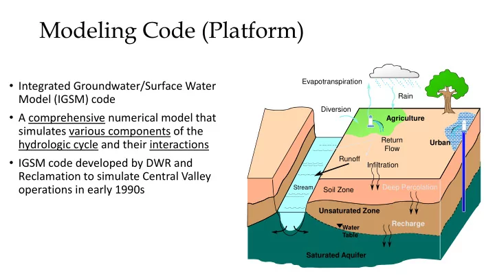
- Integrated Groundwater/Surface Water
Model (IGSM) code
- A comprehensive numerical model that
simulates various components of the hydrologic cycle and their interactions
- IGSM code developed by DWR and
Reclamation to simulate Central Valley
- perations in early 1990s
Rain Evapotranspiration Diversion Saturated Aquifer Soil Zone
Stream
Agriculture Infiltration
Water Table
Deep Percolation Runoff Unsaturated Zone Recharge Return Flow Urban