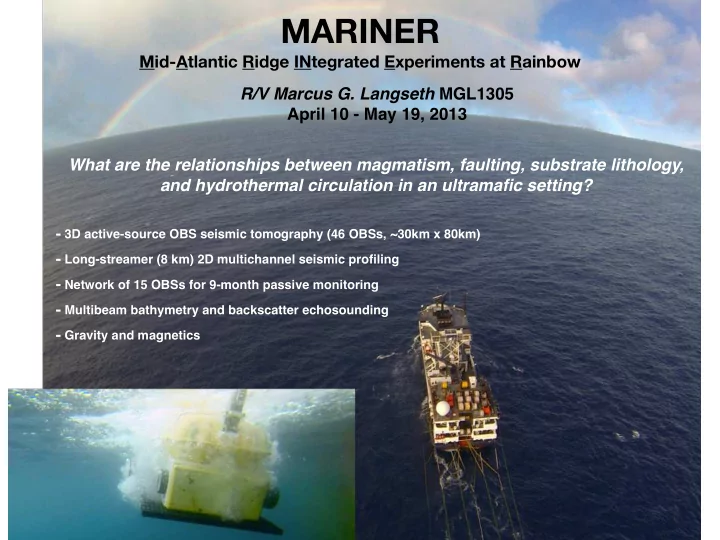

MARINER Mid-Atlantic Ridge INtegrated Experiments at Rainbow R/V Marcus G. Langseth MGL1305 April 10 - May 19, 2013 What are the relationships between magmatism, faulting, substrate lithology, and hydrothermal circulation in an ultramafic setting? - 3D active-source OBS seismic tomography (46 OBSs, ~30km x 80km) - Long-streamer (8 km) 2D multichannel seismic profiling - Network of 15 OBSs for 9-month passive monitoring - Multibeam bathymetry and backscatter echosounding - Gravity and magnetics
3D OBS Tomography and 2D MCS Z = 2 7 . 5 k s m / m 60 km k b s 4 f . 7 1 0 % Anisotropy 0 % 30 km 8 . 5 Arai, Dunn et al., in prep. s / m k 6 . 7 Z = 6 k m b 8.5 2.5 km/s s f 2 tetonic accretion magmatic accretion km 8 60 km
m 2 km 4 km 6 km 8 km 10 km km/s Canales et al., in prep.
m 2 km 4 km 6 km 8 km 10 km km/s Canales et al., in prep.
m 2 km 4 km 6 km 8 km 10 km Canales et al., in prep.
m 2 km 4 km 6 km 8 km 10 km Canales et al., in prep.
m 2 km 4 km 6 km 8 km 10 km km/s Canales et al., in prep.
m 2 km 4 km 7.25 7.25 7.25 6 km 7.63 7.63 7.63 8 km 10 km km/s Canales et al., in prep.
➡ Long-streamer (8 km in this study but optimally longer) MCS reflection combined with wide-angle OBS data is the only approach to obtain accurate images of subsurface structures in complex tectonic settings . ➡ Long-o ff set (>50 km) OBS recordings for crustal/mantle tomography and deep MCS reflection imaging require a powerful tuned seismic source . ➡ RV Langseth provides a single research platform for acquiring high-quality coincident OBS/MCS data (and other underway geophysical datasets). 2 km 4 km 6 km 8 km 10 km Canales et al., in prep. km/s
Thoughts ¡on ¡future ¡ MOR ¡Studies A ll ¡ridges: ¡ ¡ ¡Long-‑streamer ¡studies ¡of ¡ridge ¡ axis ¡hydrothermal ¡circulation. ¡ ¡ ¡ ¡-‑FWI ¡of ¡upper ¡1-‑2 ¡km ¡to ¡ ¡ characterize ¡both ¡magmatic ¡heat ¡ source ¡and ¡crustal ¡lid ¡above ¡that ¡ hosts ¡fluid ¡flow. ¡ ¡ Long-‑streamer ¡studies ¡of ¡ridge ¡ flank ¡hydrothermal ¡flow ¡and ¡ crustal ¡aging. ¡
Community ¡Experiments: ¡ 3D ¡imaging ¡of ¡magma ¡reservoir ¡ and ¡crustal ¡lid ¡beneath ¡Axial ¡ Seamount ¡to ¡support ¡OOI-‑ ¡ planned ¡30 ¡years ¡of ¡monitoring ¡ studies ¡of ¡hydrothermal ¡flow ¡and ¡ volcanism. ¡ -‑largest ¡magma ¡reservoir ¡ imaged ¡to ¡date ¡ ¡at ¡MOR. ¡ Fast ¡and ¡intermediate ¡spreading ¡ ¡ridges: ¡ Comparative ¡3D ¡studies ¡of ¡ridge ¡segmentation ¡and ¡axial ¡lens ¡ complex. ¡ 4D ¡studies ¡of ¡magma ¡flow ¡within ¡axial ¡magma ¡reservoirs ¡ ¡-‑ ¡ temporal ¡and ¡spatial ¡scales ¡of ¡magma ¡recharge. ¡
3D#studies#of#slow#and#ultraslow1spread#lithosphere:# !!"!structural!heterogeneity;! !!"!geological!nature!of!the!seismic!Moho;! !!"!mantle!exposures;! !!"!high"methane,!high"hydrogen!hydrothermal!fluid!flow! Example:!3D!studies!at!Atlan@s! Bank,!SWIR:! ! "!Modern,!high"quality!3D! !!"!Drilling!through!the!Moho!is! seismic!surveys!are!needed!to! proceeding!in!2!phases!(Leg!1,! complement!and!expand!the! Nov!30,!2015"Jan!31,!2016,! drilling!results!(currently!only! 1300!m;!Leg!2,!3000!m;!Leg!3,! low"res!2D!OBS!data!are! 6000!m)!to!test!the!hypothesis! available).! that!the!Moho!is!a! serpen@niza@on!front.! Crust/mantle boundary ? ? Seismic Moho 20!km! 0!
Recommend
More recommend