Briefing on Climate Adaptation Interagency Climate Adaptation Team - PowerPoint PPT Presentation
Briefing on Climate Adaptation Interagency Climate Adaptation Team Minnesota Environmental Quality Board November 20, 2013 Overview Introduction Presentation by Dr. Mark Seeley Agency presentations from Interagency Climate
Briefing on Climate Adaptation Interagency Climate Adaptation Team Minnesota Environmental Quality Board November 20, 2013
Overview Introduction Presentation by Dr. Mark Seeley Agency presentations from Interagency Climate Adaptation Team Opportunities for Interagency Action Questions/Discussion
Adaptation/Mitigation Adaptation: Developing/implementing strategies, initiatives and measures to help human and natural systems address climate change impacts Mitigation: Reducing greenhouse gas emissions to limit magnitude or progression of climate change
Adaptation/Mitigation Adaptation: Mitigation: Addressing current Achieving & future climate greenhouse gas impacts emissions reductions Risk management and infrastructure Energy and protection economic systems Local responses Global responses
Complementary Strategies 2013 Draft National Climate Assessment: Research indicates that both mitigation and adaptation are needed in order to minimize the damages from climate change and to adapt to the pace and ultimate magnitude of the changes that occur. http://ncadac.globalchange.gov/download/NCAJan11-2013-publicreviewdraft-chap28- adaptation.pdf
Minnesota: Interagency Climate Adaptation Team (ICAT) Started in 2009 Agriculture, BWSR, Commerce, Health, Metropolitan Council, Natural Resources, Pollution Control, Public Safety, Transportation Initiated by agencies
2013 ICAT Accomplishments 2013 ICAT report Presentation to 2013 Legislature Identified agency collaboration opportunities Information sharing, presentations, and updates
2013 ICAT Report Describes climate trends affecting MN Characterizes climate impacts Summarizes activities by agencies Presents opportunities for interagency action Underscores urgency and complexity of issue
Adaptation in other states • Adaptation planning in other states • Coastal states • Varying models Source: http://www.c2es.org/us-states-regions/policy-maps/adaptation
Other state efforts • 2012 NRDC summary report Source: http://www.nrdc.org/water/readiness/files/Water-Readiness-issue-brief.pdf
Other state efforts • Wisconsin Initiative on Climate Change Impacts (WICCI) Source: http://www.wicci.wisc.edu/
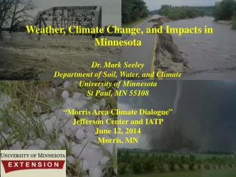
Climate Trends in Minnesota Dr. Mark Seeley Extension Climatologist/Meteorologist Dept of Soil, Water, and Climate University of Minnesota MN Environmental Quality Board November 20, 2013 St Paul, MN
"Science for adaptation starts with understanding decision-making processes and information needs, determining where the vulnerabilities are, and then moves to [climate trend analysis] climate modeling..[and] tracks whether adaptation is effective," Richard Moss, DOE ( Science, Nov, 2013) Changing Minnesota Climate Features Consequences/Implications Comment on Extremes
RECENT SIGNIFICANT CLIMATE TRENDS IN MINNESOTA AND THE WESTERN GREAT LAKES • TEMPERATURE : WARM WINTERS AND HIGHER MINIMUM TEMPERATURES • DEWPOINTS : GREATER FREQUENCY OF TROPICAL-LIKE ATMOSPHERIC WATER VAPOR • MOISTURE : AMPLIFIED PRECIPITATION SIGNAL, THUNDERSTORM CONTRIBUTION
Temp trend is upward and more frequently above the 90 th percentile
Winter (D,J,F) Spring (M,A,M) Seasonal Temperature Trends in MN Fall (S,O,N) Summer (J,J,A)
Amplified trends in average winter minimum temperatures International Falls, MN Period of Record Ave Min Temp in Deg. F 1951 - 1980 Jan -12.5 1961 - 1990 Jan -9.9 1971 - 2000 Jan -8.4 1981 - 2010 Jan -6.6 1951 - 1980 Feb -6.1 1961 - 1990 Feb -4.0 1971 - 2000 Feb -0.7 1981 - 2010 Feb -1.3 1951 - 1980 Mar 7.8 1961 - 1990 Mar 11.4 1971 – 2000 Mar 12.3 1981 - 2010 Mar 12.5
Trends in mean monthly temperatures at Willmar 1971-2000 normals vs 1981-2010 normals (F) Month Min Change Max Change Mean Change January +3.4 +1.5 +2.9 February +0.8 +0.9 +0.8 March +0.9 +1.2 +1.0 April +0.7 +1.5 +1.1 May +0.1 -0.1 NC June +0.5 +0.2 +0.3 July +0.7 +0.5 +0.6 August +0.4 +0.7 +0.5 September +0.9 +1.0 +0.9 October +0.5 +0.5 +0.5 November +1.3 +2.3 +1.7 December +2.1 +1.7 +1.8
Consequences of Warm Winters and Higher Minimum Temperatures • Change in depth and duration of soil and lake freezing • More rapid breakdown of crop residues • Later fall nitrogen applications (soil temp too high) • Change in Plant Hardiness Zones • Change in survival rates and distributions of insect pests, plant diseases, and soil microbes • Reduced energy use for heating (fewer HDD) • Increased number of freeze/thaw cycles (damaged roads) • Change in animal migration, hibernation, and foraging • Longer exposure times to mold and allergens
Trend in episodes of dewpoints of 70 F or higher (tropical air masses) Annual Hours of Dew Point Temperature => 70 Latitude 45 degrees degrees F 600 Minneapolis/St. Paul, MN 500 400 hours 300 200 100 0 1970 1971 1972 1973 1974 1975 1976 1977 1978 1979 1980 1981 1982 1983 1984 1985 1986 1987 1988 1989 1990 1991 1992 1993 1994 1995 1996 1997 1998 1999 2000 2001 2002 2003 2004 2005 2006 2007 2008 2009 2010 2011 2012 2013 year annual total Hours with dewpoints of 70 degrees F or higher at Voyageurs National Park Latitude 48.5 degrees
Frequencies of July tropical dew points (70 F or higher) and associated Heat Index values for the Twin Cities since 1945 Year Hours with DP of Range of Heat 70 F or greater Index Values (F) 1949 223 98 - 112 1987 223 98 - 104 1955 206 98 - 113 1999 192 98 – 115 (*123) 1957 192 99 – 114 2001 182 98 - 110 1977 160 100 - 108 1983 157 102 - 110 1995 110 98 - 116 2002 305 98 – 109 2004 108 98 - 105 2011 243 98 – 118 (**134) 2012 186 99 - 117 *statewide high Heat Index; ** North America high Heat Index
Historical Minnesota Heat Waves: Red denotes dewpoint driven 1883, 1894, 1901, 1910, 1917, 1921, 1931, 1933, 1934, 1936, 1937, 1947, 1948, 1949, 1955, 1957, 1959, 1964, 1976, 1977, 1983, 1988, 1995,1999, 2001, 2005, 2006, 2007, 2010, 2011, 2012, 2013 (pattern is episodic but increasing in frequency)
Consequences of Increased Frequency in Tropical-like Dew Points • Geographic and seasonal dynamics of pathogen, insect, parasitic, and microorganism populations • Change in aquatic habitats, algae blooms • Increased workload in heat related health care (exposure differentials, MS, COPD, Obesity) • Increased stress on livestock (change in ration, water, reduced milk production and reproduction problems) • Adjustment in late spring and early fall school systems • Increased demand for air conditioning/cooling systems
Change in Annual Precipitation “Normals” at Brainerd, MN PERIOD AMOUNT (IN.) 1921-1950 23.03” 1931-1960 24.68” 1941-1970 25.59” 1951-1980 26.02” 1961-1990 26.40” 1971-2000 27.55” 1981-2010 28.38” 23 percent increase since 1921-1950 period Extremes: 13.16” in 1976, 37.45” in 1986
Measurable Attributes of Precipitation Quantity Type (liquid,frozen) Intensity (9- 15”) Frequency (74-145 days) Duration (10 days) Seasonality (shifting) Landscape relationship ( interception, absorption, runoff, evaporation)
from om Brook oks s et al, NOAA-SSL, SSL, 2012
Shift in Precipitation Recurrence Intervals Three one thousand year events since 2004
Access to NOAA-Atlas 14 On the Web is cursor- based graphical and tabular access to the most current data base from NCDC WEB B SITE: http:/ ://w /www.dnr .dnr.s .state.mn. .mn.us/c s/clim limate/n /noaa_a _atla las_1 s_14.h .html
Rainf ainfall all Rec ecur urren ence ce Table ble for or Ale lexa xand ndria, ria, MN MN
MN Counties designated for federal disaster assistance in 2012 All are associated with drought except those with which designates for flood or severe storm
Possible Implications of Changes in Precipitation Quantity and Character • Altered irrigation, drainage, runoff, sediment, and shoreline management • Change in storm sewer runoff design • Modified fisheries management in aquatic habitat • Mitigation of soil erosion • Mitigation of flooding potential • Impact on insurance claims • Impact on winter tourism season
48 on June 17, 2010 First ever EF-5 Tornado in Canada, (Elie, Manitoba) June 22, 2007 First 4 inch thunderstorm rainfall Churchill, Manitoba, Aug 24, 2010
Recommend
More recommend
Explore More Topics
Stay informed with curated content and fresh updates.
